The snow? It's mostly over, but it will stick around thanks to the combination of a Pacific Storm from the west and Polar Air from the east.
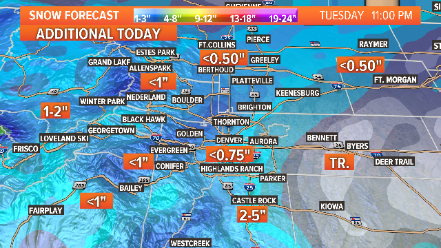
Snow amounts in some mountain areas may push close to 2 feet by the end of the day Tuesday, with less than an inch of additional accumulation expected in Denver.
FULL FORECAST | Check the latest Denver weather forecast here
YOURTAKE | Show us your snowy weather photos!
CLOSINGS | Is there school on Tuesday?
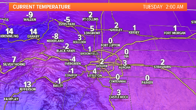
Morning lows on Tuesday plunged below zero in some areas in the foothills, with a low of 0 degrees reported at Denver International Airport and 2 degrees in Denver.
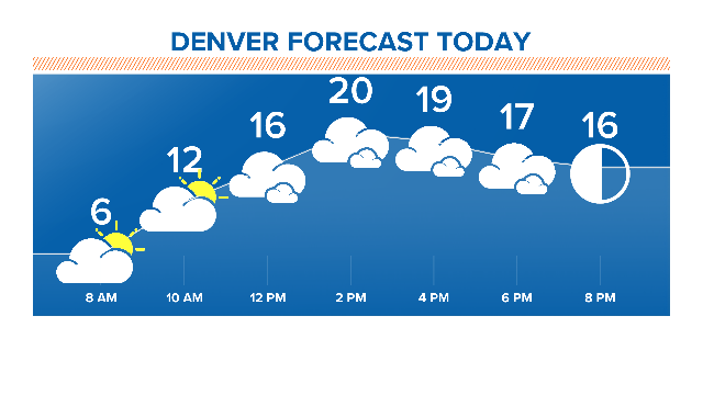
Don't expect it to get much warmer: highs will be in the 20s Tuesday and Wednesday.
TRAFFIC MAP | What are road conditions like?
All of that fresh snow combined with strong winds could create dangerous avalanche conditions.
And more snow is on the way for later in the week, with the possibility of a storm on Friday afternoon lasting through the evening.
The weekend will get a lot warmer though, with highs reaching the 50s on Sunday.