
BOULDER, Colo. — While speculation about the cause of Colorado’s most destructive wildfire has focused on a religious group’s property, investigators are also looking at other possible ignition points – including the possibility the blaze erupted from a dormant coal mine, 9Wants to Know has confirmed.
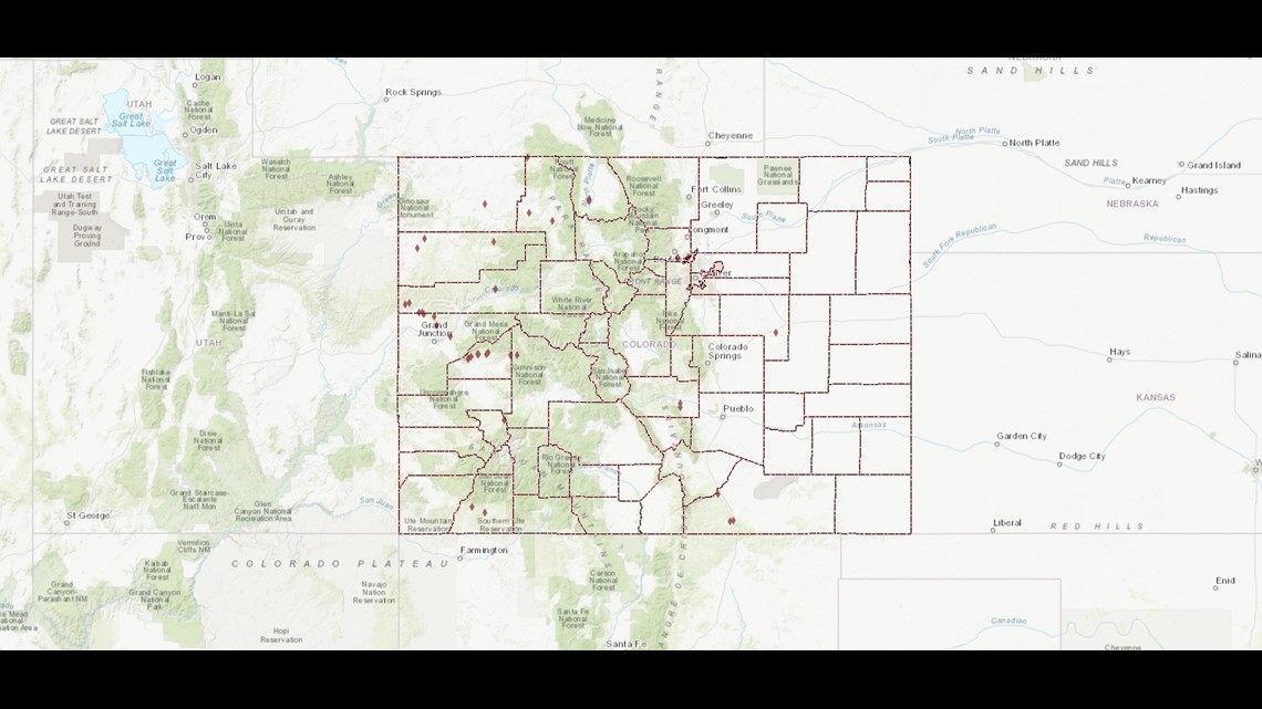
An estimated 38 abandoned coal mine fires are burning underground in Colorado, according to a 2018 state report – including one in the area where the Dec. 30 Marshall Fire is thought to have originated. Fed by ferocious winds, the fire raced across more than 6,000 acres, leveled nearly 1,000 homes, and is believed to have taken at least two lives.
Some of those underground fires have burned for decades.
“There’s not much you can do from the outside to stop these fires because often the coal produces enough oxygen, in the coal bed itself, to keep those fires going,” said Jurgen Brune, a professor in mining engineering at the Colorado School of Mines. “Those are slow burning fires, almost like glowing embers in a fireplace.”
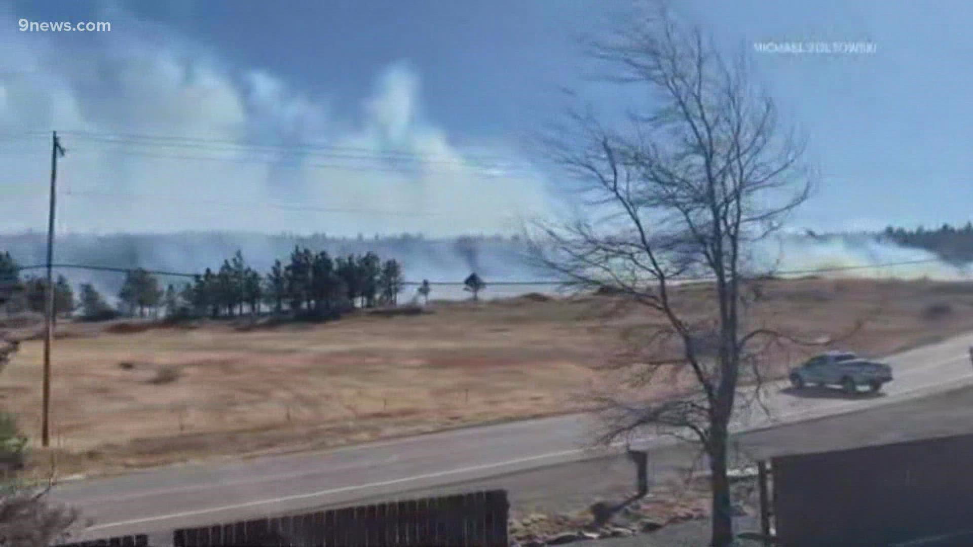
There has been intense scrutiny of land owned by a religious group known as Twelve Tribes, which includes several pieces of property near the intersection of Marshall Road and Colorado Highway 93, about a mile south of Boulder. Cellphone video shot by a neighbor during the fire’s early stages showed a shed on fire on the Twelve Tribes property.
But while investigators later got a warrant to search the property, they’ve made no arrests and haven’t pinpointed exactly what started the fire – or whether there could have been more than one ignition point.
If investigators ultimately determine a person started the fire, criminal charges could be filed.
But 9Wants to Know has learned that one of the things that has the attention of investigators is a smoldering underground fire in a long-abandoned mine just across the road from the Twelve Tribes property. Known as Marshall No. 1 and 2, the mine is home to a fire that has been burning for years and is rated No. 19 on the list of 38 underground mine fires known to be burning around the state, according to a 2018 report by the Colorado Division of Reclamation, Mining and Safety.

The mine, which was active from 1863 to 1939, is located just south of the Marshall Mesa Trailhead just off Highway 93 and Marshall Road. That trailhead remains closed, guarded by a police officer.
Cellphone video shot by a neighbor in the early moments of the fire, which was obtained by 9NEWS, shows a plume of smoke rising from the area of the mine and flowing east with the hurricane-force winds experienced that day.
And while fire activity in Marshall No. 1 and 2 was rated as “very low” in that 2018 report, it was the scene of a 2005 brush fire that was sparked by a “hot vent” from the mine. That blaze led the state to take steps in 2006 to lessen the danger. Workers brought in 275 tons of gravel to fill in low areas above the smoldering fire. They returned in 2016, excavating, compacting and backfilling areas “where surface expression of the mine fire had been observed,” according to the report.

In addition to that remediation work, additional data were collected in the area of the Marshall Mine in 2013 and 2018, including taking ground temperatures and mapping fissures, snowmelt and surface features.
It’s against that background that the investigation, now being led by the Boulder County Sheriff’s Office, includes work aimed at determining whether that long-smoldering underground fire breached the surface on Dec. 30.
While many underground fires burn for decades without flaring into the open, there is a predicable sequence of events when it happens.
“The ground that is above the coal will collapse and cause sinkholes or cracks in the road and things like that,” Brune told 9Wants to Know. “So that’s how we typically find out about these instances.”
Exactly that has happened before in Colorado with disastrous results.
On June 8, 2002, a fire smoldering for more than 90 years in an underground coal seam broke the surface on the western edge of Glenwood Springs and erupted into a blaze that covered 12,000 acres and burned down 29 homes on the west side of town.
Contact 9Wants to Know investigator Kevin Vaughan with tips about this or any story: kevin.vaughan@9news.com or 303-871-1862.
SUGGESTED VIDEOS: Investigations & Crime