Remember how it was almost 70 degrees on Sunday?
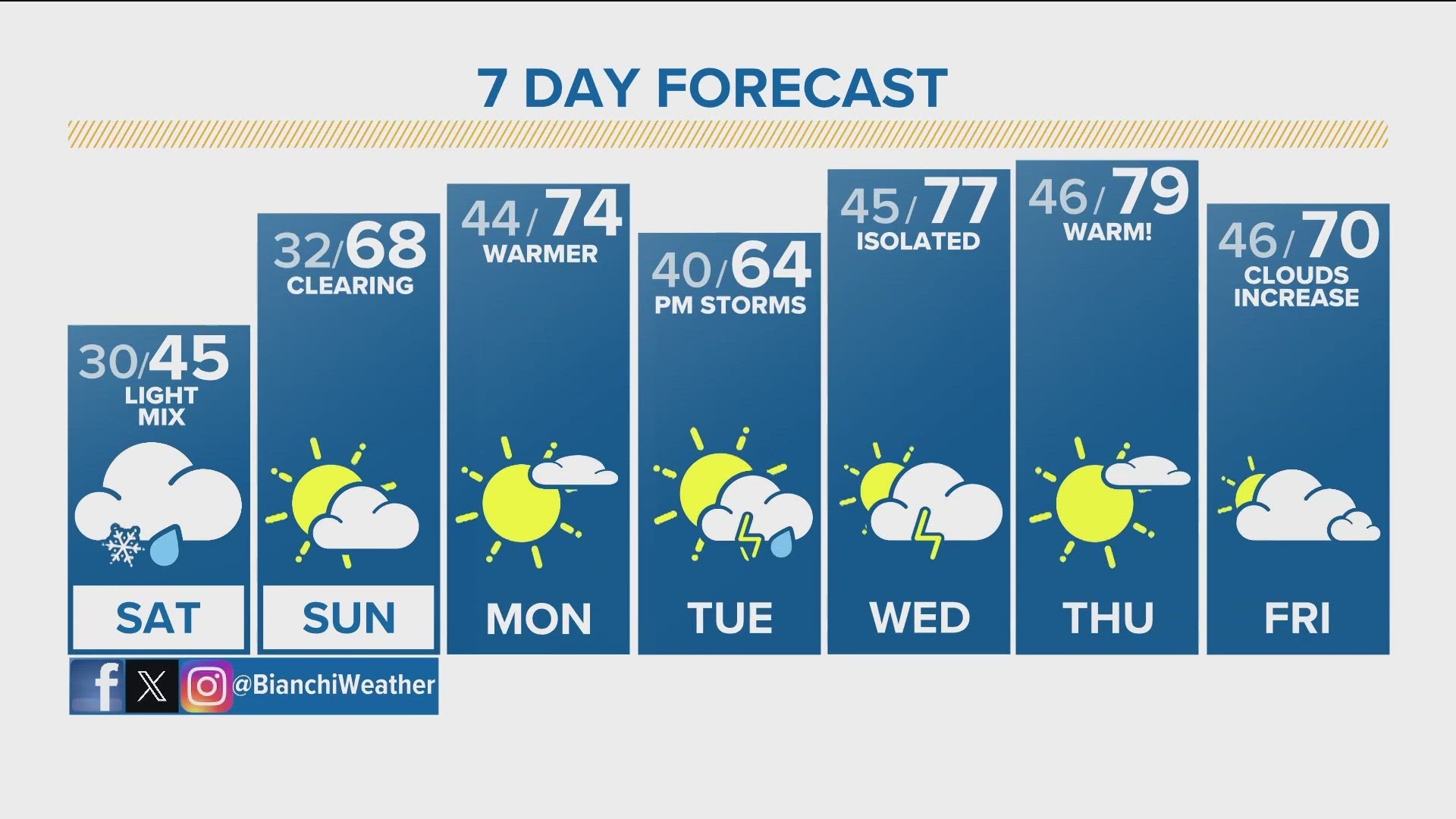
That might seem like a distant memory given how temperatures have barely gotten above freezing this week. And that winter weather will have one last hurrah before it gets a little warmer.
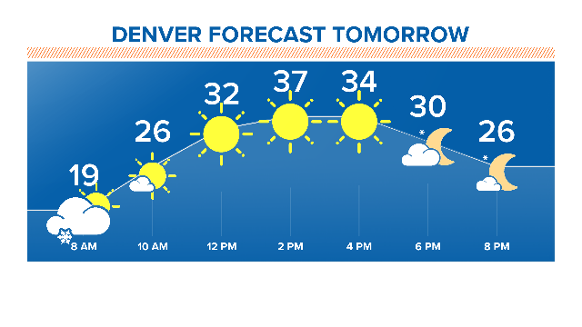
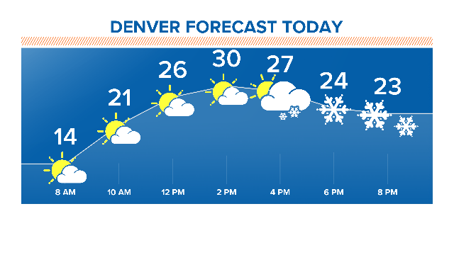
Friday started out foggy on the eastern plains and part of the Front Range. Highs during the afternoon will be 28 to 33 degrees.
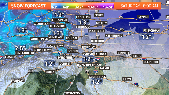
Light snow will start to develop in the Denver metro area after 3 p.m., with 1 to 2 inches of accumulation expected by Saturday morning, with 1 to 3 inches in northern Colorado.
Heavier snow is expected in the mountains and the eastern plains. Freezing drizzle can be expected in the northeastern part of the plains - as early as the afternoon. The area affected is roughly east and northeast of Fort Morgan, according to the National Weather Service
That snow will end after sunrise on Saturday when afternoon highs could top 40 degrees. Icy roads should be expected in far northeastern Colorado and stay snow-covered until perhaps noon, NWS says.
The mountains should expect slight snowfall to linger through the morning - generally along and west of the Continental Divide. Snow amounts by midday Saturday will likely be upwards of 2 inches in higher slopes.
Gusty winds will drive into our area Saturday, with 25 to 40 mph on the plans and 30 to 55 mph in the Front Range mountains and foothills.
Snow will return to the mountains and high valleys Saturday night, NWS forecasters say, pushing into Sunday. It'll likely be pretty light, but the higher slopes and passes could see anywhere from 3 to 6 inches.
Sunday will also be fairly cool, with afternoon highs from 37 to 42 degrees.
The next chance for snow is on Wednesday, so be sure to keep watching 9NEWS for the latest developing forecast.