
COLORADO, USA — Longstanding record cold temperatures are on the line tonight as a powerful cold front plunges arctic air into the Midwest and the south.
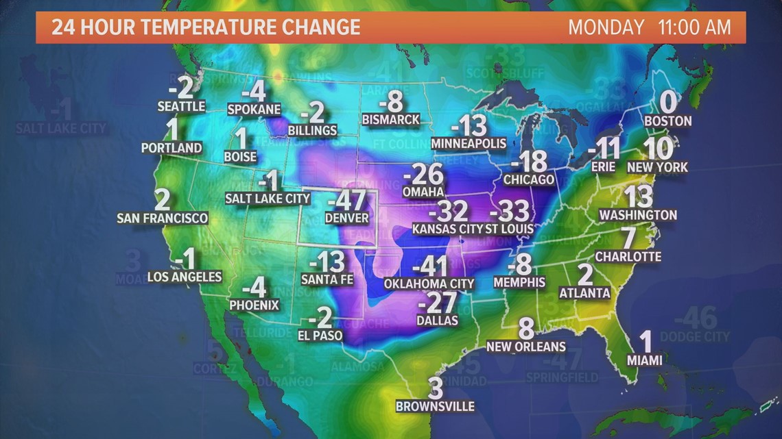
Many places experienced drastic changes in the weather between Sunday and Monday. Kansas City’s temperature was 32 degrees cooler. Even Dallas saw a temperature difference of 27 degrees.
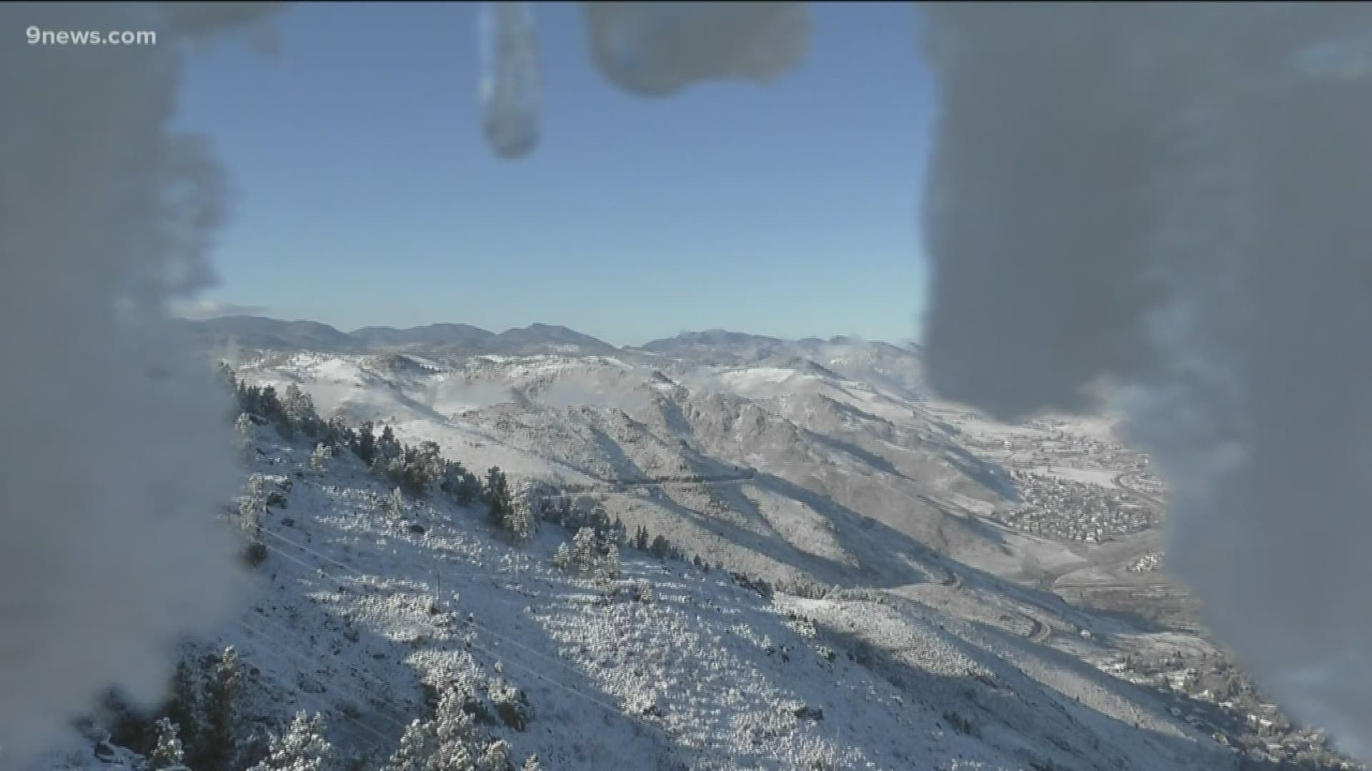
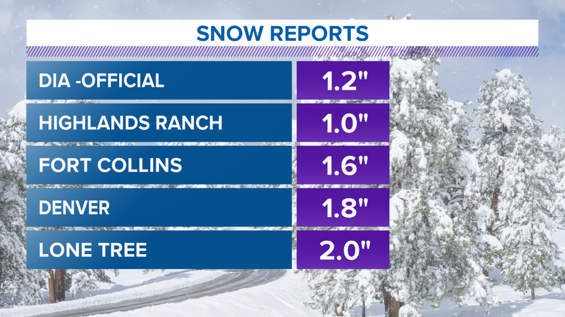
Denver’s cold air was accompanied by a little snow today, but unlike places to the east, the cold snap will be short-lived, and we won’t be setting any records. That's because Denver is sitting right on the edge of a polar vortex.
The polar vortex is a whirlpool of cold air, generally centered over the arctic. It’s always there. The boundary of the polar vortex is the polar Jetstream. It marks the separation between cold polar air to the north and warmer subtropical air.
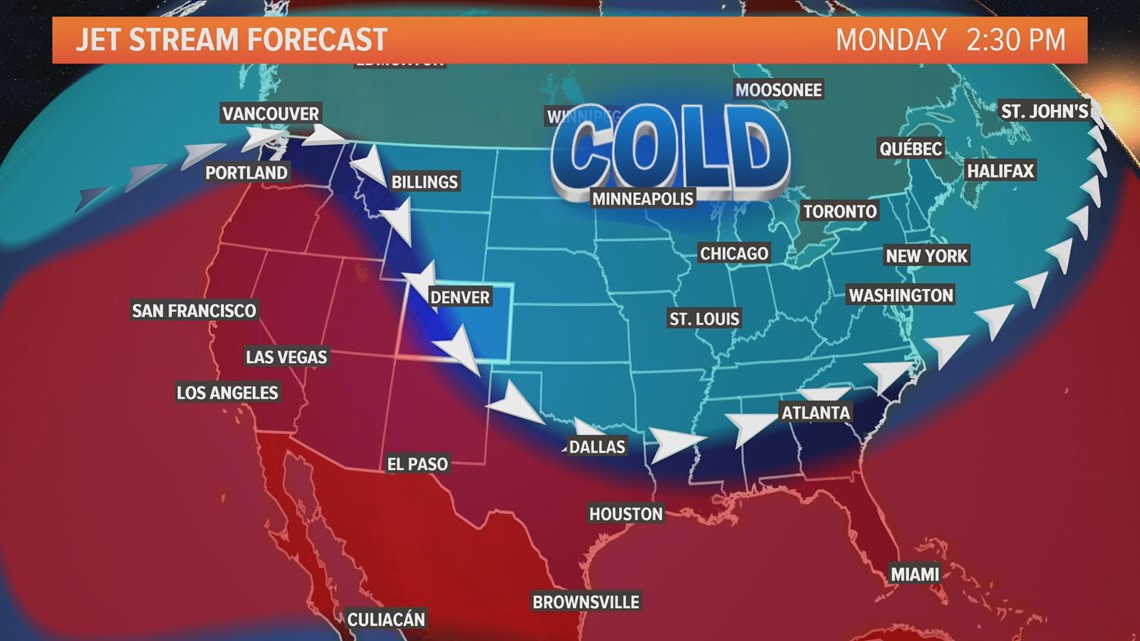
During the winter, polar air starts to dip down to the south, and in extreme cases, a big dip can bring weather that affects transportation, air travel and agriculture.
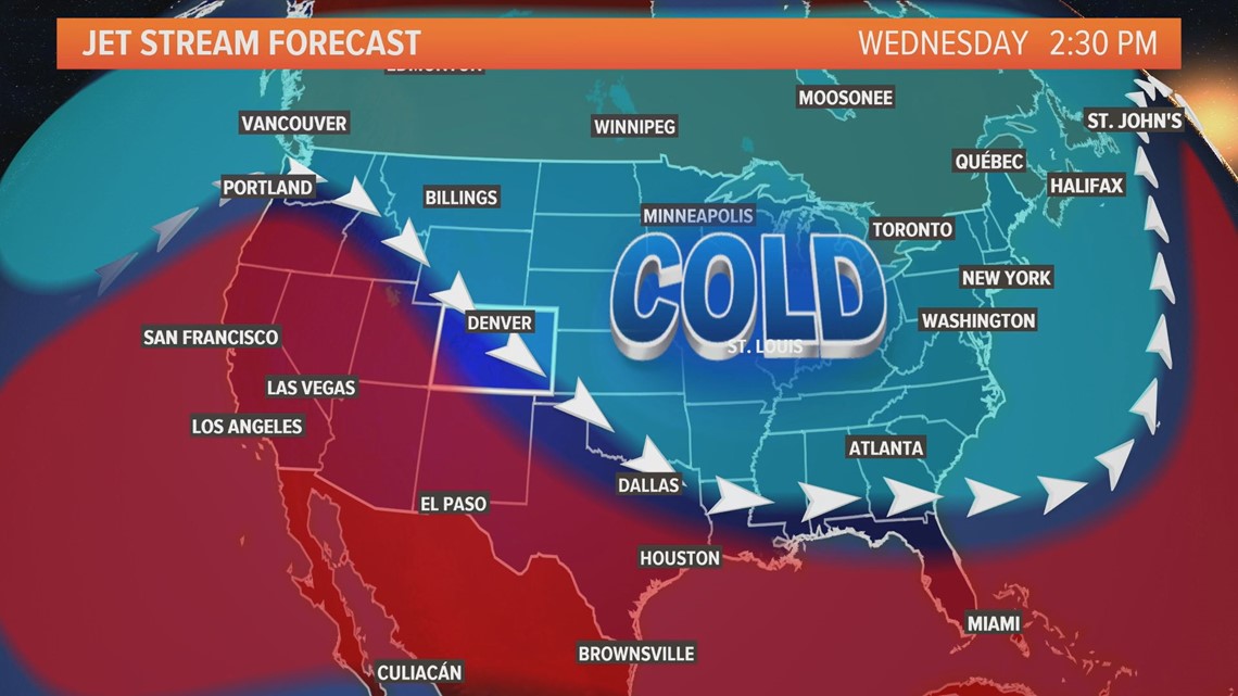
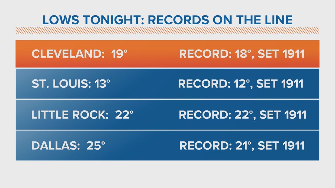
This week’s polar plunge barely grazed the Front Range. But for cities deep in its core — longstanding records that were set back in 1911 — from one of the most extreme cold fronts in U.S. history, may be broken.
Cleveland, St. Louis, Little Rock and Dallas are all forecasting lows in the teens and 20s for tomorrow morning. Temperatures could be as low as 13 degrees in St. Louis, dangerously close to their record of 12 degrees, which was set during an arctic blast in 1911.
Denver will warm up this week, but temperatures across the Midwest and south will remain below average through the weekend.
SUGGESTED VIDEOS | Science is Cool