Drought, low snowpack, and high fire danger.
These are three different ways to describe how dry it is in Colorado right now. Those three categories are closely related ... but not the same.
Think of it like this: Drought shows a deficit of moisture in the ground and soils. Fire danger shows a deficit of moisture in the fuels, which is in the trees, the branches, and on the ground.
Snowpack, at least this year, shows a deficit of moisture in the bank.
Together, these three categories show a more detailed picture of just how dry Colorado really is this year.
Seventy one percent of Colorado is in drought conditions as of March 5. That’s the largest drought our state has seen since September 2013, just before the historic floods.
This drought data gets updated once a week, by the National Drought Mitigation Center. It’s not a computer model. It’s put together by a person who weighs precipitation data, field measurements and satellite scans to subjectively report current drought conditions.
Thirteen different authors take turns putting together the reports. These authors range from drought experts, climatologists, hydrologists, meteorologists and agriculture experts.
The product they put out is called the U.S. Drought Monitor, and it's meant for use in agriculture, by water managers, by governments that might need to implement water restrictions, and for every citizen to get a general understanding for available water.
The author of this week;s report, Deborah Bathke, told 9NEWS that drought is not a direct representation of fire danger, although it is closely related. Both products are driven primarily by lack of precipitation.
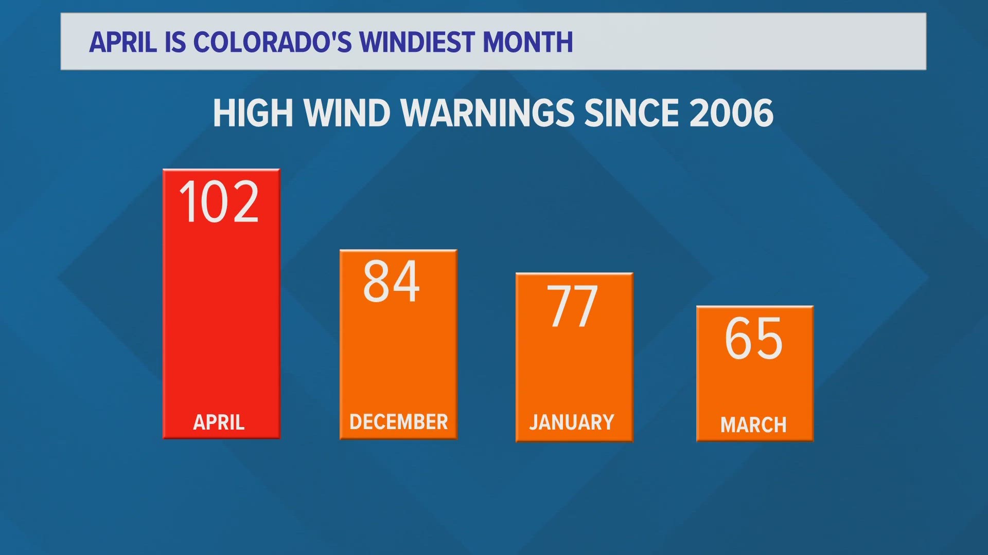
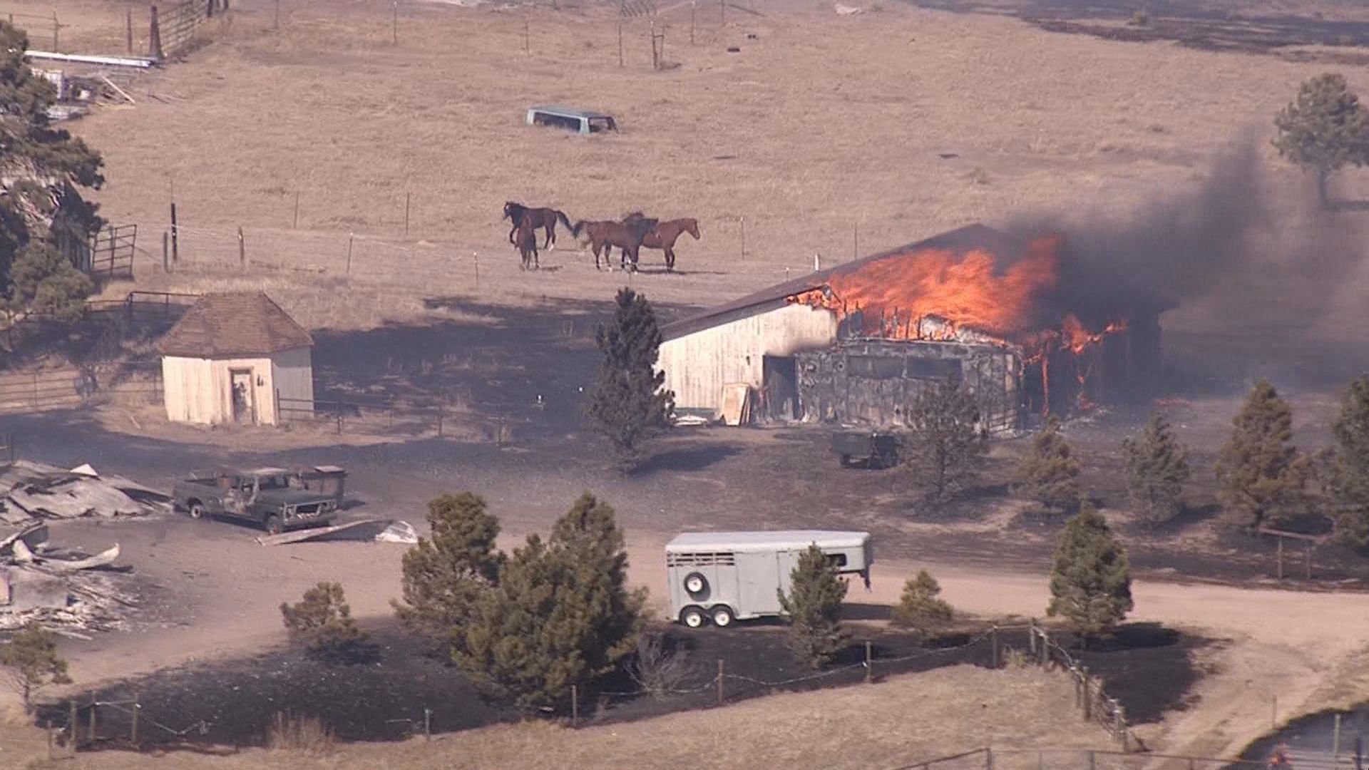
Fire danger shows both current and future conditions. Many areas along the Front Range of Colorado are listed in high or very high fire danger right now. That is due to the low moisture content in ground fuels like grasses, and shrubs, and even larger fuels like large tree branches, and limbs.
The Fire Danger Outlook is a forecast. The latest data shows a higher likelihood of above average wildland fire activity for southern Colorado through May, but average fire activity for the rest of Colorado.
That may seem contradictory to our current dry conditions, but this is factoring in the snow that is yet to melt, and climate averages of precipitation for the next three months.
Snowpack in our state is at record low levels at 9 Snotel observation sites, and is at 2nd lowest at seven other locations. Overall, Colorado is 30 percent below our average snowpack levels for March 5.
Low snowpack will have less impact on reducing our drought, and fire danger going into the spring.
Last March, northeast Colorado had very high fire danger and drought conditions as well, but was saved by higher snowpack, and a wet May. This year we have less of a chance at improvement due to our very low snowpack, which is half as much as last March.