
LAKEWOOD, Colo — As drought conditions worsen across Colorado and the west, we're seeing more wildfires. But the technology to track fires, and monitor conditions before they start, is getting better. That's all thanks to extra eyes in the sky.
Traditionally, fire crews relied on traditional lookout points and aircraft surveys to spot fires and gather data on changing weather patterns. That process relied on what humans could see and where they could get to safely.
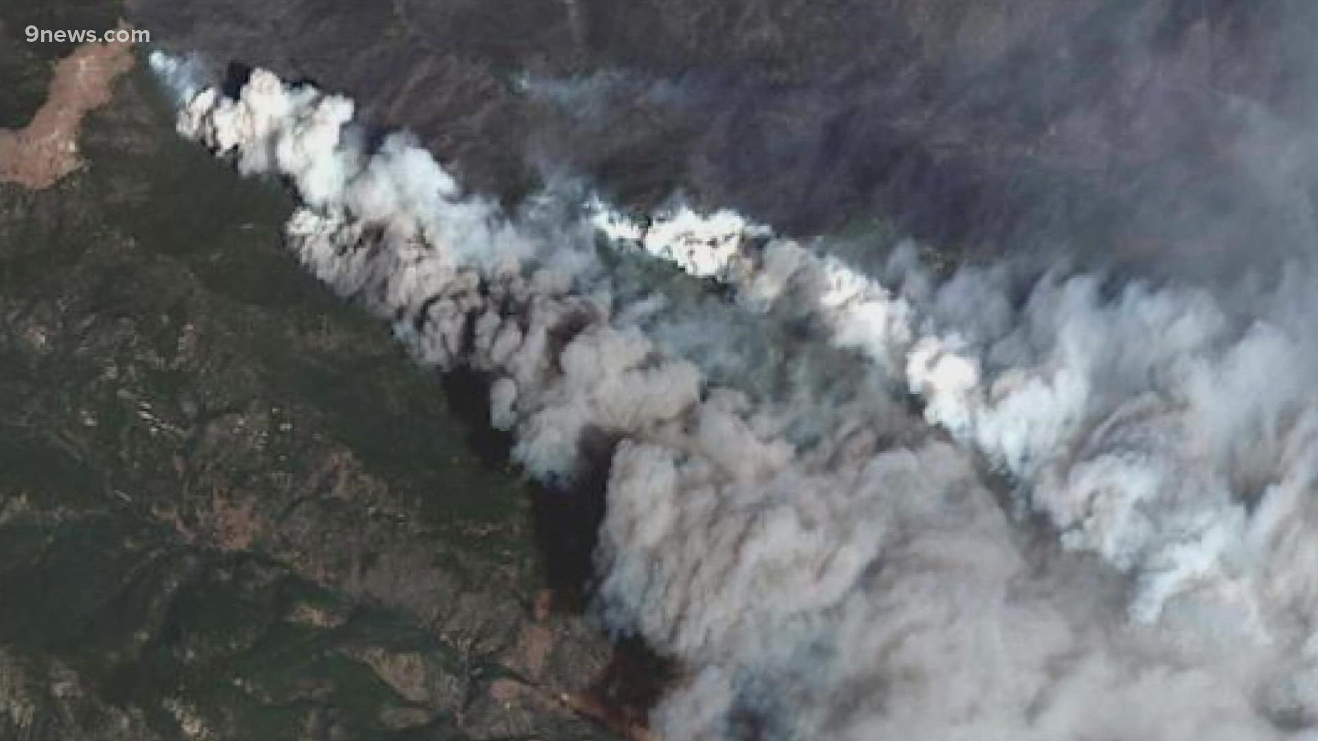
Now, fire teams like the Rocky Mountain Area Coordination Center (RMACC) have access to data and images from a variety of NASA's satellites orbiting the area. Most of that data comes from a GOES satellite, which Those pictures show smoke, fire lines and weather fronts for a specific area on a regular basis.
"Satellite is just one of the biggest players for us in our toolbox," Coleen Haskell, fire meteorologist for RMACC, said.
Once fire season picks up, a GOES satellite can send pictures of a specific area every five minutes. They show how intensely a fire is burning and whether the wind is shifting. That data gives firefighters a heads up when there's potential for fires to run.
"The more frequent observations that we get from the satellite inputs help us to detect those more quickly and get that information to the folks that can go and assess it," Haskell said. "That is what helps keep those fires small."
Satellites also provide data before a fire even starts. RMACC and other fire crews can monitor images as snow melts throughout the spring to see what areas are drier than others. With a large percentage of the state facing drought conditions, it helps teams make a to-do list of fire mitigation projects.
"It helps us prioritize by narrowing it down to what areas might already be receptive to burning," Haskell said. "Other areas that really aren't far along enough, we can sort of say 'alright, we're going to couch that for a while until we start seeing things changing.'"
The near-constant data stream has revolutionized the way Haskell and other fire meteorologists can do their jobs, making it easier to get all of that data out faster.
"When I first started working in in meteorology, and we would get one small picture, one out, every hour, and it would print out on what's called a die fax, kind of like the old Polaroid pictures," Haskell said. "It's kind of like the comic book right where you animate it by flipping the pages to get a sense of what the movie might look like. Well now, of course, it's compiled very quickly and it's animated digitally on the computers, and so we get that clear picture, whereas before we kind of had to fill in the gaps in our mind. This gives us everything that we need to see."
All of the data that is available to fire meteorologists is also available to you. NOAA has an interactive list of all the types of images available to analyze fire and smoke available online. There, you can explore the images and learn more about fire mapping.
SUGGESTED VIDEOS: Wildfires in Colorado