
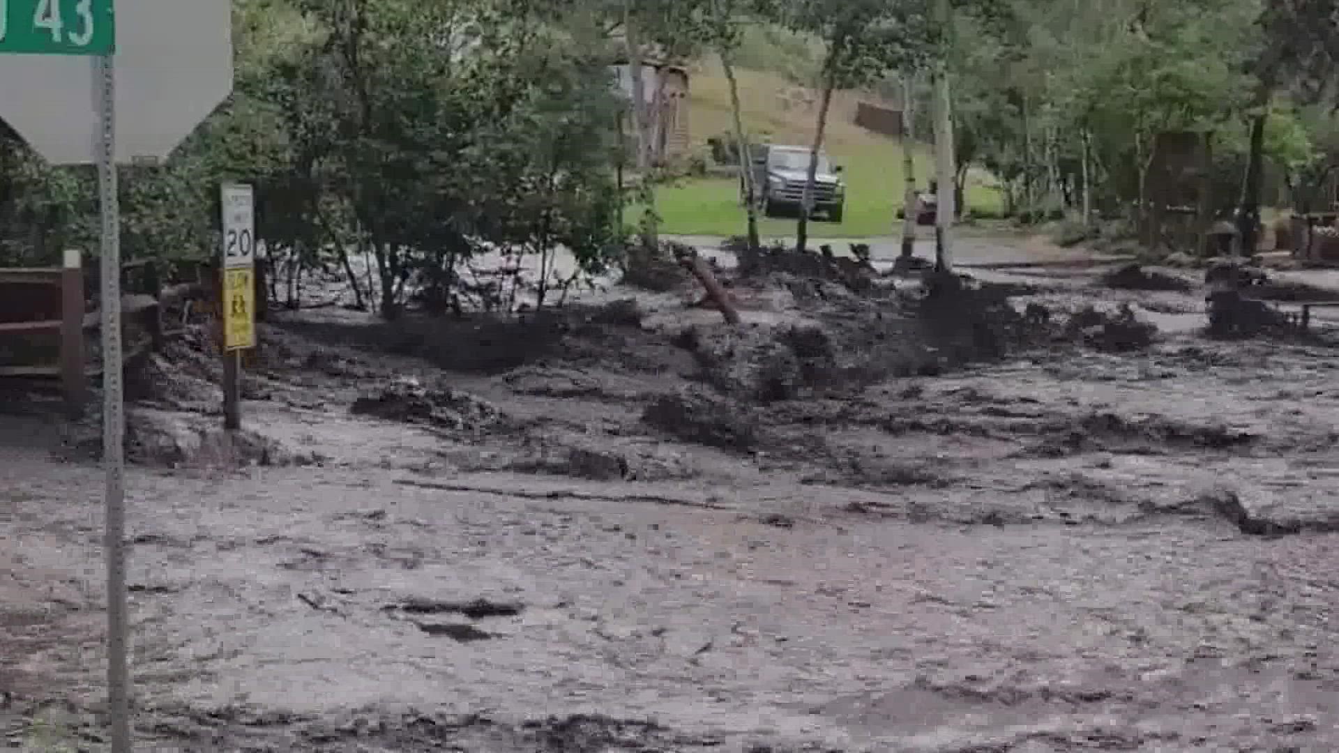
LARIMER COUNTY, Colo. — The U.S Forest Service is taking steps to mitigate flooding similar to what happened Friday, when storms and flash flooding over the Cameron Peak Fire burn scar caused some serious damage in the Glen Haven, Crystal Mountain and Buckhorn areas of Larimer County.
A mother and daughter were killed when the camp trailer they were in was swept away in the Buckhorn area, according to the Larimer County Sheriff’s Office.
9NEWS spoke with Ben Livneh, a water resource and environmental assistant professor at CU Boulder, to understand why this burn scar has experienced so much flooding over the last two years.
9NEWS also spoke with Reghan Cloudman with the U.S. Forest Service about the efforts to warn people camping or living in the burn scar.
(Editor’s note: These interviews have been edited for context and clarity.)
9NEWS: Why does a burn scar flood?
Livneh: Essentially when a fire comes in, especially a moderate to severe fire, the thing that it typically does is that it destroys vegetation and it changes the chemistry of the soils. The vegetation is your friend in the sense that it can catch a lot of rainwater and the roots can also stabilize slopes and things like that. The soil changes because you lose a lot of organic matter, which is the stuff that burns up in the fire, and so you’re left sometimes with a soil that looks quite different, and it may not be able to absorb much water at all.
So maybe the storm that would have produced a smaller flood could actually produce a larger flood in a burn scar due to these changes to the landscape.
So, should we be concerned about this burn scar any time there is heavy rain in the forecast?
Livneh: I definitely think so. If there is enough time or resources, you can put in mitigation measures, but even with that, yes. We have this idea that we’ve been seeing increases in extreme rainfall and some of that is due to climate change. So as the Front Range experiences these big fires, and with the intersection with the big rains, I think it’s just going to become a more common phenomenon that we’re going to have these post-fire floods which can be quite damaging.
I think we just have to be extra vigilant. Especially now that we have people enjoying the outdoors everywhere, living everywhere, we need to take care.
After a fire, how long do we have to worry about flooding in the burn scar?
Livneh: Some of the recent research I’ve done has put that number around three years. Obviously the most acute impacts are going to be right after the fire. Every time you get a low or medium intense storm after that fire, that’s going to help mitigate some of the risk. So some of the work we’ve shown is maybe about three years until you kind of fall back into the baseline.
When we talk about total water supply, the impact could be close to six years after the fire. It’s one of those things that taper off. It's most high risk after the fire and then it just settles down, but of course we can’t just write any place off.
When floods in the burn scar occur, what does the Forest Service do to help notify people in that area?
Cloudman: We rely really heavily on our partners with the county -- specifically for Cameron Peak, Larimer County -- and they have a robust communication system in place where people can register with LETA 911 and can get texts sent to their phone, email, that sort of thing whenever these are happening.
The county works closely with the National Weather Service as well as us to make sure that information is getting out, and we’re going to share that information as we get it out as well.
When it comes to some of our developed recreation areas in our campgrounds, following the flooding last year that we experienced in the Poudre Canyon, we also worked with the sheriff’s office and the concessionaire company that runs those campgrounds to make sure there was a link there so they could get communications if something needed to be done, like evacuating a campground or something in that nature.
Is the lack of cell phone service a challenge when trying to get these warnings out?
Cloudman: The longer we go with having so much access to our cell phones, people become pretty reliant on them and don’t realize that there are a lot of places on the landscape of Colorado that they don’t work.
One of our biggest messages to people is to know before you go, and that really includes checking what the weather is predicted to be, knowing where you’re going to go, being familiar with the landscape, having maps available to look at and to know what access points you have.
The Cameron Peak Fire was the largest fire in Colorado history and really changes the landscape. So besides the flash flooding, there are other impacts it has had on that landscape. We really encourage people to educate themselves. We still have closures in the fire area, and they’re for safety reasons as well as recovery reasons. So we recommend people check in on our website to know about those closures, and check with the National Weather Service about what the conditions are expected to be out there.
What can we do to help mitigate the risk of flood?
Cloudman: Right now we actively have mulching taking place on portions of the Cameron Peak burn scar. We have people working on roads and trails.
It’s really going to take this concerted effort of everyone working together, identifying priority areas and doing what we can to mitigate the risk. But the risk is there and it will always be when you’re out in the woods. This is just an additional one people need to make themselves aware of.
SUGGESTED VIDEOS: Severe Weather