
DENVER — A blustery fall day on the Front Range doesn’t always mean cold. Sometimes the wind can be warm and dry.
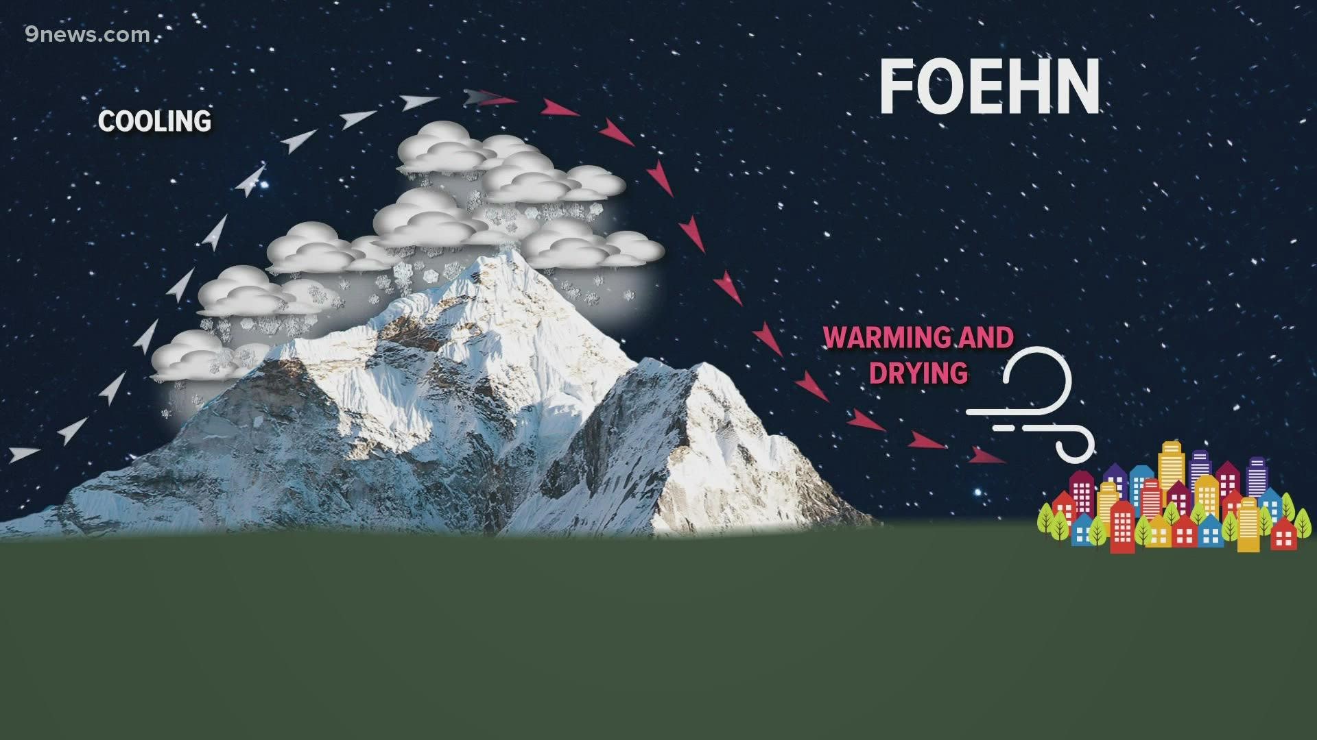
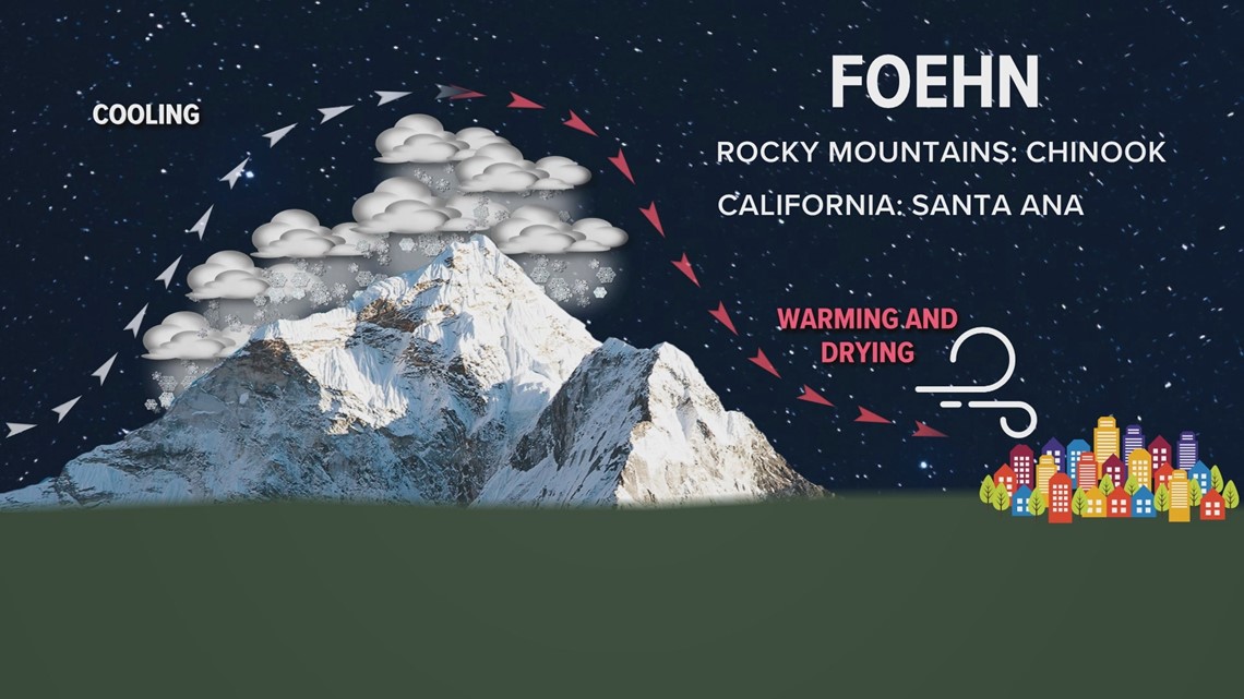
The wind has been blowing out of the west since Friday night. As the air hits the west slope of the Rocky Mountains, it rises, cools, and creates a layer of clouds. Then as the air sinks on the east side of the mountains, it warms and dries due to the change in pressure.
That type of wind is generally called a foehn, but some areas have specific names for local foehn winds.
A foehn wind that occurs in the Rocky Mountains is known as a chinook. In southern California, it's called Santa Ana. In northern California, it's called Diablo.

The soils and vegetation on the Front Range are already dry due to the lack of rain and snow, and the chinook winds have been amplifying the dry conditions.
There are fire weather warnings in place through Tuesday evening that include the entire Denver metro area. The winds are expected to pick up again Monday night while humidity levels stay low.
The chinook wind also helped many areas on the Front Range stay relatively warm in the overnight hours into Monday morning. It was 75 degrees in Longmont and 70 in Denver at 9:30 a.m.
The low temperature in Denver Monday morning was 56 degrees. The record warmest low temperature for Nov. 15 is 48 degrees, set back in 1941. That record was in jeopardy of being broken until it hit 46 degrees at Denver International Airport at 8 p.m. Monday.
SUGGESTED VIDEOS: Science & Weather