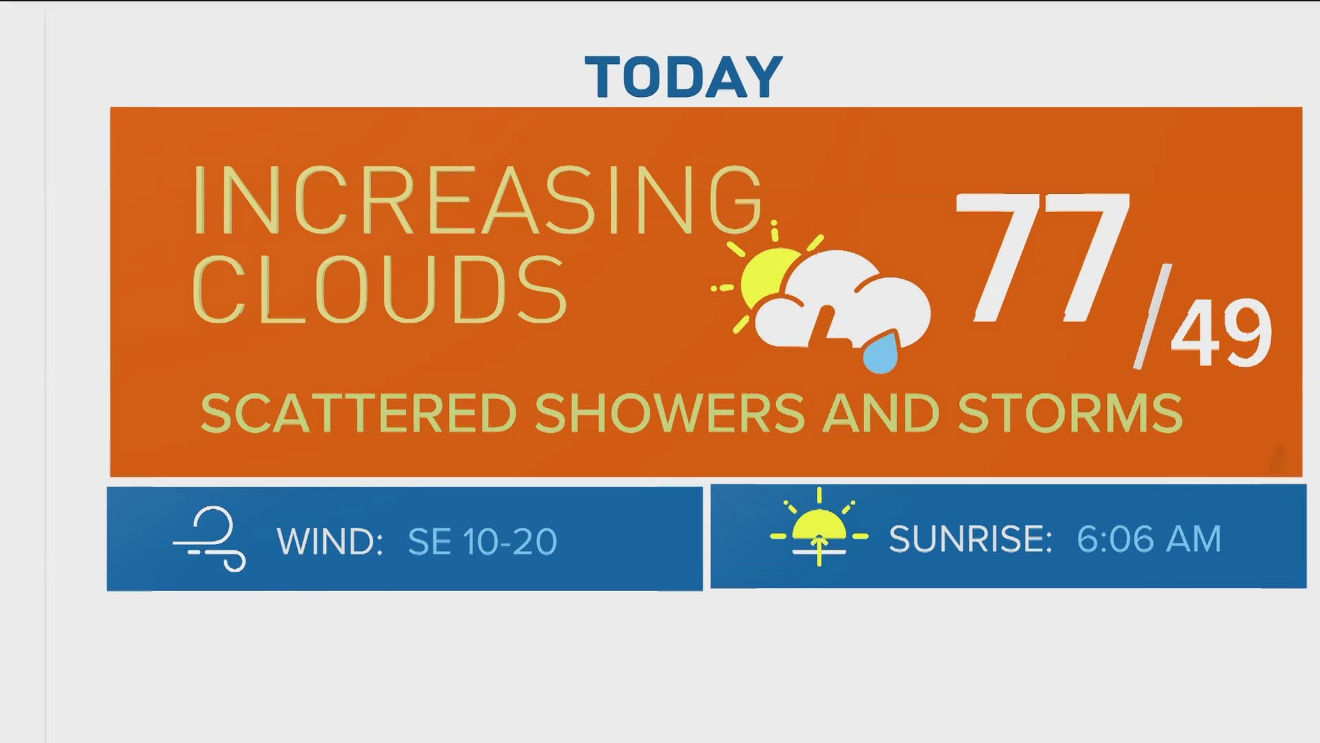
DENVER — Enjoy the 50-degree weather and sunshine while we've got it, because it looks like bitterly cold temperatures and at least some snow will return next week for Colorado and the Front Range.
It looks like an arctic cold front will push through the Front Range on Tuesday or Wednesday of next week, pushing in temperatures that once again will run 20 or more degrees below our seasonal averages. That could include low temperatures at or even below zero on Wednesday or Thursday of next week.
That could include more snow for the Denver area, although at this time it doesn't seem like it'll be nearly as much as what we saw this past Wednesday.
Unlike last week's storm, there's a fair bit of computer forecast model disagreement about how next week might play out. But here's what we know at the moment.

Cold
The real story from next week's weather will be the bitterly cold temperatures that'll likely move through eastern Colorado. An arctic cold front likely pushes through the region at some point on Wednesday, and that'll drop high temperatures from the low 50s on Tuesday down to overnight lows around 0° by Thursday morning.
Because this is an arctic cold front pushing in from our north, it'll bring eastern Colorado bitterly cold air, but it probably won't affect the mountains nearly as much.
Colder air is heavier and denser than warmer air, and so these arctic fronts are often shallow and can't travel over the mountains. So as a result, Thursday may be one of those weird days where it's (much) colder in Denver than places double its elevation.
Computer models are showing lows around 0° for Thursday morning, with sub-zero lows not out of the question. It could be accompanied by gusty winds that'll drop wind chills well below zero, with Thursday looking like the coldest day of the week.
Snow
It seems unlikely that the Front Range will pick up as much snow as this week's storm, but chances are we're in for at least some more snowfall this week.
A storm system looks to pass off to our north on Tuesday and Wednesday, and that'll bring the chance for some light snow. At this time, it looks like Wednesday holds the best chance for any Front Range snowfall, although there's the chance for a rain-snow mix on Tuesday and snow on Thursday as well.
This storm doesn't look as strong as last week's, and the northerly track means there's a higher chance that the Denver area misses out on the snow entirely.
As opposed to last week's more southern-centered storm, this week's storm looks more likely to favor northern Colorado's mountains with higher snowfall totals.
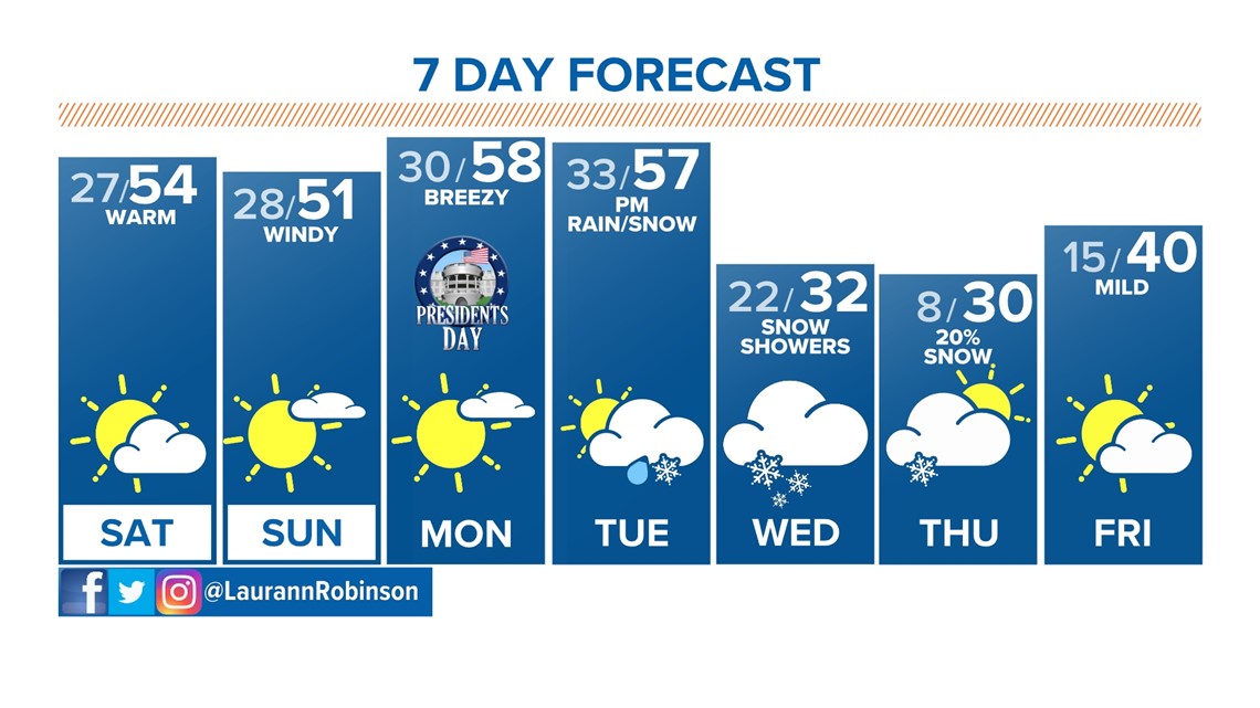
In the meantime, mild temperatures in the 50s will continue through the early part of next week in the Denver area. After a quiet Saturday, gusty winds and snow will make travel difficult in the high country on Sunday and perhaps Monday.
SUGGESTED VIDEOS: Colorado Climate