

DENVER, Colorado — Two years ago Wednesday, the Denver metro area was dealing with a storm system that brought quite a hail storm.
Baseball size stones hit the west side and it quickly became the most damaging storm in Denver history.
It also ranked as the second most expensive hail storm in the country's history.
We're looking back at how that storm developed, and how much warning we had.
First Alert
A storm system moved down the west coast from the north and developed quickly in the desert southwest. Warm moist air pressing into Colorado from the southwest would supply the fuel for a major hail storm.
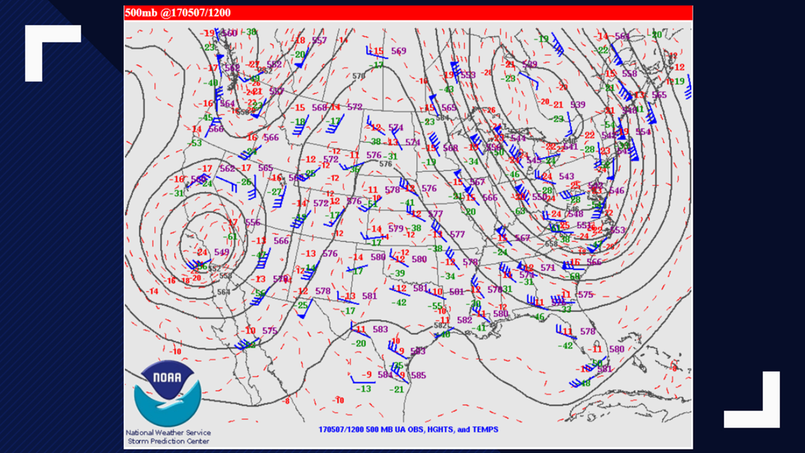
Large damaging hail was forecast for the Denver metro about 36 hours in advance. The first alert to incoming severe weather is called a Convective Outlook, and on Sunday morning May 7, 9NEWS meteorologists broadcast a Marginal threat coming for Monday afternoon.
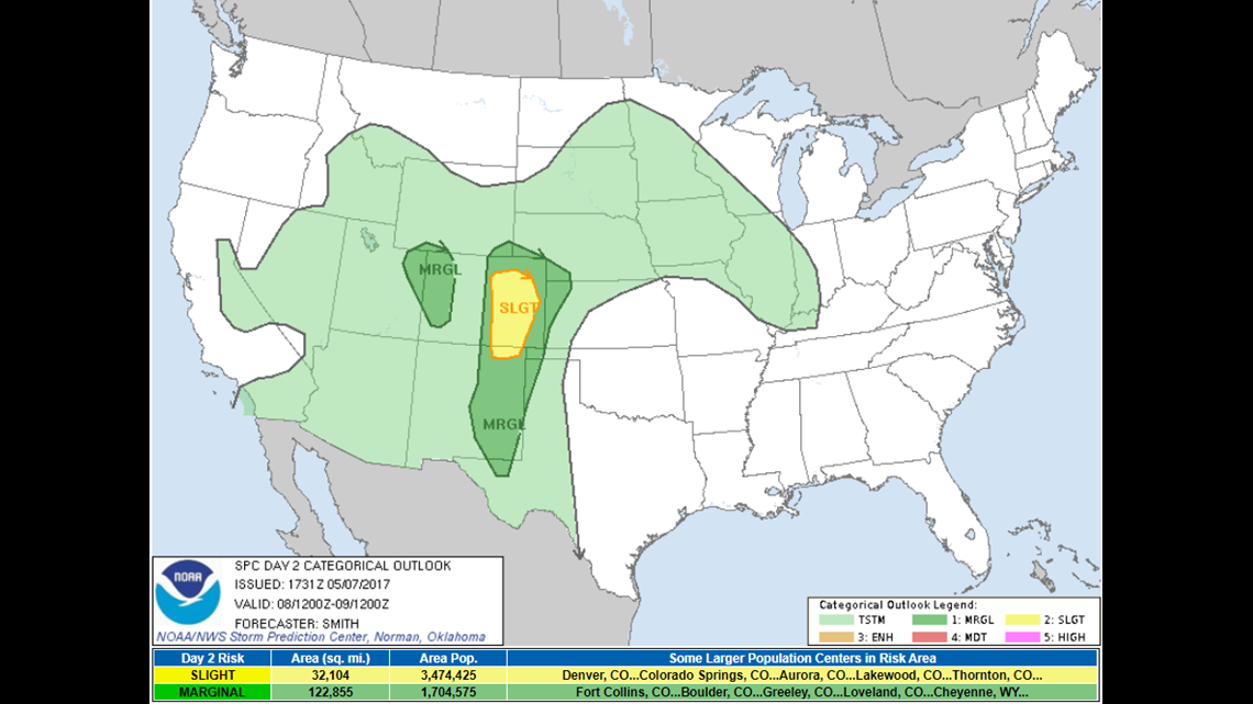
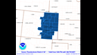
The outlook was elevated to Slight by Sunday afternoon. The yellow area indicates that level 2 threat on a scale of 5. It is important to know in Colorado that most of our damaging severe weather happens when the threat level is Marginal (1) or Slight (2), so don't let the benign titles of the threat levels lull you into a false sense of security.
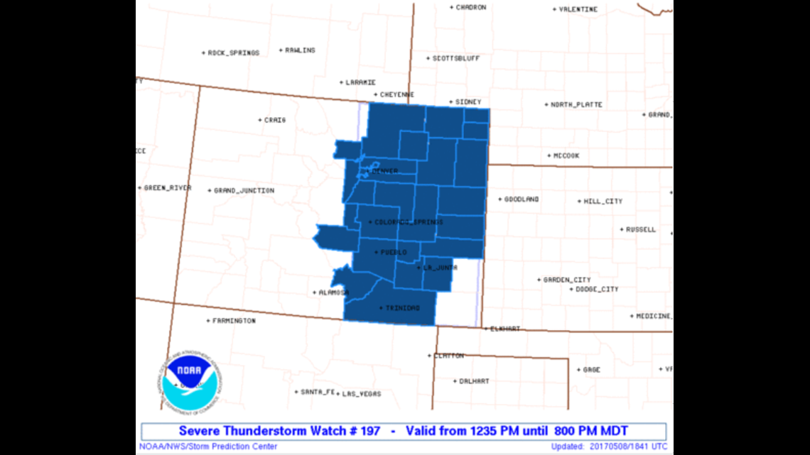
Watch issued
Then on Monday, May 8, at 12:45 p.m., a Severe Thunderstorm Watch was issued as confidence in damaging hail impacting the Denver metro grew.
This was two hours before the baseball size hail event in the west metro. If a convective outlook is not enough to convince you to take action, a Severe Thunderstorm Watch should do it. This is only issued when a high chance of severe weather is expected.
Not all the area in the watch will get hit, but the majority of the time, it does hit somewhere in the Watch box, and it certainly did on May 8, 2017.
The Warnings
Thunderstorms started to grow as the Watch was issued.
At 2:25 p.m. a Severe Thunderstorm Warning was issued for a thunderstorm over Evergreen. This was the cell that would move into the metro and unleash the massive hail damage 20 minutes later.

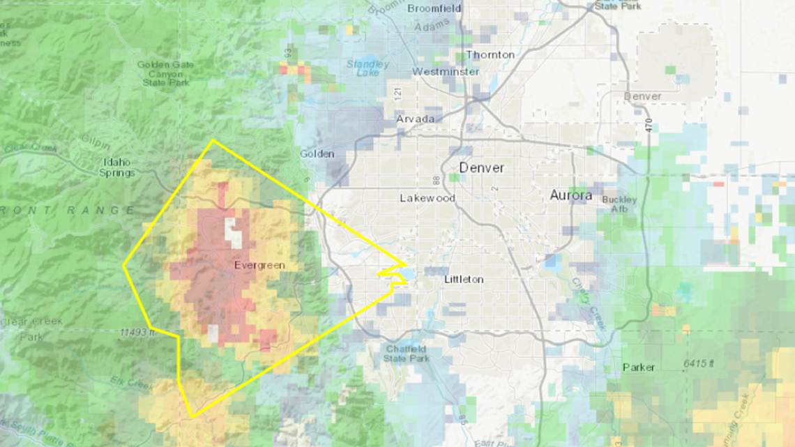
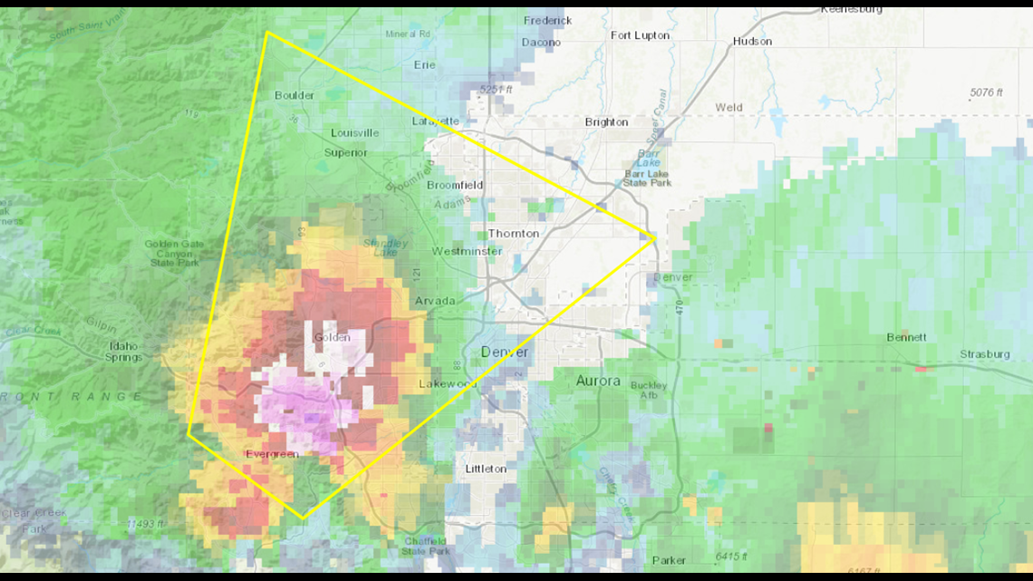
After weakening slightly as it came off the foothills, it re-fired and a new Severe Thunderstorm Warning was issued at 2:45.
For the next hour, that thunderstorm cell would produce damaging hail from Lakewood all the way to Thornton.

Due to the complex terrain, and wind shear around the Denver metro area, thunderstorms can develop rapidly.
The average lead time for a severe thunderstorm from time of warning to time of impact is 17 minutes nationwide. But in Colorado, that lead time is only 13 and a half minutes.
The Tornado Warning
At the same time, about 2:45 p.m., another storm cell would produce a funnel cloud in Elbert County near Agate, bringing a tornado warning.


The strength of that storm system was evident across northeast Colorado that day, but it was the hail damage in the Denver metro, the reached a record $2.4 billion in damage, that leaves the most memories two years later.
SUGGESTED VIDEOS | Science is cool