
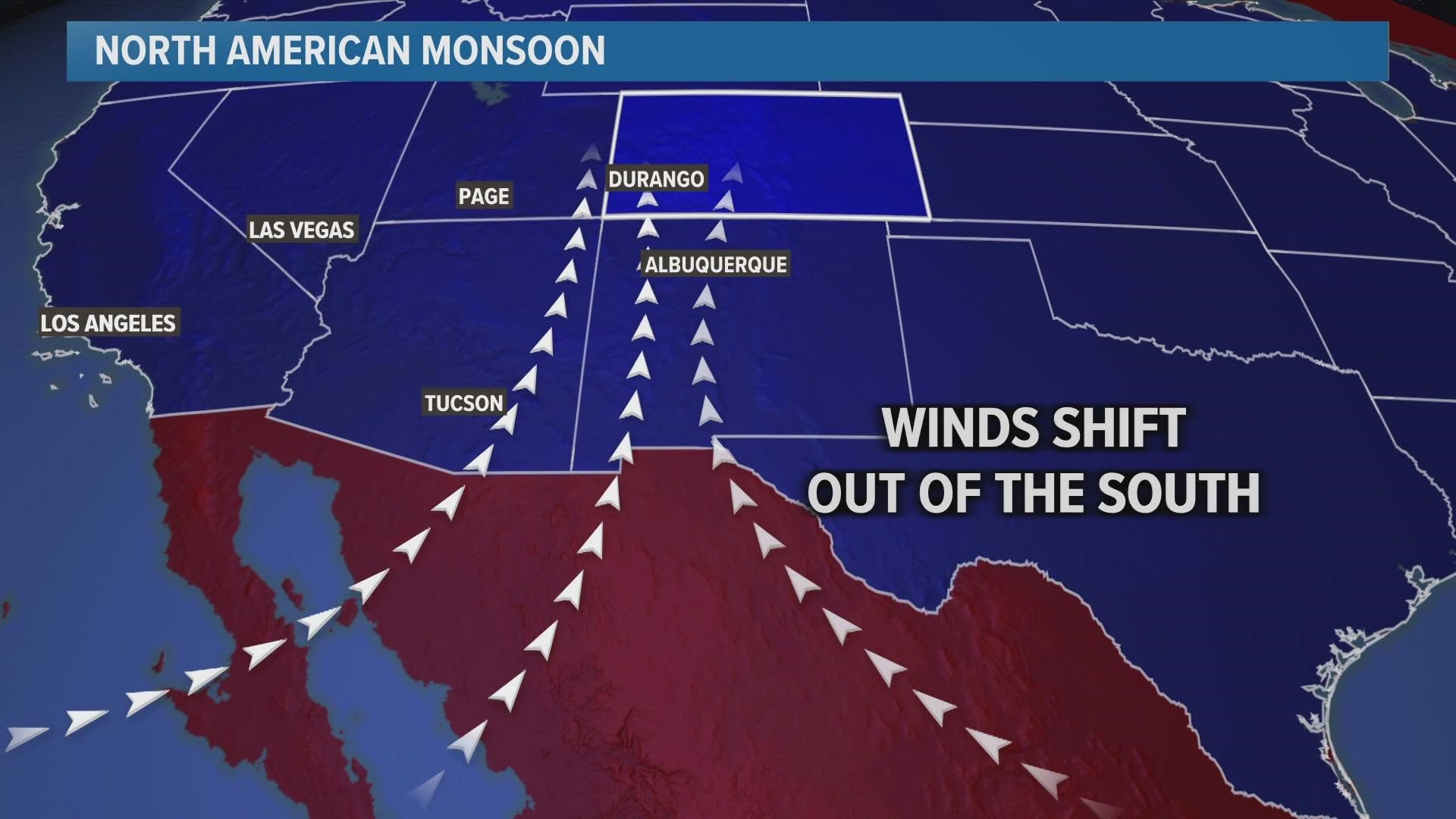
DENVER — When people hear the word monsoon, they often think about heavy rain. That can happen as a result, but the monsoon is actually a shift in the wind pattern.
During the North American Monsoon, the air moves up from the south and can reach all the way up into Colorado.
The first monsoon surge of the season will impact Colorado Thursday night and last through the day on Monday.
The main impact on the Front Range will be smoke – not rain. With several large wildfires burning in Arizona and New Mexico, a south wind will push that smoke straight into Colorado.
Some smoke was visible on Thursday night and Friday morning but will be more noticeable on Friday evening into Saturday. Possibly even thick enough to block the view of the mountains from Denver.
Thunderstorms will get a moisture boost from the monsoon but they will only be scattered on the plains. A couple of monsoon-charged storms hit Weld County on Thursday night bringing pea to 1.5" hail, accumulating small hail, and close to 2" of rain in some areas.
Similar storms can be expected over the weekend on the Front Range and eastern plains.
Those monsoon showers will have more impact in the mountains, so expect an elevated risk for burn scar flooding over the weekend. One flash flood warning has already been issued in the Cameron Peak burn area briefly on Thursday night.
The large burn scars from the 2020 season will still carry a high flood risk, but the impacts do get reduced a little each year after the fire. It can take more than 10 years to fully heal a burn area.
There is a high flash flood threat this weekend in New Mexico where recent and ongoing wildfire areas are located -- The fresher the burn scar, the more likely flash flooding will occur.
However, no flood watches had been issued as of Friday morning.
The heaviest rain is expected on the western slope where more than an inch of rain will be possible by Sunday night. A lot of lightning is also likely, so we’ll have to watch out for the possibility of more fire starting.
SUGGESTED VIDEOS: Latest from 9NEWS