
DENVER — Severe thunderstorms will be possible in northeast Colorado between 4 and 8 p.m. Thursday. As of 3:30 p.m. on Thursday afternoon, gusty winds were already pushing into far northern Colorado, with winds topping 40 mph in parts of Weld and Larimer Counties.
Severe weather is considered to be large hail that's 1 inch in diameter or larger, wind gusts of 58 mph or greater, or tornadoes.
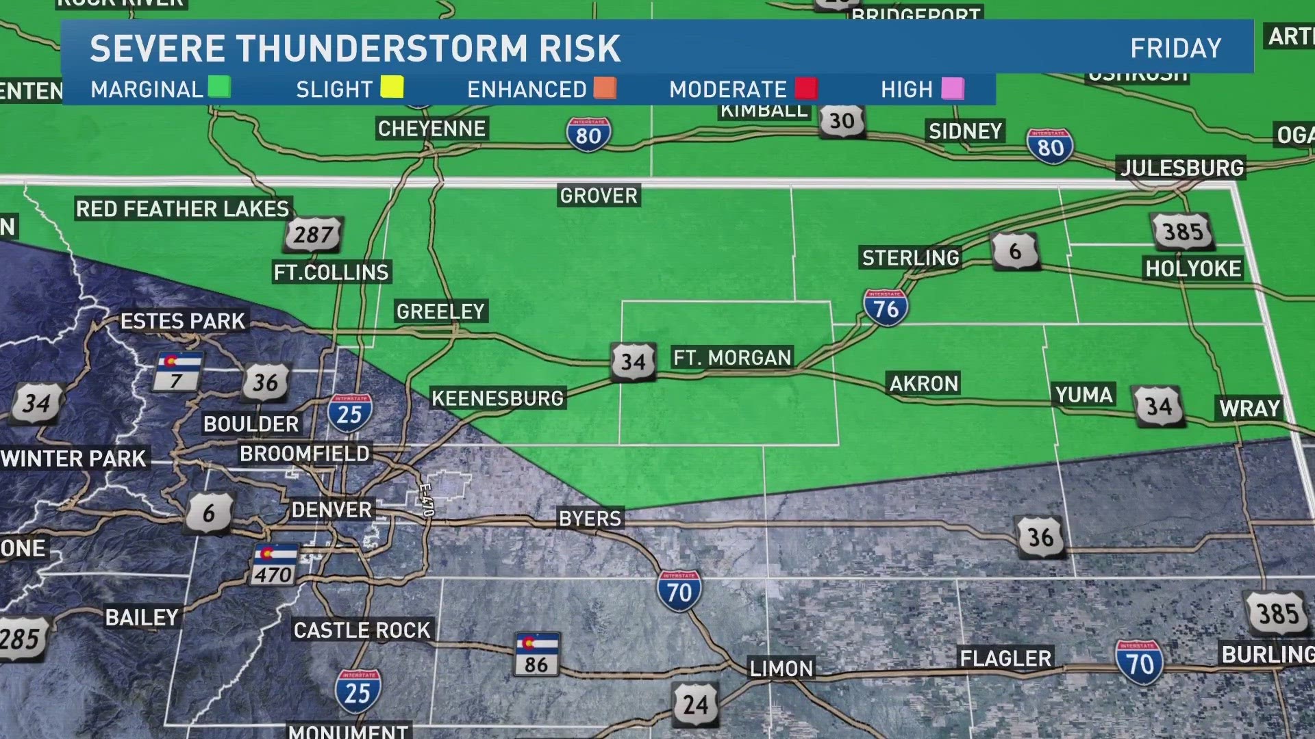
NOAA's Storm Prediction Center (SPC) issues a product everyday that's called the Convective Outlook. On 9NEWS, our meteorologists simply call it the Severe Thunderstorm Risk.

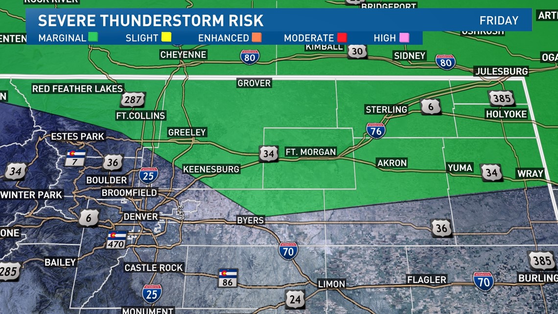
SPC issued a Marginal Convective Outlook for Thursday afternoon covering the area to the north and northeast of Denver, including Ft. Collins, Greeley, Ft. Morgan, and Sterling.
Marginal is a Level 1 threat out of 5 levels. Marginal means only a few isolated storms are expected to become severe. A Level 5 High threat would mean that numerous thunderstorms could become severe and be very widespread across the area.

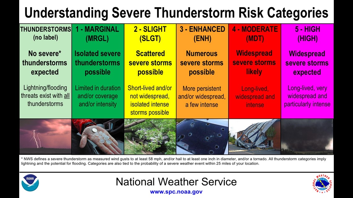
In Colorado, most of our most destructive storms happen on Marginal or Slight Risk days because we tend to get more isolated and scattered thunderstorms, as opposed to large outbreaks.
These severe thunderstorm risk forecasts usually get issued at least 24 hours in advance, but for bigger storms systems they can give you a three-day warning or even longer.
Colorado cold front
Besides the thunderstorm threat that will develop in the earlier part of the afternoon Thursday, there will also be a powerful cold front that will sweep across the area.
It's expected to arrive in the Denver area sometime between 5 and 8 p.m. Earlier on Thursday afternoon, the same front dropped temperatures in Casper, Wyoming by 22 degrees in just 30 minutes. It also plunged temperatures by 13 degrees in just 20 minutes.
That could produce severe and damaging wind gusts of 58 mph or greater. It will also push up a few storm cells that could produce lightning, small hail, graupel and even some very heavy snowfall.
> Top stories from 9NEWS curated daily just for you! Sign up for the 9NEWSLETTER right now to get can’t-miss stories, Next and Broncos content, weather and more delivered right to your inbox.
SUGGESTED VIDEOS: Colorado Climate