
COLORADO, USA — Fire danger has been very high on the plains and in the foothills, with a record number of Red Flag warnings issued so far this year. Colorado is now up to 107 Red Flag warnings issued through May 11.
That critical fire weather has mainly been limited to the plains and the lower foothills so far, but now some of the higher mountain forests are starting to dry out.
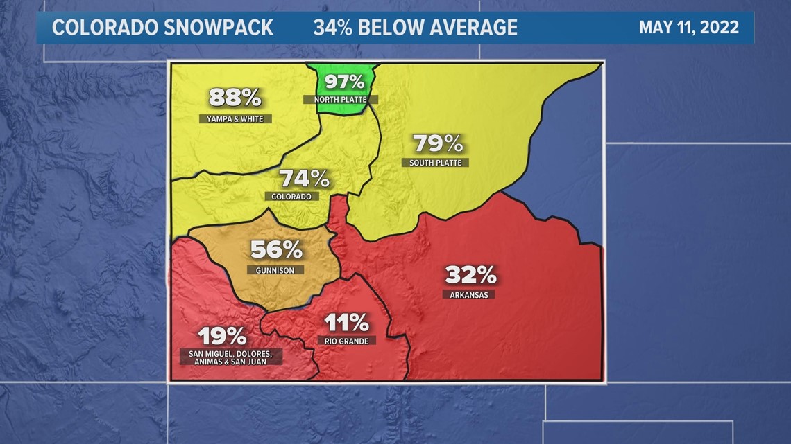
Snowpack in southern Colorado never got very high this winter, and now what little snow there was is melting at a near-record pace.
Current snowpack percentages show the Arkansas headwaters 68% below average; the San Miguel, Dolores, Animas and San Juan headwaters at 81% below average; and the Rio Grande headwaters at 89% below average.
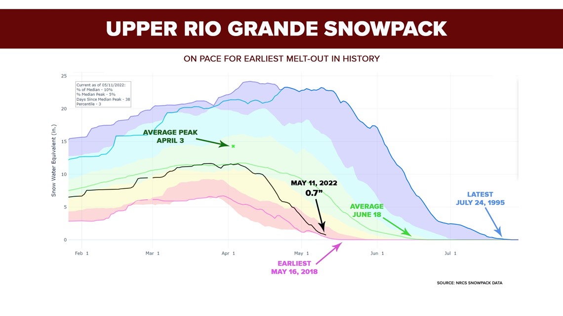
Those percentages show how much water is left in the snowpack compared to how much is normally there on May 11. That way, we can track how fast the snow is melting.

And Southern Colorado is melting out fast.
The Upper Rio Grande headwaters has only seven-tenths of an inch of water left in the snow there. That's on pace to completely melt out earlier than it ever has. May 16 is the earliest on record, in 2018.
And since there has been an average daily melt of a little more than a tenth of an inch per day, that basin could reach zero on or before May 16.
The 416 Fire started not far from that basin on June 1, 2018, followed by the Spring Creek, Weston Pass and Lake Christine fires.

To the north, we can still see quite a bit of snow on the mountains looking west from the Front Range. But if you think having that snow there in mid-May equals no fire danger this summer – think again.
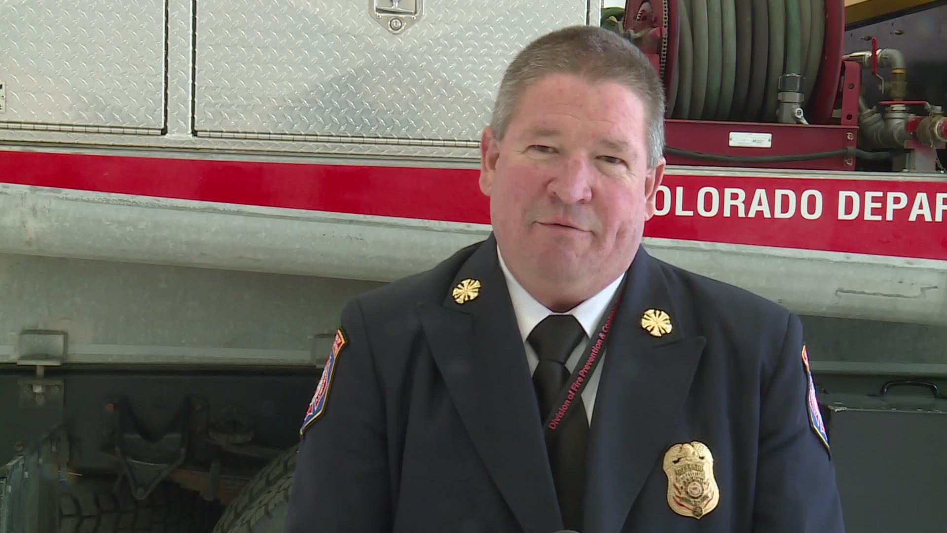
“I don’t think snowpack is a very good indicator at all," said Mike Morgan, the Director of the Colorado Division of Fire Prevention and Control. "It may have been at one time, but that's just not as useful in predicting summer fire risk anymore."
Morgan, who's been a firefighter for 36 years, said he's seen too many years recently, like 2020, where the snow was still in good shape by mid-May, but one month later it was not only melted, but also evaporated from the soil and the vegetation.
“Those fuels dry out quicker and quicker under higher temperatures and windy conditions," he said. "So if we’re not getting that ongoing moisture, the river can be full and yet the fuels can be dead everywhere around it.”
As Morgan has one eye on the Red Flag warnings on the plains and in the foothills this week, the other eye is on the higher forests, where the snow is melting fast and patches of beetle-killed trees are still vast.
“It doesn’t matter how much snow you have on the ground -- you know a dead pine tree is not going to green up," he said.
SUGGESTED VIDEOS: Colorado Climate