
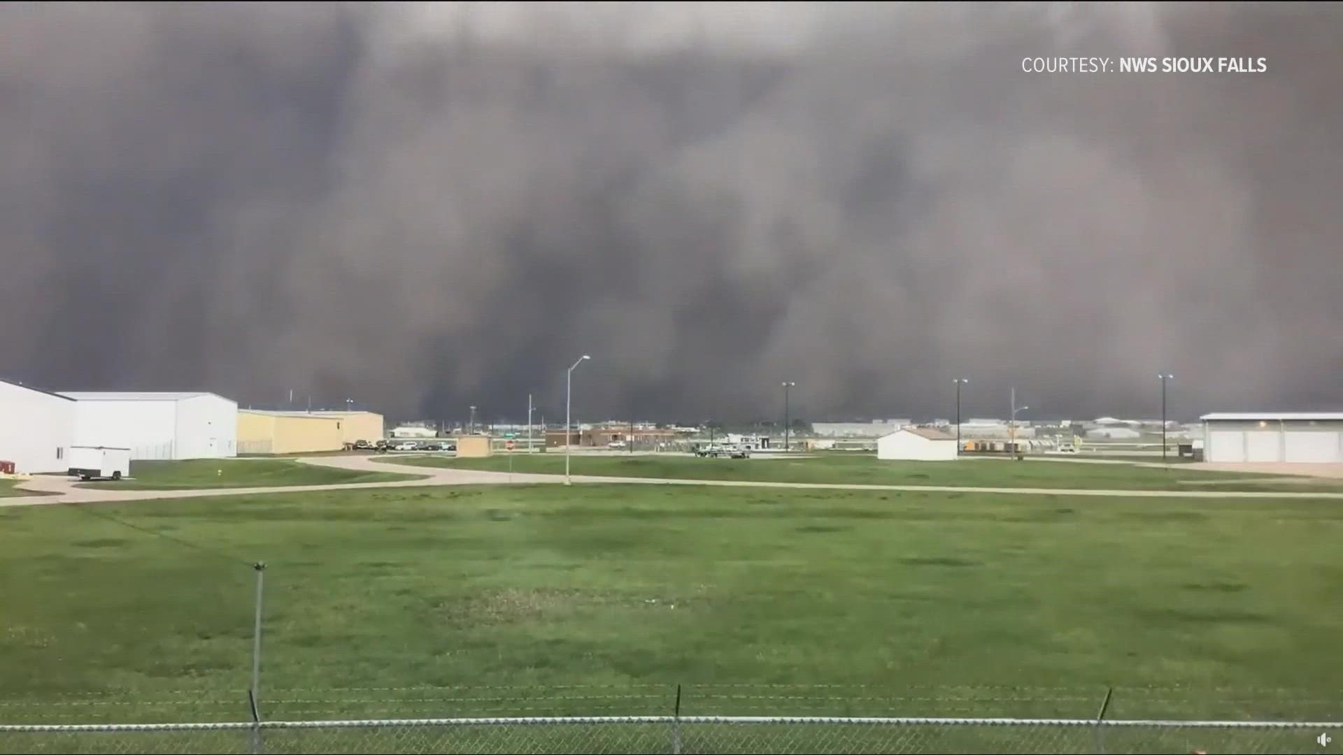
SIOUX FALLS, S.D. — A massive wall of dust stormed through Sioux Falls, South Dakota on Thursday. The air was so thick with dirt, the sky turned dark as night at 4 o'clock in the afternoon.
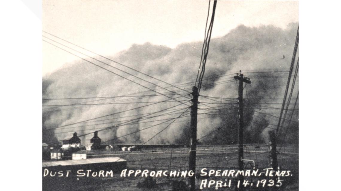
Images from the storm stirred comparisons to the iconic photos of the 1930s Dust Bowl era.
Those Dust Bowl pictures also show thick walls of dust towering high above the ground, but there is one big difference when compared to Thursday’s South Dakota storm.
That dust storm was caused by a line of thunderstorms called a derecho. Satellite images show lightning strokes highlighting a squall line within a thunderstorm complex. The wall of dust was just out in front of the storm.
After that dust moved across the airport in Sioux Falls, it was followed by a half-inch of rain in a short amount of time. Raindrops were seen hitting the camera lens at the National Weather Service office while it was recording a time-lapse.
There are not too many accounts of heavy rain following the dust storms of the 1930s.
The most notorious storm of the Dust Bowl era happened on April 14, 1935. The storm they called Black Sunday was caused by a powerful and well-organized cold front that swept down from Canada.
Instead of thunderstorms pushing the dust, it was cold arctic air.

So the mechanism that pushed the dust was different in both storms, but the underlying conditions of the soil were the same. It's drought that allows that much topsoil to get pushed around by the weather.
The question of which drought was worse is a tough one to answer plainly, especially given the factor of nearly half a million people being displaced during the 1930s.
Precipitation records of the 1930s show a far worse deficit compared to the drought of the last 10 years. The Dust Bowl's extent and intensity were also greater, and there were fewer breaks in severe drought conditions between 1930-1940.
But evaporation has become much more significant now. The atmosphere is taking more water away from the earth than it did 90 years ago.
Because of human-caused climate change, the atmosphere has warmed by about a degree Celsius since 1900. That has increased the capacity for the atmosphere to hold water vapor, and that additional water is coming from the planet.
RELATED: Summer wildfires in Pacific Northwest affecting Colorado's carbon monoxide levels, scientists say
SUGGESTED VIDEOS: Colorado Climate