COLORADO, USA — Following record highs earlier this week, highs Friday will only reach into the mid-40s and then drop throughout the day bringing a chance of snow.
The forecast on Friday calls for scattered rain showers and isolated thunderstorms with snow mixing in during the afternoon and evening. As of 12:30 p.m., a band of snow was moving through the Denver metro area.
A few lingering showers will stick around early Saturday before skies gradually clear during the afternoon. It'll stay cool with highs in the upper 40s and lower 50s for another day.
Sunday, the sunshine returns and temperatures start to rebound. Highs climb into the middle 60s Sunday, then warm even further, into the middle 70s next Monday and Tuesday.
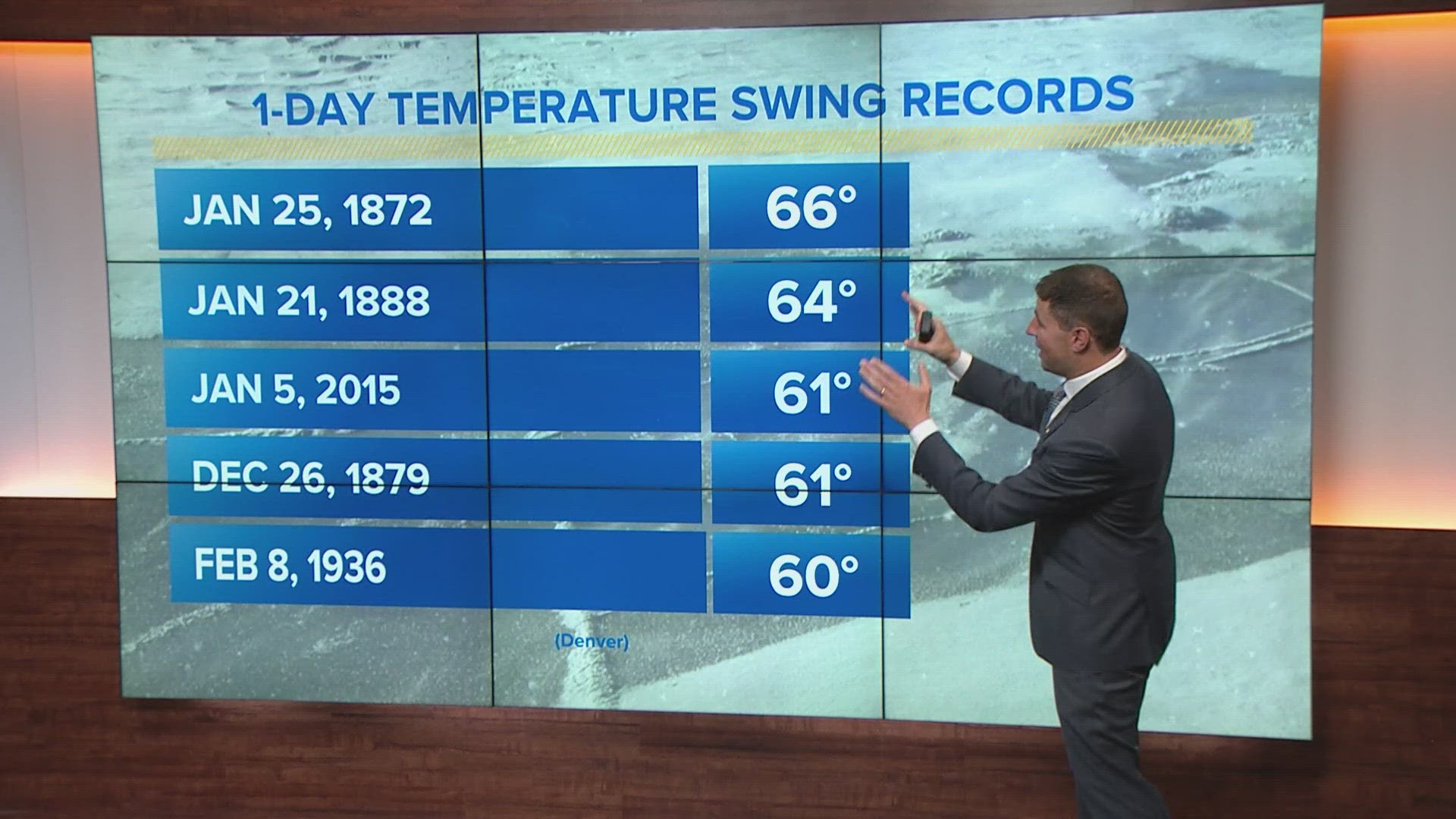
Temperature records have been kept in Denver for 152 years – and it’s never been as hot on April 11 as it was on Tuesday.
It spiked to 85 degrees just before 3:30 p.m. Denver also hit 85 on Wednesday which broke the record for that day by 6 degrees.
Just last Wednesday, Denver broke a record cold temperature at 11 degrees.
So far, 2023 has been extreme, with two cold records in January and three in February. With the records set this week, that brings the total to eight, which is the most temperature records in the first four months of any year since 10 were broken in 2006.
SUGGESTED VIDEOS: Colorado Climate
CLOSINGS: Latest closings and delays in Colorado
WEATHER LINE 9: Updated weather forecast information at 303-871-1492.
TRAFFIC CENTER: Keep up on crashes and travel times here
If you have a weather report, photo or video to share, you can contact the 9NEWS Weather Team in these ways:
EMAIL: Weather photos, videos
Share updates on our Facebook wall: facebook.com/9weather
Tweet your updates using the hashtag #9WX or tweet us at twitter.com/9NEWSWeather