
DENVER — The Colorado Front Range is famous for 60-degree sunshine in between winter storms, and the data backs that reputation up.
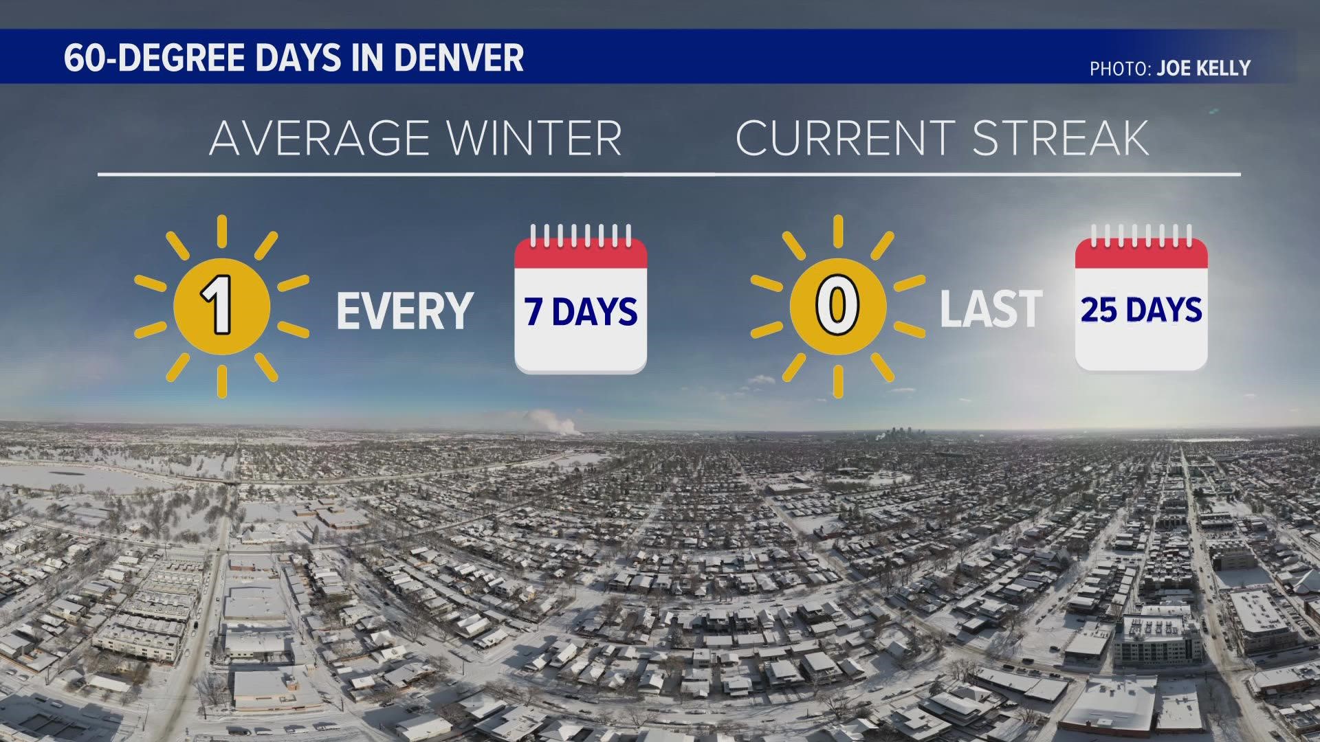
Denver averages 13 60-degree days every winter, which in meteorological records goes from Dec.1 through the end of February. That means there's a 60-degree day about once every week.
That's just not happening this season.
This is forecast to be the first January without at least one 60-degree day in 13 years. The last time the temperature hit 60 in Denver was on December 27th. It did hit 60 degrees in some parts of the Front Range on Jan. 14, but the official measurement at Denver International Airport was 59.
The snow covering the ground in northeast Colorado has a dramatic effect on the daily temperature being able to rise. The snow itself is cold, which creates a layer of chilly air just above the ground. The snowpack also reflects the sunlight away from the earth.
The more snow that sits on the ground, the harder it is to get a warm day, and without warm days, the snow can’t melt. It’s a feedback loop – re-enforcing colder days.
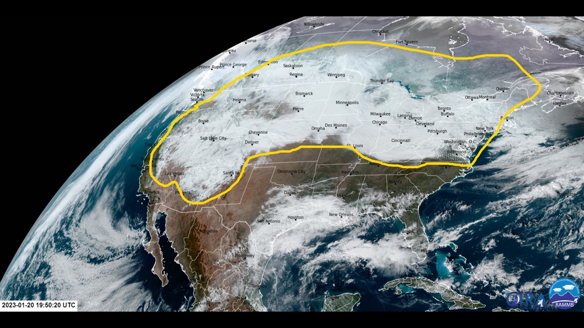
A look at the visual image from the GOES-16 weather satellite hovering 22,000 miles above the earth, shows just how extensive this winter's snowpack has been in North America.
That’s a patch of stingy cold, big enough to effect weather patterns.

The polar jet stream guides storms into Colorado over the winter. And when it’s unusually cold to the south of it, and unusually warm to the north of it, the jet stream gets wavy – meaning more storms.
Climate change is nearly three times more advanced in the Arctic compared to the mid-latitudes. In 2022, the average annual sea ice extent in the Arctic was approximately 4.13 million square miles — the 11th-smallest annual average sea ice extent in the 1979-2022 record, according to data from the National Snow and Ice Data Centeroffsite link.

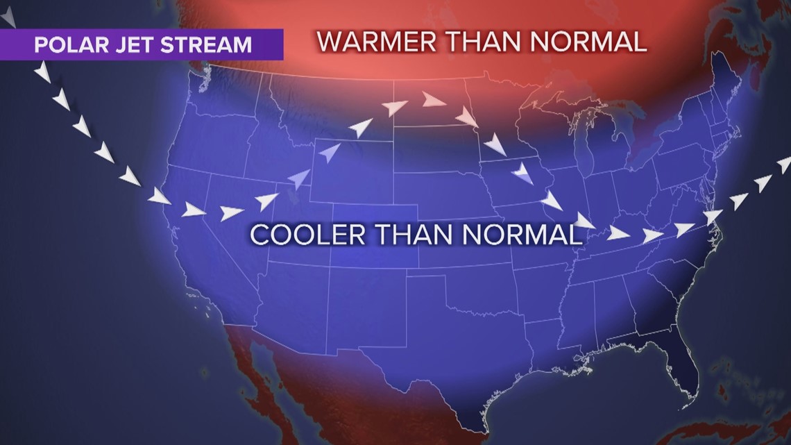
So, in a way, once the snow got established on the ground in North America, it may have helped reenforce a stormy weather pattern. Another feedback loop allowing an unusually cold and snowy winter to continue.
It could be several more weeks before Denver gets one of it’s famous 60-degree winter days. Long range computer models show this cold pattern lasting on the Front Range through at least the first week of February.
SUGGESTED VIDEOS: Colorado Climate