Winter is finally here, but the famed weather pattern known as El Niño has still not arrived.
El Niño is an atmospheric oscillation that disrupts the way the air circulates in the tropics and lower atmosphere, thereby changing the normal weather pattern for many places around the planet.
The main impacts are in the tropics, but it has a ripple effect that even alters the weather in North America.

Most of the Colorado High Country has benefited from big snow events this fall, but El Niño can’t take credit for that.
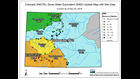
The snow pack map from the Natural Resources Conservation Service reflects the absence of El Niño. The southwest part of the state is showing below average snow so far this year. An El Niño event would favor southern Colorado.
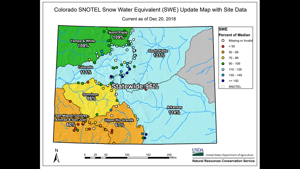
Another spot lacking in snowfall is the Front Range. Southern storm tracks, which are more numerous during El Niño, tend to bring average or above average snow to places like Denver and the Front Range foothills.
One of the signals of El Niño’s presence is warmer than average sea surface temperatures in the equatorial Pacific Ocean. Those temperatures have been warm enough to declare an El Niño since October, so what gives?
“El Niño is what we call a coupled ocean/atmospheric phenomena," said Mike Halpert with NOAA's Climate Prediction Center. "And while the ocean is warm right now, the atmosphere is really not locking into those characteristic El Niño patterns."

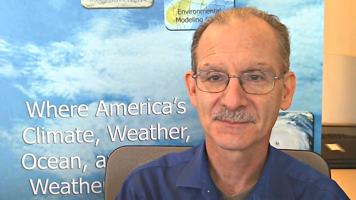
Climate scientists look for changes in sea level pressure between the eastern and western part of the Pacific, changes in the low-level winds, and even the upper level winds, as well as tropical rainfall. Halpert said they really haven’t seen much of that yet.
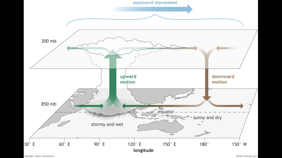
Halpert is one of the scientists who decide whether El Niño is present or not, and one explanation he can offer as to why the atmospheric signals are not matching the ocean signals is interference from another weather phenomena called the Madden-Julian Oscillation (MJO).
“At times it will be in phases that will kind of work in concert with El Niño, and at times it will be opposite to that," Halpert said. "So it will be almost fighting those kind of El Niño impacts. And when we deal with that, it kind of clouds our overall signal."
It also matters which part of the Pacific Ocean has the greatest departure from normal sea surface temperatures. Sometimes the warmest temps set up in the western Pacific, giving us what’s called a Modoki El Niño.
Halpert says that did not happen this year, but there has been an unusual warming across the entire El Niño sector from west to east.
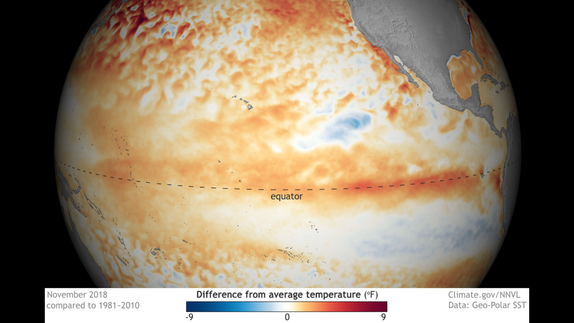
“Right now, because the whole Pacific is warm, we’re not seeing any type of gradients," Halpert said. "It’s possible that the fact it’s warmer than normal everywhere is something that is preventing these shifts in tropical rainfall, and why we're not seeing that true atmospheric response."
Halpert said that every forecasting tool, including a number of computer forecast models at his disposal, shows a high degree of certainty that the ocean temperatures in the equatorial Pacific will remain warmer than average for the rest of the winter and even into the spring.
“We just have to believe that if the ocean continues to stay warm eventually it will have an impact on the atmosphere, and will force the more typical El Niño impacts,” Halpert said.
The Climate Prediction Center has raised the likelihood of El Niño occurring this winter to 90 percent, and has now extended a 60 percent chance that it will last through the spring.
SUGGESTED VIDEOS | Feature stories from 9NEWS