
COLORADO, USA — On Sunday night, Denver, Lakewood and Arvada all saw soft ice pellets.
In some cases, it even accumulated.
That "it," though, is a tricky weather word that some may not have even heard of before.
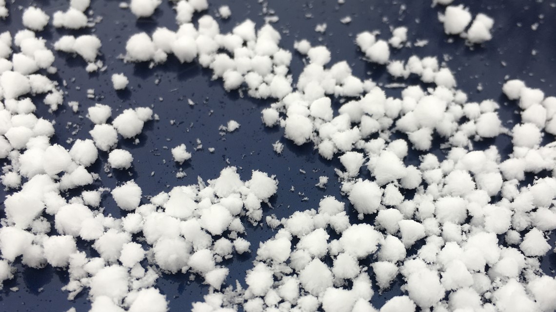
Graupel is a unique form of wintry precipitation that's not sleet, hail or snow -- even though it probably resembles a little bit of all three. So what exactly is it?
It all starts at the top of our atmosphere. That's where precipitation starts, and it usually begins in the form of snow.
In a graupel event, as the snowflake falls, it'll run into a layer of "supercooled" water. Supercooled water is water that's in its liquid form despite the fact that the air around it is at or below 32 degrees (the freezing point). Normally, water at or below 32 degrees is either frozen as ice or snow.
So as the snowflake falls, the water will gradually accumulate on its outer layer. That adds an icy exterior to the snowflake.
If you think of a Tootsie Pop, the chocolate center in this case would be a snowflake, while the sugary outer core would be ice that's frozen onto the flake.
The end result of graupel is it resembles an icy pellet. Unlike hail or sleet, though, graupel is soft and easily crushable, similar to the texture of Dippin' Dots ice cream.

We're fairly prone to graupel in Colorado, especially during spring and fall. Temperatures at the surface are usually at or just above freezing when graupel falls.
So the next time you see an icy pellet and it looks soft and it's easily crushable, you know you're probably looking at graupel.
RELATED: Chilly start to the week in Colorado
SUGGESTED VIDEOS: Colorado Climate