
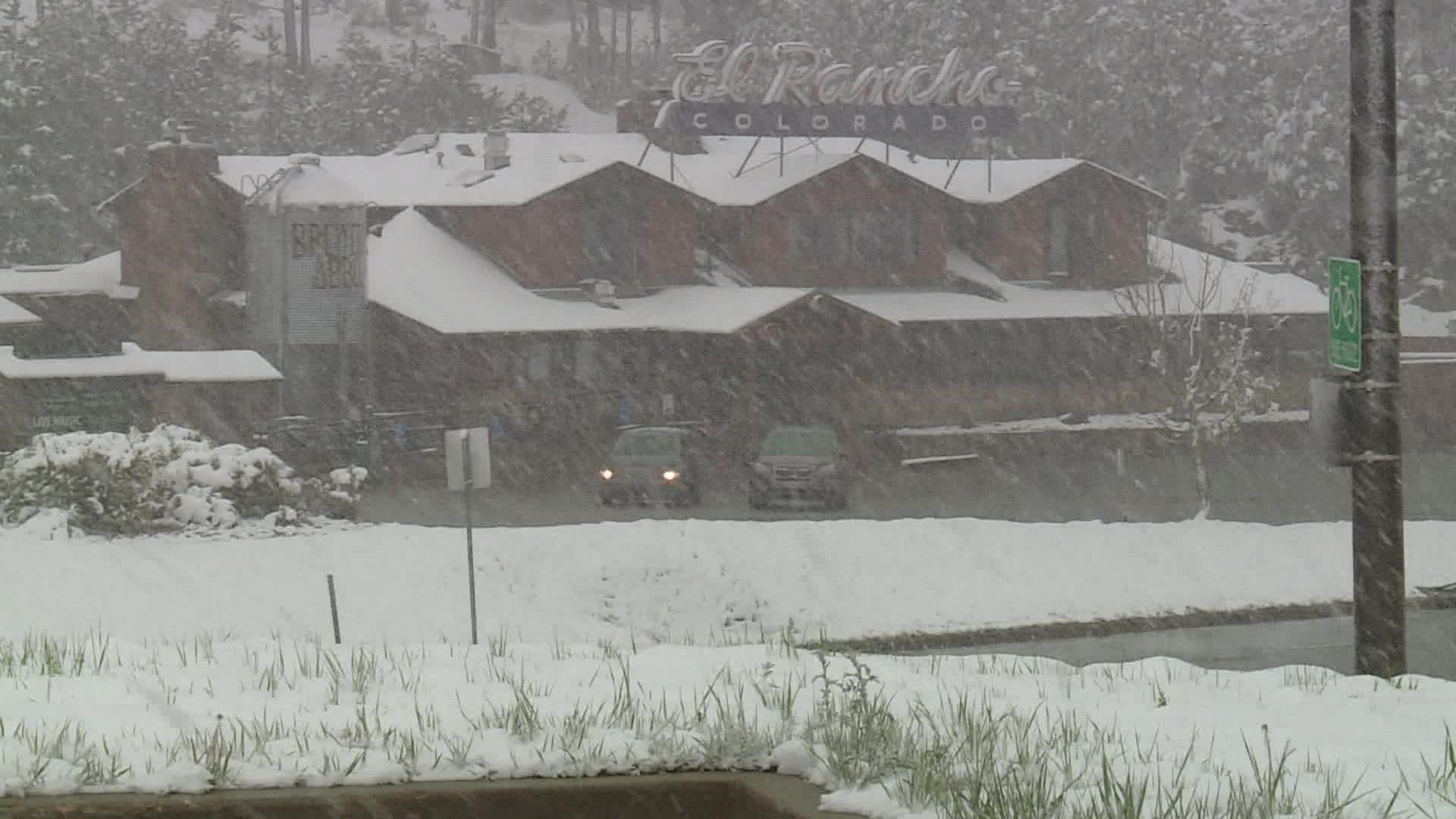
COLORADO, USA — The early snow on the Colorado peaks this week brought the hope of a deep powder season ahead, but the weather outlook is not as optimistic.
There’s a high chance for yet another below average snow season for the mountains this winter.
The reason for that outlook is a very unusual third consecutive La Niña. That’s when the Pacific Ocean near the equator is cooler than normal.
Climatologists have learned that when that region of the Pacific Ocean is in a cooler phase, it often results in high pressure over the western U.S. which causes a variable jet stream and tends to limit winter storm chances in Colorado, especially the southern half of the state.

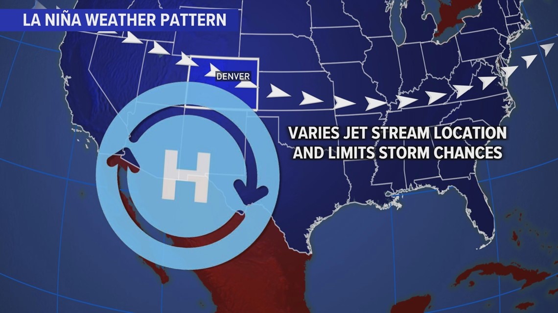
And when that part of the Pacific Ocean is in a warm phase, its called El Niño. Those tend to bring more storm systems to Colorado.
That ocean temperature condition is generally known as the El Niño Southern Oscillation (ENSO).
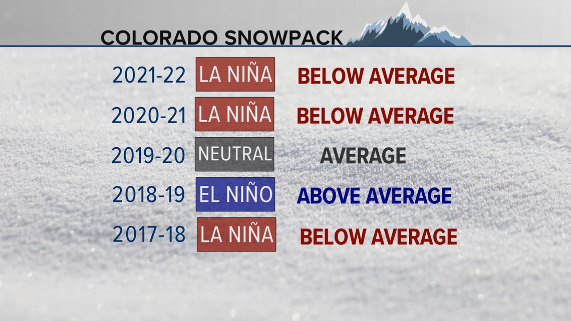
Over the past five years, the snow in Colorado has followed this climate connection.
Below average snow has occurred the past two winters during La Niña's, average snow with neutral conditions in 2019-2020, above average snow during the 2018-2019 El Niño, and below average snow during the La Niña of 2017-2018.

There has now been below average snowpack in Colorado in four consecutive La Niña winters (2021-22, 2020-21, 2017-18, 2011-12). That's using the Climate Prediction Center's (CPC) Oceanic Niño Index to define past conditions, and only count the seasons where La Niña conditions were present from November through the end of March.
Note: Sometimes the ocean temperatures in the Equatorial Pacific can indicate an El Niño or La Niña, but there is no atmospheric coupling to complete the oscillation.
But the La Niña snow connection has not also been that relievable. The three La Niña seasons before that (2010-11, 2008-09, 2007-08) yielded above average snowpack in Colorado.
Other oceanic oscillations can offset or strengthen the ENSO conditions. Like the Atlantic Multidecadal Oscillation (AMO), Pacific Decadal Oscillation (PDO) or the timing of the Madden-Julian Oscillation (MJO).
There is also a chance that this season's La Niña could come to an end early. The Climate Prediction Center says there is a 46% chance that the La Niña may vanish by January.
2016 started off under a weak La Niña that only lasted through December, when it shifted into neutral conditions for the rest of the snow season. There was tremendous snow in Colorado from January through March and that season peaked a little above the average.
But for now, the La Niña is forecast to remain all winter, so that will tilt the preseason snow outlook for the Colorado mountains to a below average winter.
What's average?
The average is based on how much water is contained in the snowpack, or the snow-water equivalent (SWE). The average statewide SWE for Colorado is 16.8 inches reaching an average peak on April 8.
The total snow across the state can vary greatly in an average season that adds up to 16.8 inches of SWE, but in general Colorado gets between 250 to 350 inches of snow across the entire state from October to May.
Note: In some cases, the statewide snowpack might be below average during a La Niña season, but the northern half of the mountains are well above average while the southern half is well below. So individual weather stations can be at near record snowpack, while the statewide average is below normal.
SUGGESTED VIDEOS: Colorado Climate