
DENVER — THE FORECAST BY: Meteorologist Laurann Robinson
FORECAST AT A GLANCE: Strong scattered storms and mountain snow, Friday night.
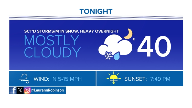
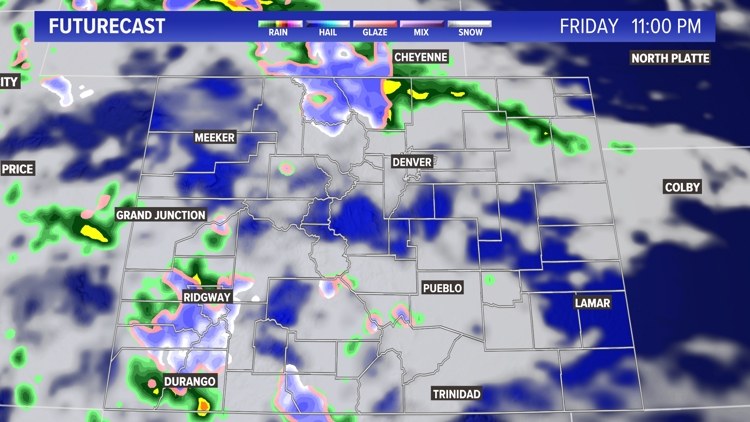
Friday evening, the front range/eastern plains should watch for scattered storms, with some becoming strong. Prepare for small to medium- sized hail, strong winds, heavy downpours, and lots of lightning and thunder. Storms will stay strong throughout the overnight hours.
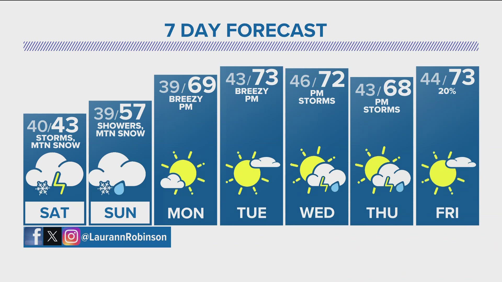
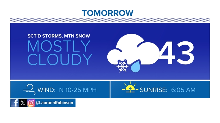
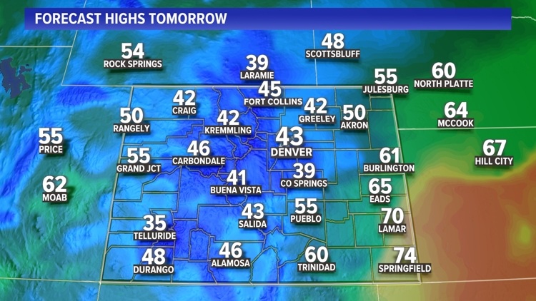
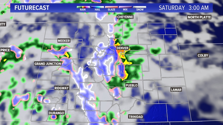
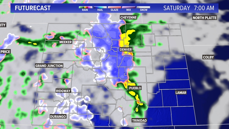
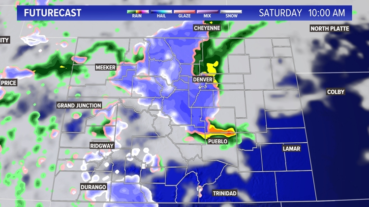
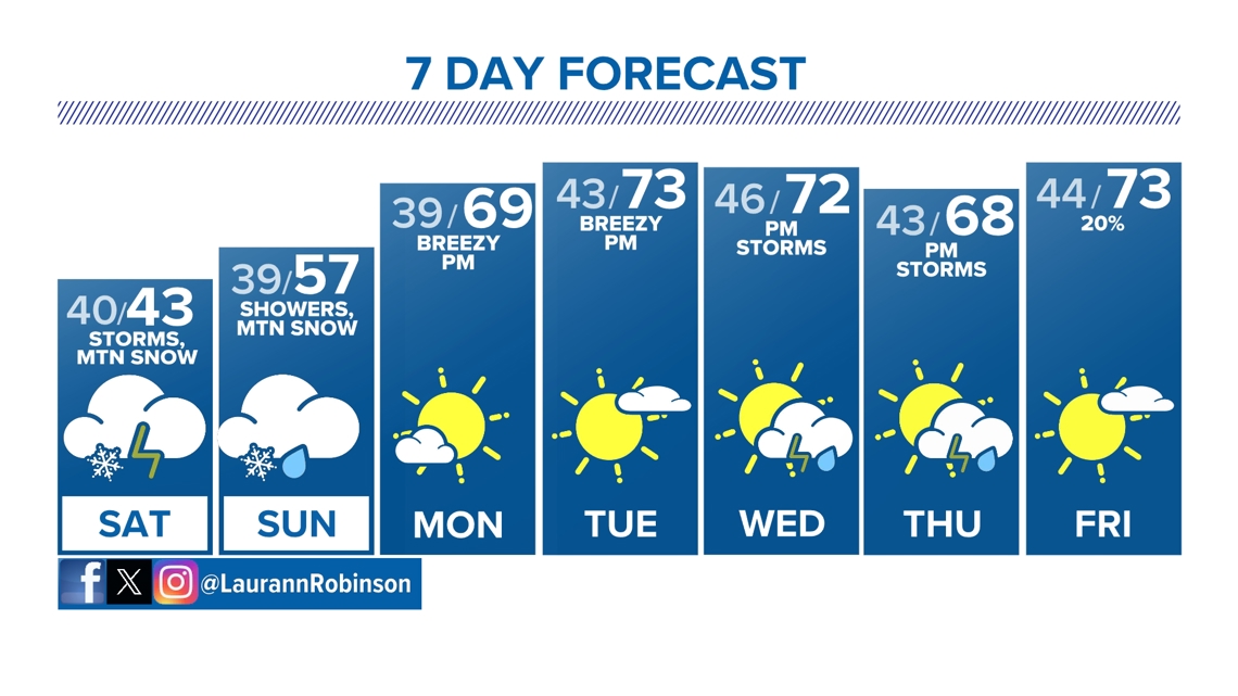
Saturday, cooler air will takeover, with highs only a few degrees warmer than our overnight lows, peaking in the lower 40s. Wet weather will stick around, as well, with scattered rain showers across the front range, storms across the plains and more snow across the foothills and mountains.
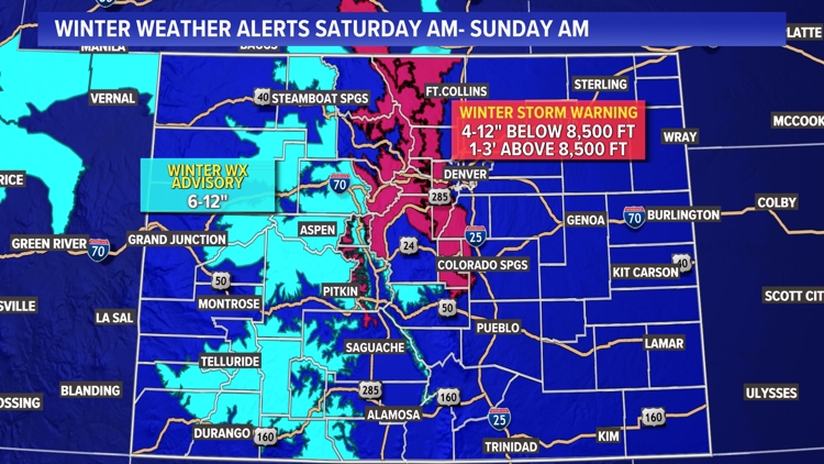
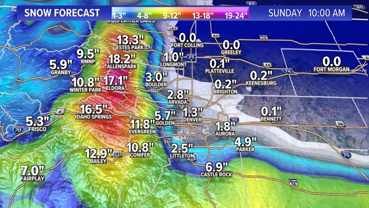
To the west, heavy snowfall will be the big story, from the foothills through the high country. Winter Storm Warnings and Winter Weather Advisories will be in effect through Sunday morning. The higher elevations of the foothills, into eastern portions of the high country, should expect the highest snow totals, with 1 to 3 feet of new snow possible. Additionally, foothill and mountain roads across Colorado should prepare for hazardous travel conditions through the first half of the weekend.
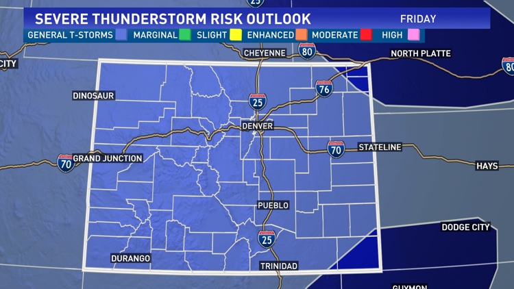
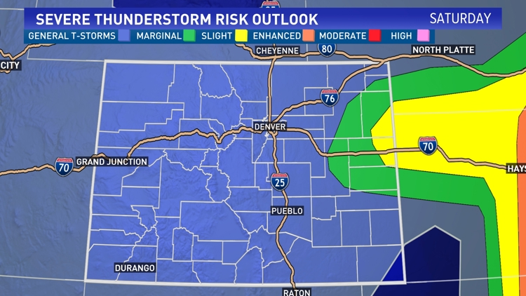
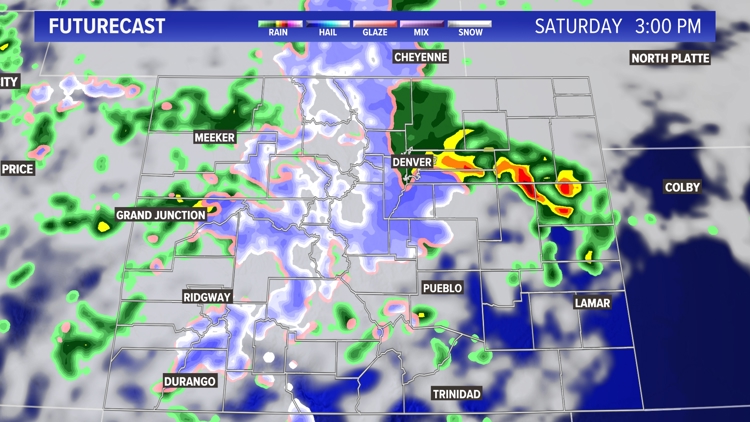
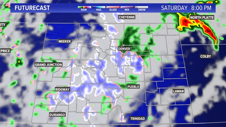
To the east, we'll watch for strong storms across the plains, Saturday afternoon/evening. Central portions of the plains will be under MARGINAL and SLIGHT chances for severe weather, meaning large hail, strong winds, heavy downpours, lightning and thunder will all be likely. Additionally, there is also a small possibility for a tornado to pop-up, in this forecast area.
Sunday, we'll continue to watch for scattered rain showers, and mountain snow. Highs increase just a tad, peaking in the middle to upper 50s. Sunday night, we'll start to clear out, with lows remaining mild, in the upper 30s.
Your outdoor activities can resume as we start the workweek, with sunny skies returning and afternoon highs bouncing back into above-average territory. Afternoon highs will climb into the upper 60s/lower 70s, Monday and Tuesday.
Midweek, temperatures stay warm, but we'll watch for afternoon storm chances to return Wednesday and Thursday, with slight chances next Friday.
Strong storms, mountain snow Friday night


FRIDAY: Mostly cloudy with scattered showers and storms, mountain snow, high 67; storms and heavy mountain snow overnight, low 40.
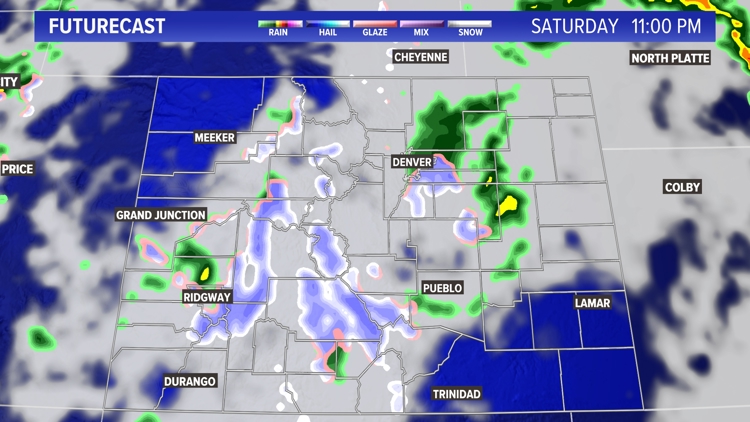
SATURDAY: Cloudy and cooler, with scattered showers, storms to the east and snow to the west, high 43; showers overnight, low 39.
SUNDAY: Cloudy and cooler, with scattered showers, high 57; mostly cloudy, but clearing overnight, low 39.
MONDAY: Mostly sunny and warmer; high 69; mostly clear overnight, low 43.
TUESDAY: Mostly sunny and warm, high 73; mostly clear overnight, low 46.
WEDNESDAY: Mostly sunny and warm, with late-day storms, high 72; partly cloudy, with storm chances overnight, low 43.
THURSDAY: Mostly sunny and warm, with late-day storms, high 68; partly cloudy, with storms chances overnight, low 44.
FRIDAY: Mostly sunny and warm, with a slight chance for late-day storms, high 73; partly cloudy overnight, low 46.
CLOSINGS: Latest closings and delays in Colorado
WEATHER LINE 9: Updated weather forecast information at 303-871-1492.
SUGGESTED VIDEOS: Denver March Snowstorm 2024
TRAFFIC CENTER: Keep up on crashes and travel times here
If you have a weather report, photo or video to share, you can contact the 9NEWS Weather Team in these ways:
EMAIL: Weather photos, videos
Share updates on our Facebook wall: facebook.com/9weather
Tweet your updates using the hashtag #9WX or tweet us at twitter.com/9NEWSWeather
Download the 9NEWS app:
iTunes: on9news.tv/itunes
Google Play: on9news.tv/1lWnC5n
The 9NEWS Weather team of Kathy Sabine, Cory Reppenhagen, Laurann Robinson, Keely Chalmers, Ed Greene and Chris Bianchi update the Denver weather forecast multiple times each day. Bookmark this link to always have the latest forecast from 9NEWS. The team values your local weather reports and often features your photos and videos during weather segments in all newscasts.
SUGGESTED VIDEOS: Science is Cool