DENVER — For the first time this spring season, widespread severe weather is possible for Denver and the Front Range.
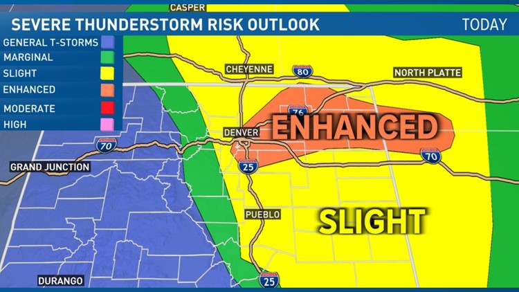
The threat for severe storms will be Wednesday, with the possibility of large hail and damaging winds from Denver north to Fort Collins.
It could also mark the highest severe weather risk the Denver metro area has seen in several years.
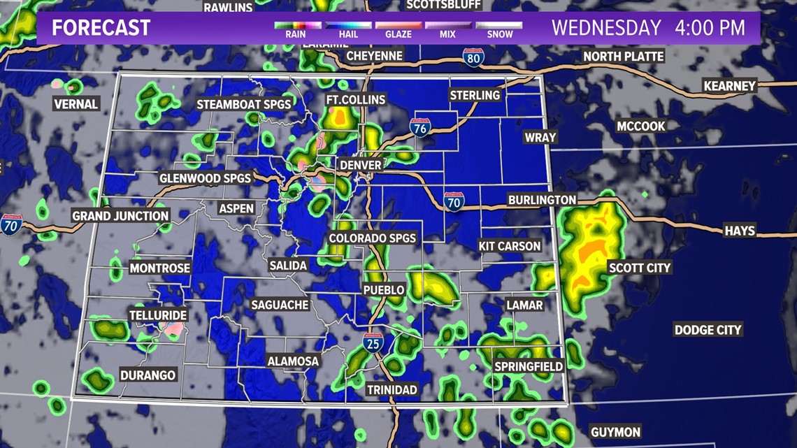
The highest threat to the Denver metro area looks to be between 12 p.m. and 6 p.m. Wednesday. Some risk also remains from 6 p.m. until midnight, though the threat will probably be considerably lower at that point.
ALERTS: Latest Colorado weather alerts
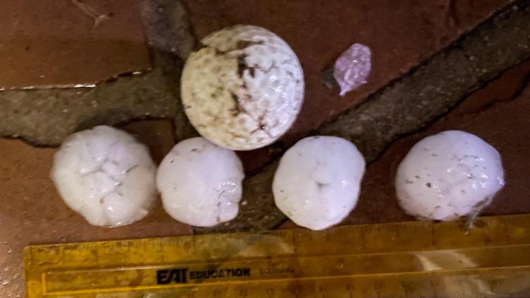
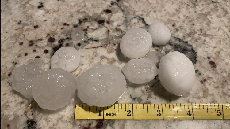
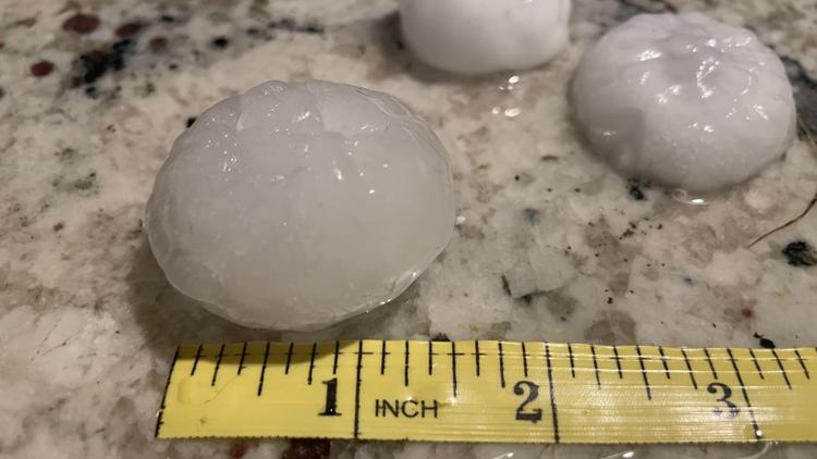
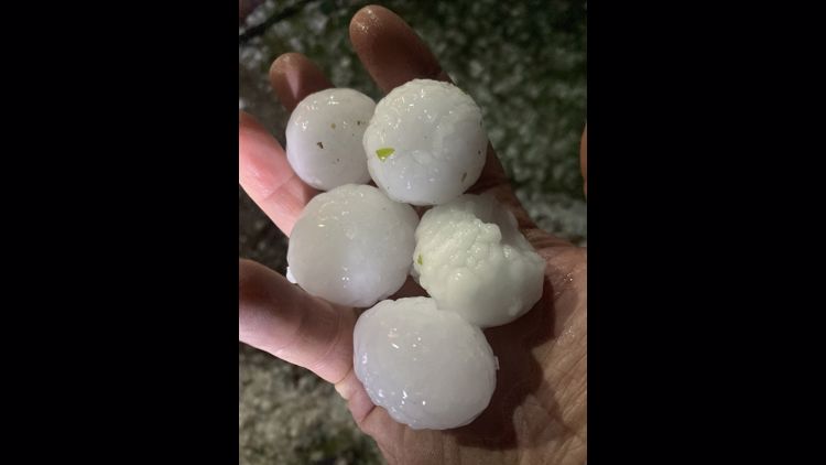
At this time, it appears that large hail will be the main hazard for the Denver area on Wednesday, although winds exceeding 60 mph or even 70 mph could also threaten the metro area.
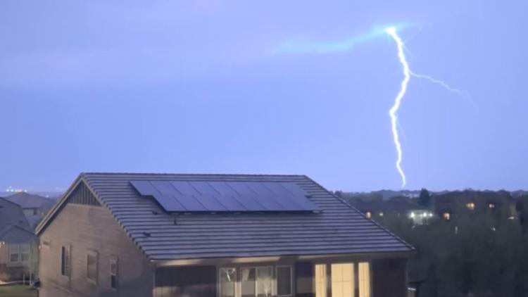
There is also a threat for tornadoes across eastern Colorado, including in the Denver area. There's a good chance eastern Colorado will see its first Tornado Watch of 2023 on Wednesday.
Hail, strong winds and a few tornadoes are all possible as a meandering area of low pressure tracks near the Four Corners on Wednesday, allowing lots of moisture to reach eastern Colorado.
On top of that, lots of wind shear — the change in wind speed and direction with height — will create the potential for supercell thunderstorms to develop.
If you have access to a garage or carport, Wednesday will undoubtedly be a good day to have your car under one. If you're planning on planting your garden, you might want to hold off on doing so until the end of the week.
The Storm Prediction Center (SPC), the governing body for severe weather forecasting, put Denver and much of northeastern Colorado under a so-called "Slight Risk" for severe storms on Wednesday. That's significant because it's relatively rare for the SPC to put Denver under such a risk category two days ahead of time.
Severe storms pass through Colorado


The last time the SPC put Denver in a Slight Risk category or higher this far in advance was in late May 2018. That means there's an added degree of confidence about Wednesday having the potential to produce widespread severe weather for eastern Colorado, including the Denver area.
That all said, beneficial moisture will also accompany Wednesday's storms. As of Monday, only two-hundredths of an inch of rain had fallen at Denver International Airport, far below the month-to-date average of about an inch. Wednesday's storms and Thursday's cooler, steadier type of rainfall should bring some needed rain.
A widespread 1 to 2 inches of beneficial rain looks to fall on northeastern Colorado this week, mostly on Wednesday night and Thursday.
In the higher terrain, snow looks likely as well above 8,000 feet in elevation, with perhaps snow levels dropping to 7,000 feet by Thursday morning.
Before all of this, there's also a threat for severe weather Tuesday night into Wednesday morning, especially north of Denver for places like Fort Collins and Greeley.
Stay with 9NEWS for the latest on this week's severe weather threat.

SUGGESTED VIDEOS: Colorado Climate