December is off to a warm start, but that will all change in the next 24 hours.
Colder temperatures, snow and strong winds are headed for our region for the start of the workweek.
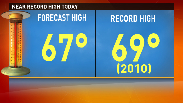
We’ll round out the weekend with near record temperatures and partly cloudy skies. Sunday’s high for Denver is forecast for 67°, two degrees shy of the record high of 69° set in 2010.
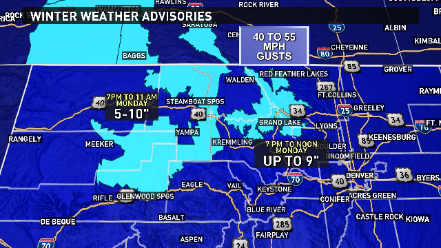
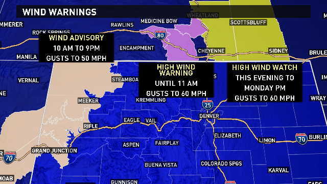
Traveling at times will be challenging for northwestern Colorado and southern Wyoming because of strong winds.
A cold front arrives tonight and snow increases in the mountains. Traveling will be more challenging in the early evening hours through midday on Monday in the northern mountains.
Icy and snowy roads are expected as well as low visibility due to blowing snow.
For the Front Range, clouds and winds increase as colder air approaches. Monday’s high will be in the upper 30s with winds up to 20 mph and a chance for afternoon flurries with little to no accumulation.
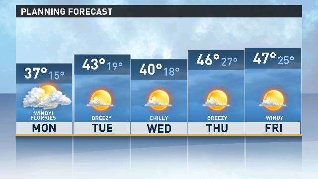
The snowy weather decreases through the afternoon in Colorado but the chilly temperatures remain.
Temperatures for the rest of the week will be at or below normal.