
A storm system moving into Colorado today will trigger afternoon thunderstorms, some of which will likely be severe.
The main concern is for hail larger than one inch in diameter, and wind gusts of 60 mph or greater. An isolated, and short lived tornado is possible, but not probable.
The Denver metro area is included in this risk. That area is listed as a Marginal Risk.
Chances of rain will increase starting at about noon today, and we will likely see several attempts at thunderstorm formation in the metro over the course of the afternoon, especially if some outflow boundaries from storms to the east make their way into the metro.
Severe storms are possible this afternoon and evening. #9WX #cowx #9news #9newsmornings pic.twitter.com/47to2nG2PV
— Marty Coniglio (@martyconiglio) August 10, 2017
The higher threat of severe weather is east and southeast of the Denver area. Most of east and southeast Colorado is covered by a Slight Risk, as issued by the Storm Prediction Center.
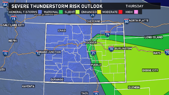
The 9News Weather Titan will be out in the field all afternoon and evening, with Cory Reppenhagen and Becky Ditchfield. They will be monitoring storms between I-76 and I-70.
You can send your weather pictures and videos (safely!) to us on social media using #9WX or send them directly to 9News via YourTake.