
BOULDER, Colo. — The historic spread of the 2020 East Troublesome Fire could have been better predicted.
A new report from the National Center for Atmospheric Research (NCAR) shows that outdated information about how many beetle-killed trees were in that area might have led to less accurate fire spread forecasts.
Shortly after the East Troublesome Fire started in October 2020, a computer prediction model showed fire commanders how that fire might spread as a major wind event approached the area.
The fire went on to consume 170,000 acres of forest in the next three days -- by far exceeding the forecast from the fire spread model.
There are three major data inputs to a fire behavior model.
One is topography -- the slope and shape of the terrain, which doesn't change much over time.
Another is the weather forecast.
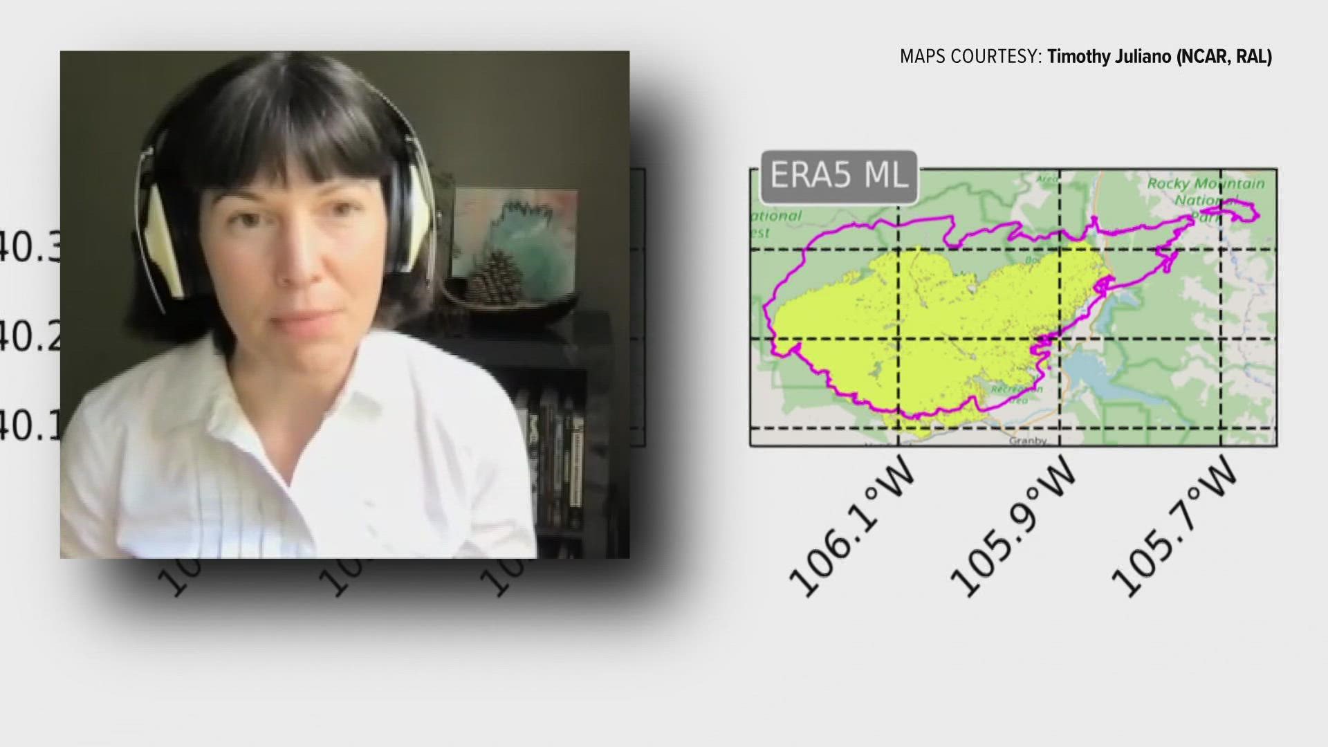
"And the meteorology was actually quite good for that event," said Amy DeCastro, an earth systems scientist with NCAR. "We have high accuracy and trust in the weather forecasts that we use in our fire modeling."
The third input is fuels -- the type and condition of the vegetation.
The NCAR report, led by DeCastro, showed big discrepancies in the fuels data fed into the computer models during the East Troublesome Fire, compared to what types of trees actually stood in the fire's way.
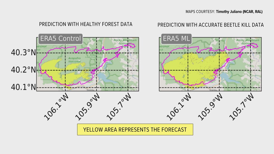
A government data set called LANDFIRE is the main input of fuels data into the fire behavior model. It showed that the East Troublesome Fire was about to consume a healthy and standing pine forest.
"But what I knew from observations with my eyeballs, was that the tree health was in a different state," said DeCastro, who frequently hiked, fished and rode horseback in that area before the fire. "Those trees had been infested with pine beetles, a bunch of tree mortality had occurred and there was also a bunch of blow down. A lot of dead and down trees just scattered everywhere."
A wildfire would spread much more rapidly and burn more intensely in dead beetle kill than it would burning through a healthy forest.
DeCastro said she was surprised to find the discrepancy in the LANDFIRE data after the fire, and that was her motivation to start a new study and to find a new solution.
With math and computing as her strong suit, she designed a new program that uses artificial intelligence to identify changes in fuel types by looking at images from two high-resolution satellites.
Sentinel 1 and Sentinel 2 are on a sun-synchronous, near-polar orbit that delivers spatial resolution of down to 5 meters and a swath of up to 400 kilometers.
DeCastro used her personal observations of the beetle-killed trees to train the computer program to identify the changes to the landscape since the last update to the LANDFIRE dataset.
LANDFIRE is only updated every five years, because that is actually how long it takes to categorize every forest in the country.
The data used in the East Troublesome modeling was four years old.
After the AI program ran the fire behavior model with the new tree data, the results were astounding.
“It captured 40% more of the observed burned area space," DeCastro said. "So it’s a much more accurate forecast with the adjusted fuels.”
The yellow area on the left side of the graphic shows the fire spread forecast with a healthy forest. The yellow area on the right is the new forecast, properly representing the beetle kill.

The new AI program has been made available to run on any fire behavior model on an open and free platform. The catch is that a fire commander or analyst would have to have observed knowledge that the fuels in front of a fire are different than the LANDFIRE dataset.
So the AI can be trained to enter a new fuels input. It would work great in the early stages of a wildfire that might last several days, but it would be more difficult to run in a small and short-lived wildfire like the Marshall Fire.
DeCastro believes advancements in high-resolution satellites and supercomputing might be able to keep up with increasingly extreme wildfire behavior. The LANDFIRE data updates every five years, while the satellites capture new high-resolution images about every five days.
“I know that the situation looks pretty dire, but we do have the capability to make these models better,” she said.
SUGGESTED VIDEOS: Wildfires in Colorado