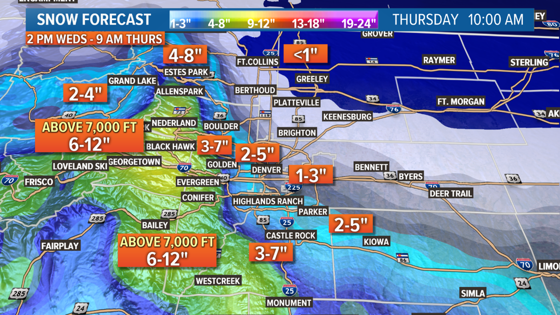
Upslope flow, or the movement of air up a sloped surface such as the side of a hill or a steep mountain slope, poses a big challenge for weather forecasters. In today's case, it means there will be a big difference between how much snow accumulation the western and southern suburbs of the Denver area will get, versus locations east of the city, like Denver International Airport (DIA).
The challenge lies in figuring out where the snowfall will begin to get heavier. With upslope along the Front Range, that snowfall is determined by the direction and strength of the wind.
Here's how upslope works
As storm systems pass south and southeast of Colorado, winds along the Front Range shift to the east/northeast.
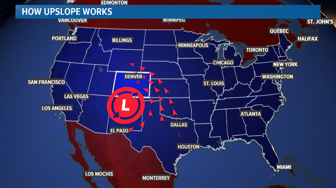
That wind pushes against the mountains and then moves vertically.

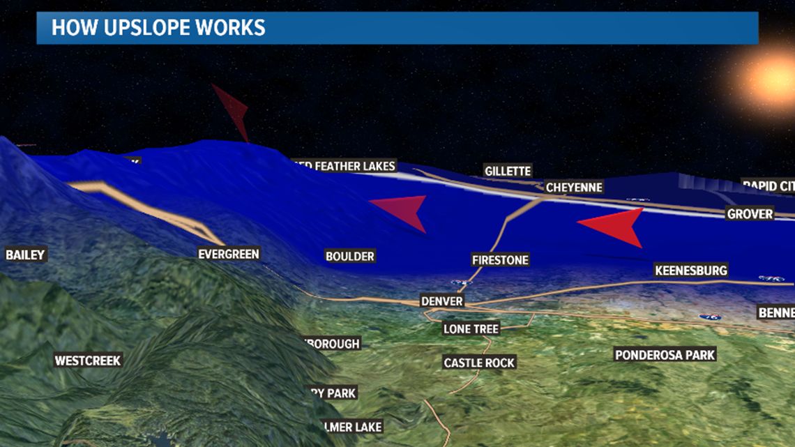
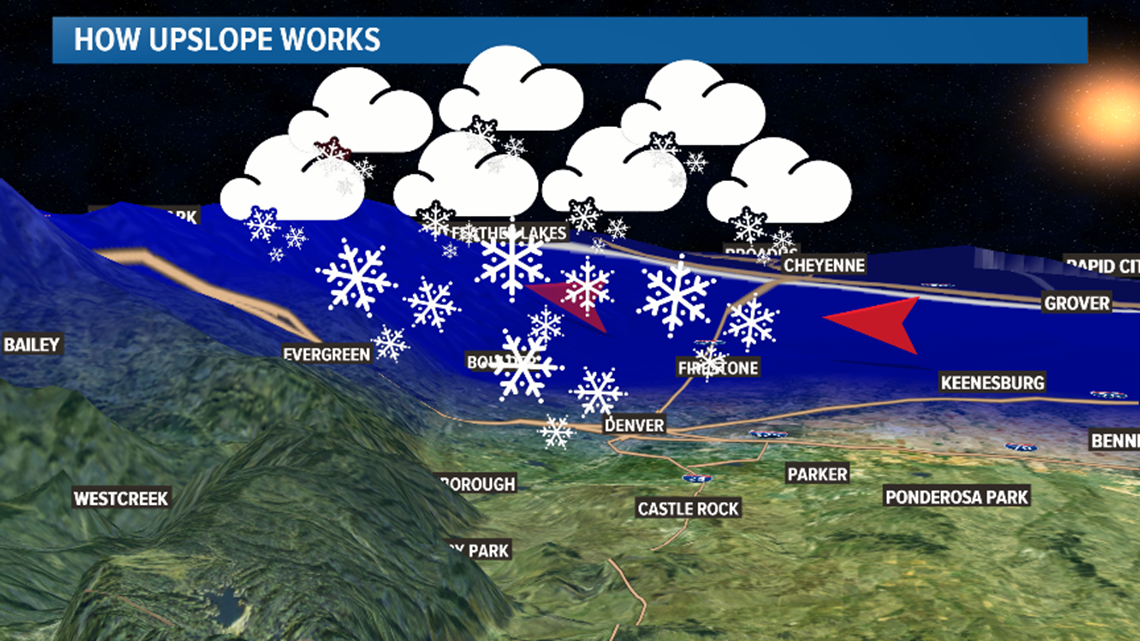
The upward, rising movement of that air aids in the development of clouds and snow showers.

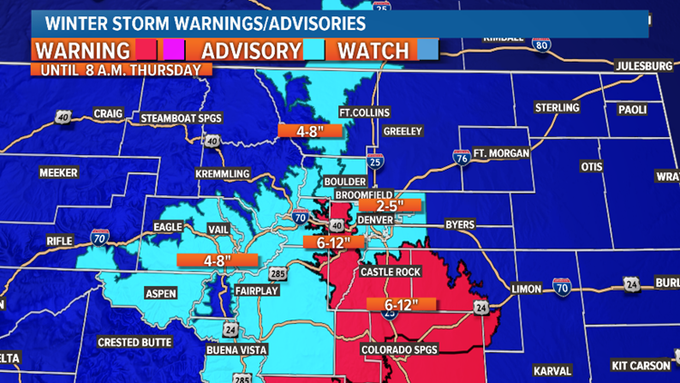
The specific direction of the wind gives us an idea of where the heavy snow bands will form. Today’s wind will be out of the northeast. That means upslope will occur along the Rockies to our west and along the Palmer Divide to our south.
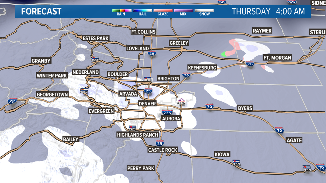
This is where we will find our highest snow totals. Foothill locations west of Denver and those areas south along the Palmer Divide could see up to a foot of snow accumulate by early Thursday morning, while locations out near DIA may get less than an inch.

Any shift in the wind can change the forecast significantly. This is what makes forecasting so tricky during an upslope event.
As the storm shifts, the winds will shift. As the wind shifts, snow bands will shift and eventually the snow will come to an end.
Since this is an upslope event for the Front Range, it also means mountain areas west of the Foothills will not see as much snow. Those locations are more likely to see the wind flow downhill. When winds flow down a mountain or hillside it creates drier conditions and less snowfall.
This particular storm is forecast to come to an end along the Front Range late Wednesday night, with a few lingering, light snow showers early Thursday morning.
WEATHER LINKS: TRAFFIC | FORECAST | INTERACTIVE RADAR
SUGGESTED VIDEOS | Local stories from 9NEWS