
DENVER — Critical fire weather returns to Colorado this weekend, while other parts of the state could get more than a foot of snow.
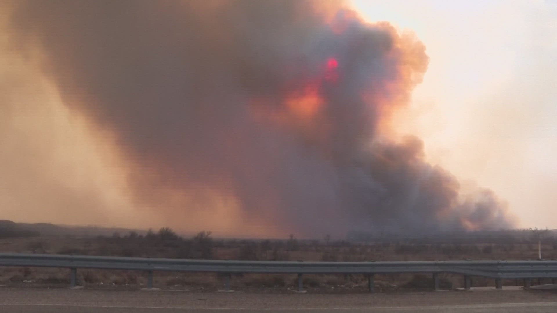
High fire danger with strong forecasted winds have led to Red Flag Warnings being issued for Friday and Saturday on the eastern Colorado plains.
Meanwhile, Colorado's mountains are forecast to see snow and strong winds from Saturday through Monday morning.
Red Flag Warning
The National Weather Service has issued a Red Flag Warning for wind and low relative humidity into Saturday for much of eastern Colorado, including the Front Range and Denver metro area.
With southwest winds from 20 to 30 mph with gusts up to 45 mph and relative humidity as low as 11% on the Front Range. While the wind gusts could reach 60 to 70 mph in southeastern Colorado with relative humidity as low as 6%.
Conditions will be favorable for rapid fire spread. People should avoid outdoor burning and any activity that may produce a spark and start a wildfire.
Denver will see sunny, mild and breezy weather with a high temperature of 66 degrees on Saturday. Sunday will be cooler with a high of 54.
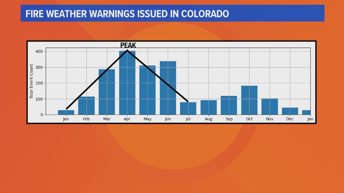
This is already the 14th fire weather warning in Colorado this year – the most in 7 years. And it’s likely to remain active.
While fire weather cannot be accurately forecast more than eight days out, we do know the peak months are March and April. That is because winds in Colorado are stronger in those months, and the warmer temperatures evaporate rain and melt snow quicker.
Fire weather conditions usually don’t subside until July when the winds are normally lighter, and the higher humidity moves into the state.

Winter Storm Warning
Heavy mountain snow and strong winds are forecast to produce difficult travel in Colorado's mountains Saturday evening through Monday morning.
A Winter Storm Warning has been issued across several western Colorado counties with 10-24 inches of snow expected on the high mountain passes and 2-8 inches in most of the mountain towns.


Travel could be very difficult to impossible with widespread blowing snow significantly reducing visibility, especially on ridge tops. The National Weather Service predicted winds could gust as high as 75 mph.
Rabbit Ears Pass, Rocky Mountain National Park, Medicine Bow Range, the mountains of Summit County, Mosquito Range, Indian Peaks, Grand and Battlement Mesas, and the West Elk and Sawatch Mountains will be affected by wintry weather this weekend.
SUGGESTED VIDEOS: Snow in Colorado
MORE WAYS TO GET 9NEWS
Subscribe to our daily 9NEWSLETTER
Download the 9NEWS APP
iTunes: http://on9news.tv/itunes
Google Play: http://on9news.tv/1lWnC5n
ADD THE 9NEWS+ APP TO YOUR STREAMING DEVICE
ROKU: add the channel from the ROKU store or by searching for KUSA.
For both Apple TV and Fire TV, search for "9news" to find the free app to add to your account. Another option for Fire TV is to have the app delivered directly to your Fire TV through Amazon.
> Top stories curated daily just for you! Sign up for the 9NEWSLETTER to get can’t-miss stories, Next and Broncos content, weather and more delivered right to your inbox.