
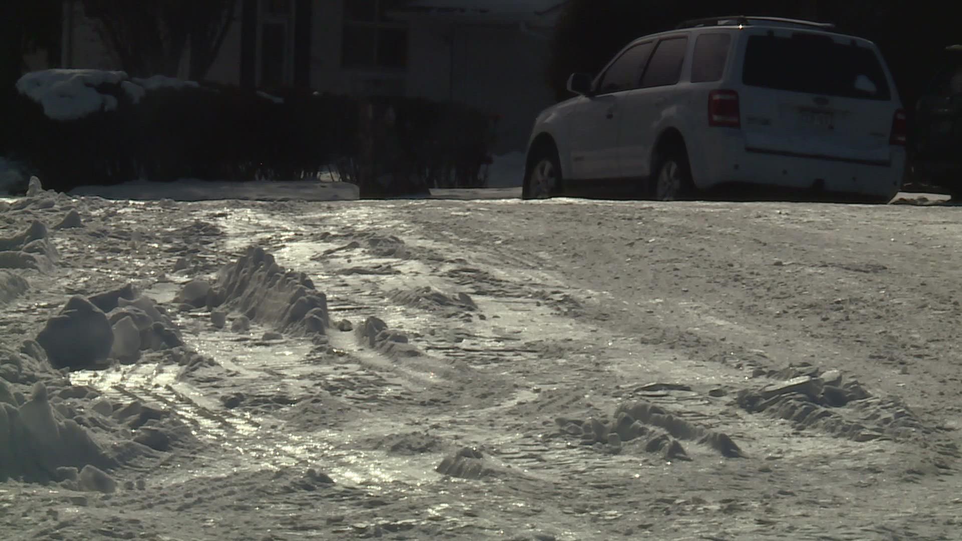
DENVER — Most of the neighborhood streets in the Denver metro area are still buried under snow and ice, which is very unusual for this area.
The last time more than 2 inches of snow stayed on the ground for more than a week in Denver was 11 years ago. That streak hit 16 days in February of 2012.
The record is 60 days from Dec. 21, 2006, to Feb. 18, 2007. There was at least 3 inches of snow on the ground for the entire month of January in 2007.
The data comes from a sophisticated weather sensor at Denver International Airport (DIA) that reports the lowest snow depth daily. It reported 4 inches still on the ground as of Friday, so the streak will likely last until Sunday or Monday.
Before that, the sensor was located at Stapleton Airport. Snow depth was also reported manually throughout Denver's history.
Denver is famous for its sunny rebounds after big snow events, but that just hasn't happened this season. The lack of sunshine has obviously prevented snow melt, but it has also allowed the snow to pack down and solidify.
Snowpack gets harder to melt the longer it sits because it gets denser. That essentially means there’s more water and ice in the snowpack as opposed to snow crystals and air pockets.
The denser the snowpack, the more heat energy required to cause melting.
It usually takes a combination of factors to melt snow, but here's a look at some of the different snow melt methods individually.
Sublimation
The limited sunshine we've been getting in the Denver area over the last nine days has been hitting the top of the snowpack, causing a process known as sublimation -- directly transforming solid snow into water vapor, skipping the melting stage all together. That’s a very slow method of eliminating snowpack.
Low Albedo
Albedo is the amount of solar radiation that gets reflected by objects. Snow has a high albedo, which means 90-99% of the sun's energy gets reflected before it has a chance to cause warming.
But there are always a few spots on the ground or on a roof that are darker in color. Those spots can absorb the sun's energy better, and cause peripheral melting.
Many times, that is what happens on neighborhood streets -- the snow will melt from the bald spots first and move to the thick, more icy patches last.
Direct Melting
The snow may reflect most of the sun's energy, but not all of it. The center of deep snowpack may remain insulated, but often the top layer can start to melt.
But oftentimes when that happens, the water just drips downward into the snowpack and refreezes before running off. That actually helps solidify the snowpack and make it more difficult for melting the next day.
This has certainly been happening a lot over the last nine days in the Denver metro area.
Effect of Weather Conditions
Just raising the air temperature around the snowpack can also melt snow, but you may have noticed that even on days were the temperature gets up between 32 and 40 degrees, there is not much melting going on.
That's mainly because of the way the snowpack insulates itself, keeping the core temperature of the layer below freezing despite limited sunshine and warmer air temperatures.
The air temperature really needs to get up around 50 degrees, or at least the upper 40s in the Denver area to make a big impact. Usually when the temperature approaches 50 degrees, there is a combination of melting factors being applied anyway.
High humidity would aide the effectiveness of warmer air melting snow, but that doesn't happen very often in Denver.
Wind can also help accelerate the snow melting process. It can remove the insulated layer from the center of the snowpack. That allows air circulation, which gives warmer air a chance to penetrate the snowpack.
Radiation from the Ground
The quickest way to get dense snowpack to melt is to heat up the ground underneath it. For that to happen, the sunshine needs to be full and direct for a long period of time.
The radiation goes through the snow and heats the ground. The warming of the snowpack comes as the heat radiates back up into the sky.
There is a combination of factors unfolding when it gets sunny enough to warm the ground through the snow, but that is the actual physical process that causes the snowpack to warm evenly and melt the fastest.
We won’t see the bulk of our snow melt until that happens, which will likely start on Sunday, as long as the sun stays up long enough on Saturday to lay the groundwork, so to speak.
So, we’ll finally get to see our neighborhood streets again sometime early next week. By the end of the day on Tuesday, the majority of the snow should be melted expect for patches of the thicker stuff, the stuff in the shady areas, and the snow that has been piled up.
SUGGESTED VIDEOS: Colorado Climate