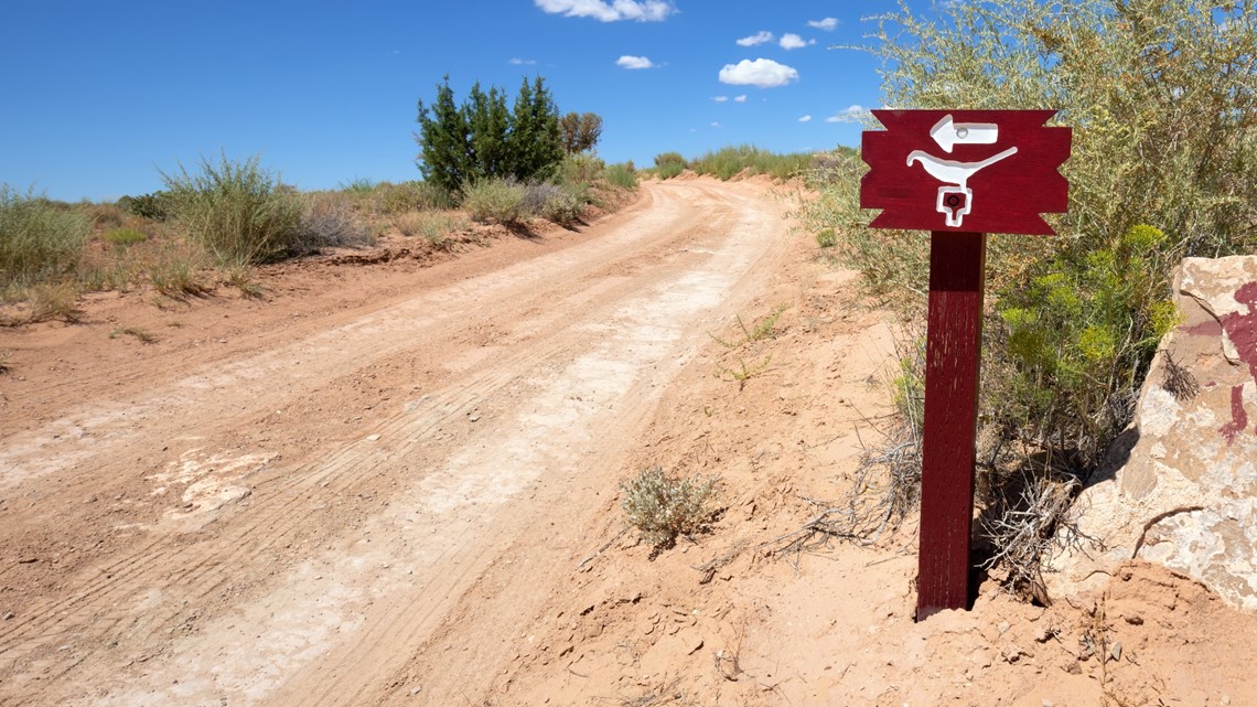
UTAH, USA — The directions from the camp host were pretty vague: head south on the dirt road for a while, make a left when you see the dilapidated phone booth, and then head down the road where you see a sign with the painted bird on it.
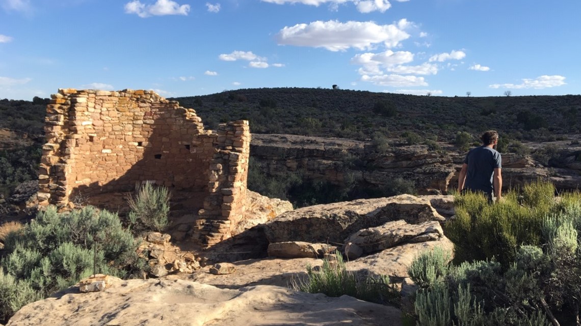
Against all odds, the guidance was actually pretty solid, and after a bumpy trip down a dirt road that was essentially just two ruts, my boyfriend and I found ourselves all alone at a pristine site with a mostly intact cluster of 800-year-old Puebloan ruins.
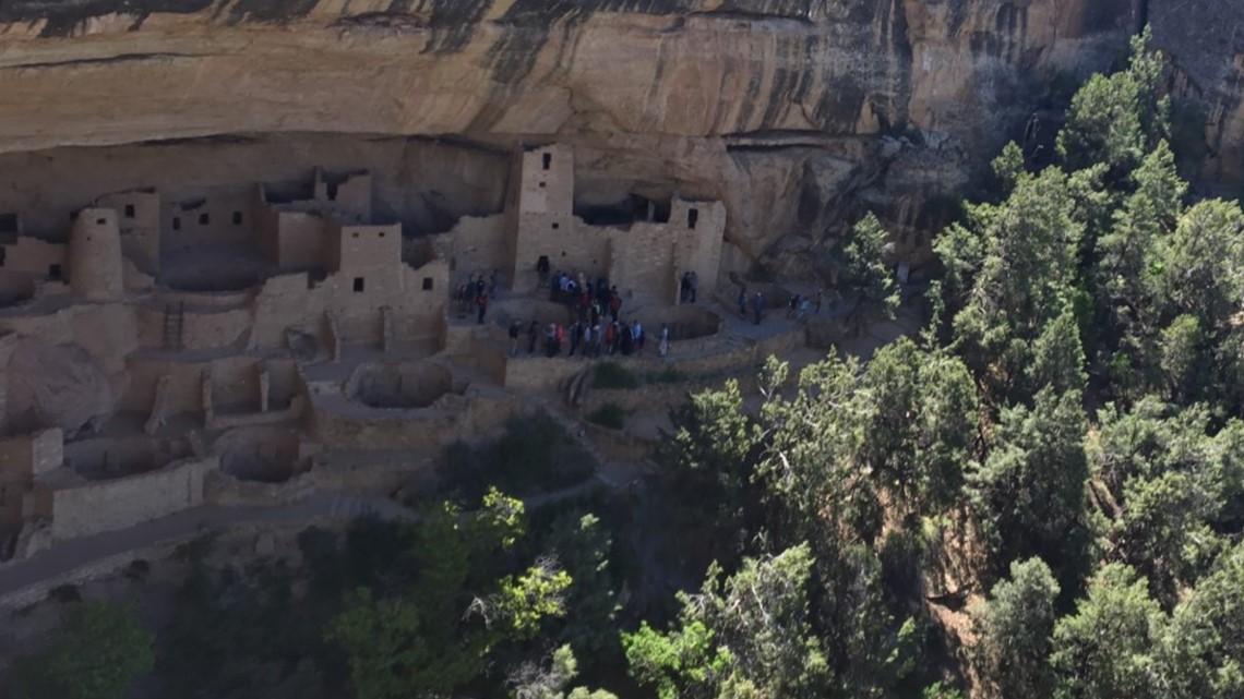
It was Memorial Day weekend, but as we explored, it was just the two of us. The day before, we had been at Mesa Verde, fighting for places to park the truck as we joined the stream of people gawking at the famous cliff dwellings. They were incredible, but crowds tend to damper the sacred experience of communing with our ancestors.


More than 600,000 people visited Mesa Verde in 2017 (yes, that’s the most recent data on their website). That same year, only 30,000 people went to nearby Hovenweep National Monument. In part, that’s because it’s harder to get to.
>>> Watch the video above for a 2016 special about "Rediscovering Mesa Verde" by 9NEWS Anchor Kyle Clark.

Hovenweep straddles the Colorado and Utah borders, and is around an hour from Cortez by way of a two-lane county road. The nearest gas station to the national monument is 20 miles away. Cell phone coverage is sporadic at best, and if you’re an indoorsy person who doesn’t like to camp, there’s nowhere to stay.
But if you’re willing to make a trek, Hovenweep is truly one of the most spectacular places in the southwest. And this is where it’s worth mentioning that by writing this story, I’m not trying to “ruin” Hovenweep. To begin with, it’s public land: none of us are more entitled to it than anyone else by its very definition.
Secondly, we are entirely in control of what we do ruin and what we don’t: this means packing your trash out, not breaking the law (which we shouldn’t have to tell people, but here we are), and just being a good, considerate person. Hovenweep is a place worth preserving and cherishing – and if you’re making the effort to see it, you should also make sure that your grandchildren can do the same.

Keeping reading for more photos and a guide to exploring Hovenweep. This story is part of our weekly 9Neighborhoods series. Have any ideas for communities around Colorado that we should check out next? Email us at webteam@9news.com.
A 10,000-year-old history

Hovenweep was first settled more than 10,000 years ago, when nomadic Paleoindians came to the area to hunt and gather food.
The first permanent settlement in the canyons came by around 900 AD, but the towers and brick structures that now remain were likely built between 1200 AD and 1300 AD, according to the park's website.
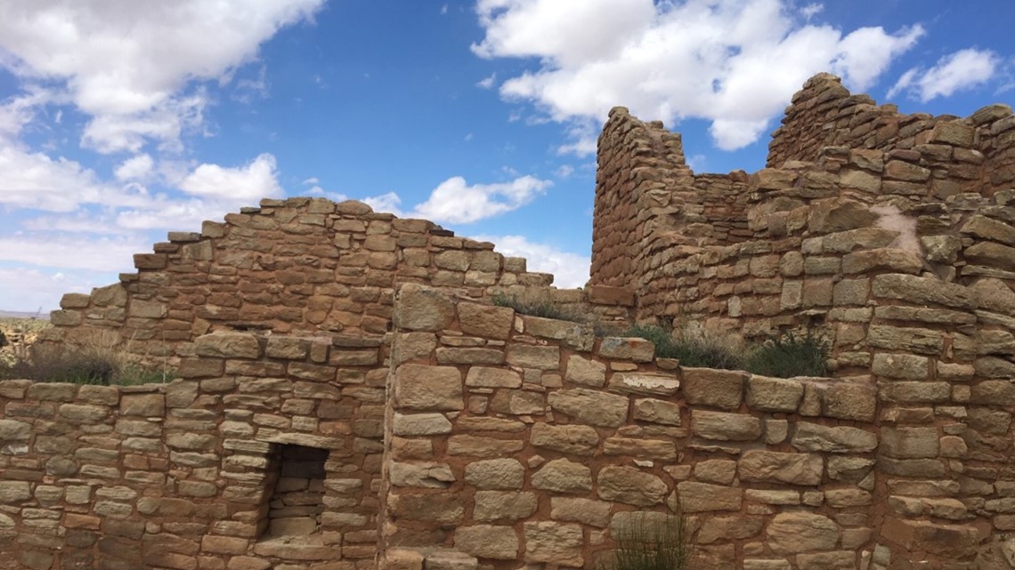
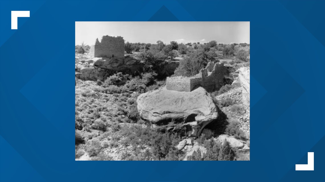
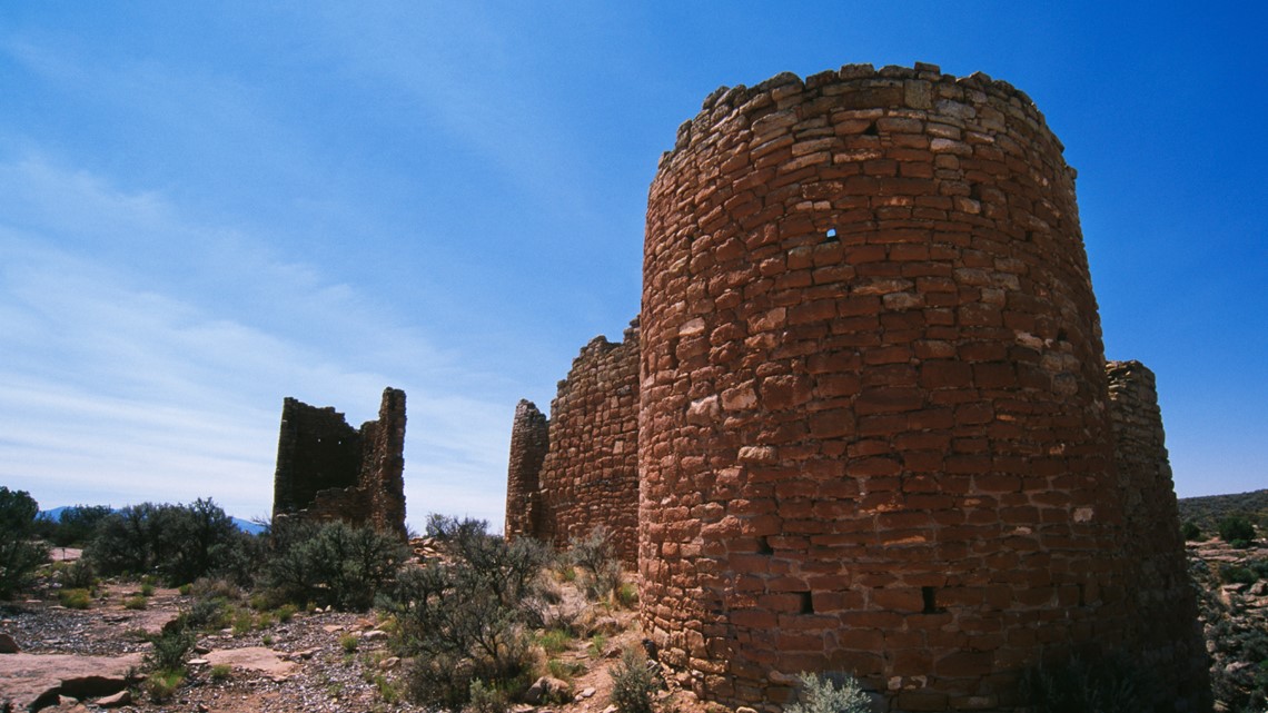
The towers might be the most striking ruins in the park. According to Hovenweep, there are multiple theories about what they were for, but few answers. They could have been anything from celestial observatories to defense structures to even storage facilities.
In addition to towers, the ancient Puebloan people built numerous dwellings into the cliffs, as well as kivas (which are circular ceremony structures). Even some of the most precariously perched stone buildings still remain 800 years later.

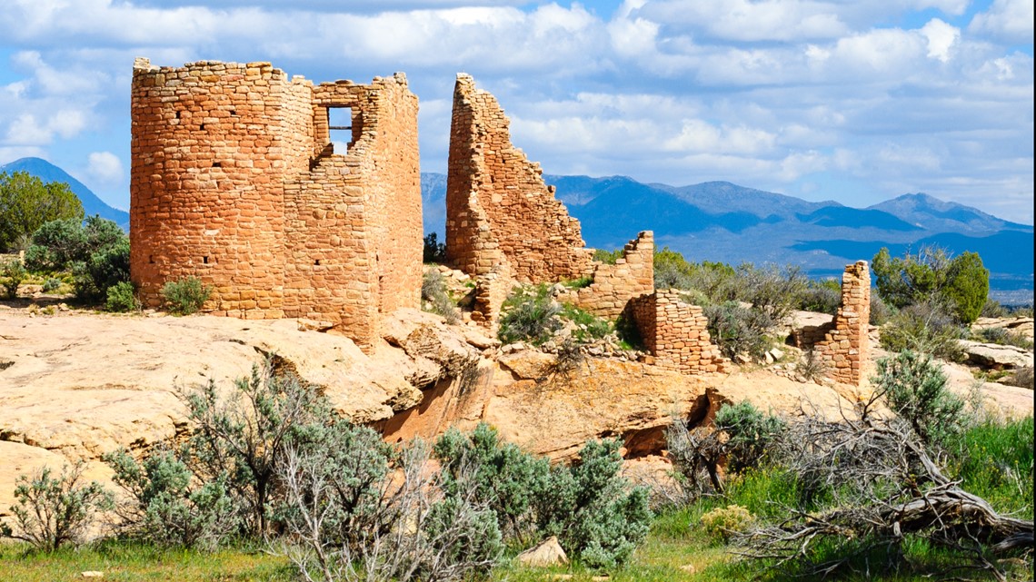
At Hovenweep's peak, the cities had 2,500 inhabitants, who were able to grow crops like squash and corn in harvested terraces, making the most out of an otherwise harsh environment.
But, by the end of the 13th century, archaeologists say the population left and migrated south to the Rio Grande Valley in New Mexico and into the Colorado River basin in Arizona. The reason why isn't totally known: Hovenweep's website says it could be anything from a drought to warfare.


The Pueblo, Zuni and Hopi people are the ancestors of Hovenweep's first inhabitants.
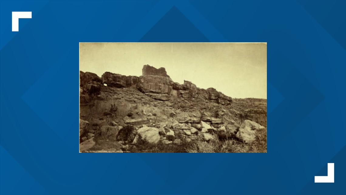
Europeans didn't come to the area until 1864. The name "Hovenweep" was later given to the ruins after the Ute word meaning "Deserted Valley."
After a survey recommended that Hovenweep was worth protecting, President Warren G. Harding made it a unit of the National Park system.

Things to do

One big thing to mention: the bathroom at the campground at Hovenweep has running water. During my visit, this was an absolute delight just because I was able to wash off the grime that came with a few days of wandering southwest Colorado without this luxury.
The campground has 31 sites, and while it's optimized for tent camping, a few can fit RVs.
Right off the campground is the Holly Trail, which is four miles one way and leads to the Holly Ruins. From there, visitors can easily check out the Horseshoe and Hackberry Ruins, before hiking another four miles back to the camp.

If this sounds a little strenuous, the Square Tower Group trail is only 1.5 miles and accessible right from the visitor's center. It winds along the canyon rim before descending inside and back up to the other side.
This offers views of numerous towers and other ruins.
A one-mile hike from the visitor's center (that's largely paved) also offers very cool glimpses of the ancient Puebloan architecture.
If you have a high-clearance vehicle, it's also possible to drive to some of the outlying sites. You can check out a park map below:
Outside of hiking, Hovenweep touts its stargazing. Given its remoteness, it's possible for visitors to see up to 15,000 stars over the course of the night.
In fact, Hovenweep has a dark sky designation. With that being said, since the trails close at sunset, stargazing can only happen at the visitor's center and campground.
Another thing worth mentioning? Even though the ruins might be what catch your eye, Hovenweep is actually home to more than 100 species of birds, making it something of a destination for birders.
For a trip itinerary based on the length of your stay, click here: http://bit.ly/39NsEgn
A couple safety things to mention? Don't plan on having a cellphone signal at Hovenweep. Also, while you can pick up some very basic food items at the visitor's center (like granola bars) and some water, it's probably a better bet to pack in everything you need ahead of time.
This is the desert, and during the summer, it can get very hot. So, if you're doing strenuous activity during that time, you're better off getting it in early or when the sun is setting.
Spring and fall are some of the most mild times at the park.
Getting there

Like we said above, Hovenweep is not necessarily easy to get to. No commercial transportation serves the park.
The good news? All the main access roads are paved, meaning your Honda sedan will do just fine. On its website, Hovenweep says not to use GPS to get there -- instead, it recommends good-old fashioned maps.
Here are the park's directions from a few nearby cities:
From Cortez, Colorado (42 miles) - Drive 2 miles south of Cortez on US 491. Follow County Road G / McElmo Canyon Road for 30 miles, turn right onto County Road 5099/401 for 4 miles, turn right on County Road 413/213 for 6 miles, turn right to enter the park.
From Blanding, Utah (45 miles) - Travel south on US 191 approximately 15 miles, turn left off US 191 to UT 262 for 8 miles, turn left off UT 262 to County Road 5099/401 for 16 miles (passing Hatch Trading Post), turn left at Hovenweep sign for 6 miles and turn right to enter the park.
From Pleasant View, Colorado - Turn off US 491 (22 miles north of Cortez) to County Road CC for 5 miles, turn left on County Road 10 for 22 miles, turn left to enter the park.
From Bluff, Utah (42 miles) - Turn off US 191 just north of Bluff to UT 162 for approximately 16 miles, turn slight right and then slight left in Montezuma Creek, Utah, to continue on UT 162 for 7 miles, turn left on McElmo Canyon Road (at the park sign) for 9 miles, turn left on County Road 5099/401 for 4 miles, turn right on County Road 413/213 for 6 miles, turn right into park.
SUGGESTED VIDEOS | Local stories from 9NEWS