
DENVER — Here we go, winter lovers.
After an exceptionally mild and dry few weeks, it looks like a more winter-like pattern moves into Colorado starting this weekend, with perhaps a stronger storm bringing more widespread snow and chilly weather by the middle of next week.
The second storm will probably bring the mountains their first healthy snowfall event of this winter season. And no, we're not just talking about a dusting at the highest elevations.
For starters, there'll be two separate storms creating the winter-like weather, the first of which arrives this weekend.
The first storm arrives from the Southwest this weekend, and an accompanying cold front will drop temperatures across Colorado on Friday and Saturday. That'll lead to some mostly light snow for elevations at or above 10,000 feet this weekend, mainly across the western half of the state.
The first storm, however, probably won't bring a lot of active weather to the Denver area. A brief cooldown and perhaps some rain showers and a rumble of thunder or two will do it for Denver area impacts this weekend.
It's the second storm that'll likely bring biggest impacts. This system will arrive from the northwest starting on Monday, bringing with it some healthy mountain snow and a big statewide cooldown. Highs in Denver will likely stay in the 40s or 50s next Wednesday.
For the mountains, snow is likely on Monday, Tuesday, and Wednesday. Some higher elevation areas could see as much as a foot of snow before the system moves out by Wednesday or Thursday.

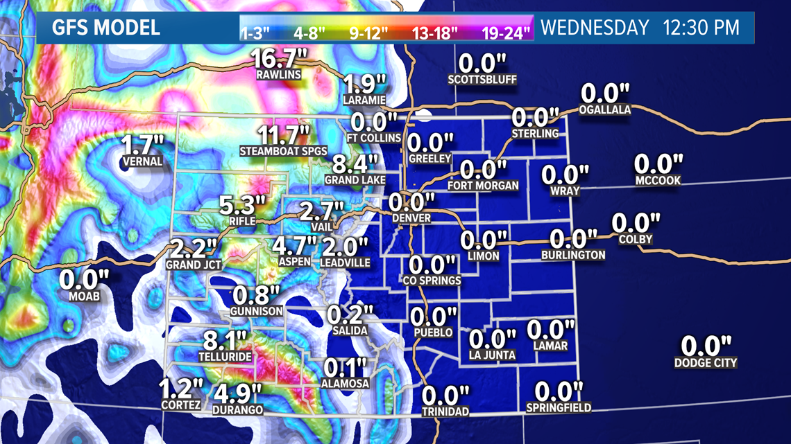
If things pan out just right, a little slushy snow might not be out of the question for the metro area for the middle of next week, either. As usual, the Palmer Divide and the foothills west of Denver would be the most likely areas to see some wet snowflakes, likely Tuesday or Wednesday.
Since this forecast is several days out, stay tuned to 9NEWS for any updates and changes.
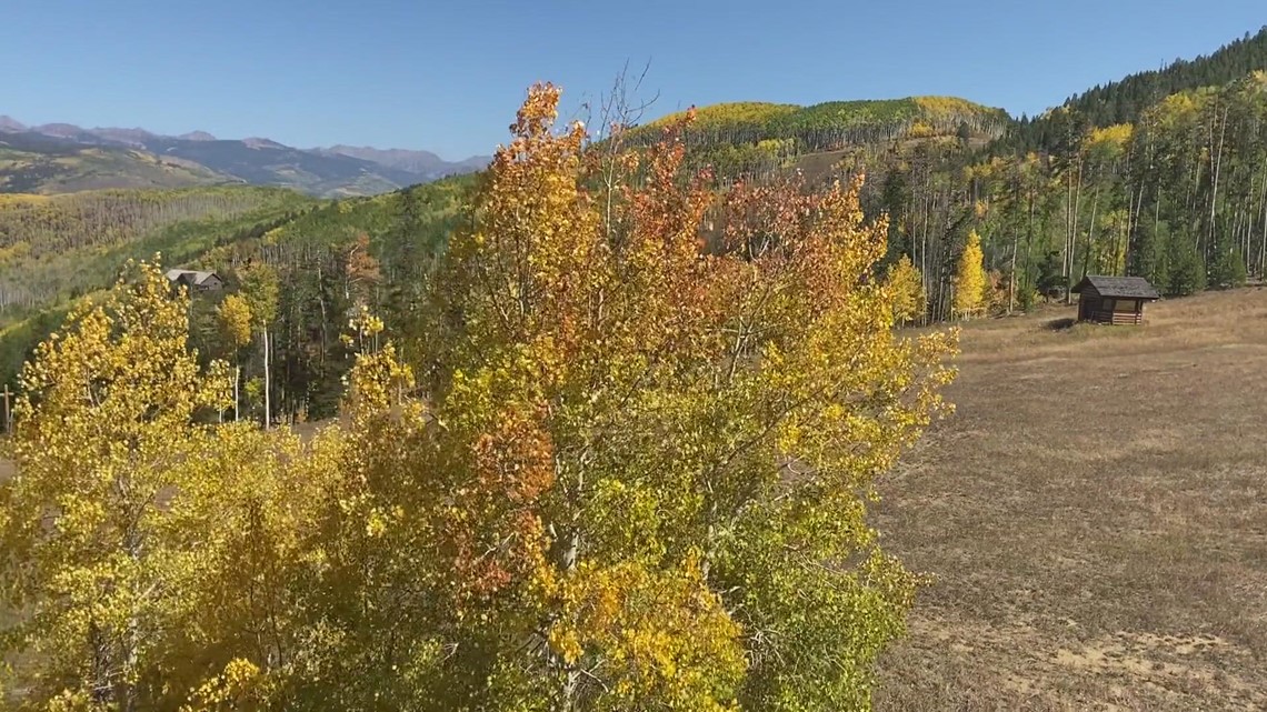
This will also likely end the fall foliage season across Colorado, since the snow and accompanying wind will likely bring down the last orange and yellow leaves after a stunning display.

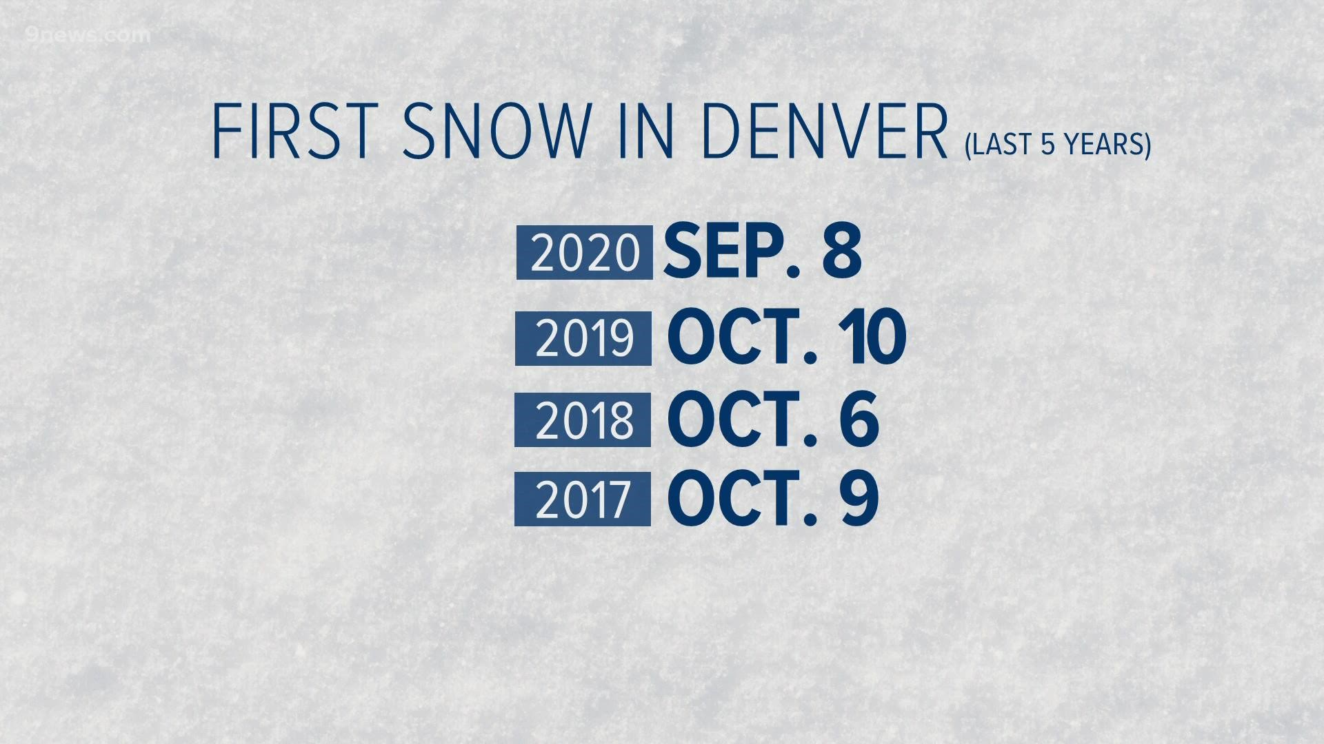
If we do end up seeing snow in Denver, however, it wouldn't be especially unusual. Denver's average first measurable snowfall date falls on Oct. 18. Mid-October snows are far from unheard of along the Front Range, and the fact that the mountains have waited this long to see their first big storm is the more unusual component of next week's snow.
In any case, if you're planning on traveling through the higher elevations next week, be ready for some wintry weather.
SUGGESTED VIDEOS: Science & Weather