
DENVER — A blustery Wednesday on the Front Range was just a precursor of a fierce winter weather pattern developing for the next seven days that will include a possible bomb cyclone followed by a polar vortex.
Bomb Cyclone, Thursday and Friday
The strong winds are from a storm system that's starting to take shape over the Rocky Mountain region. The overall impacts to the Front Range will be minimal with this storm: The winds on Wednesday were in the 30 to 50 mph range, just shy of high wind warning criteria.
As the storm system strengthens on Thursday, it will bring moderate snowfall to the nearby mountains and maybe a dusting of snow on a few parts of the Front Range on Thursday morning, but the storm is forecast to become a powerful cyclone as it moves into the states east of Colorado.

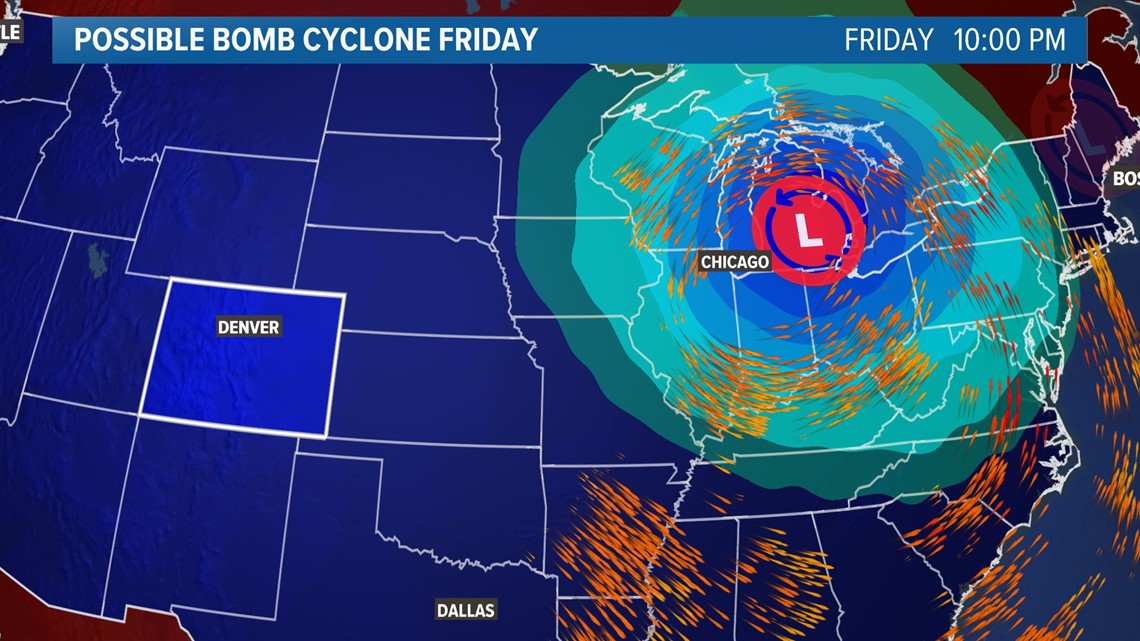
It could even undergo bombogenesis, which is a term than describes a rapidly strengthening cyclone – dropping by 24 millibars of barometric surface pressure or more in 24 hours or less. That's why these storms a sometimes referred to as "bomb cyclones."
The cyclone is forecast to be over the Texas Panhandle on Thursday morning with a surface pressure of about 998 millibars. Then it should reach maturity over the Great Lakes region on Friday, with a surface pressure of about 974 millibars on Friday evening.
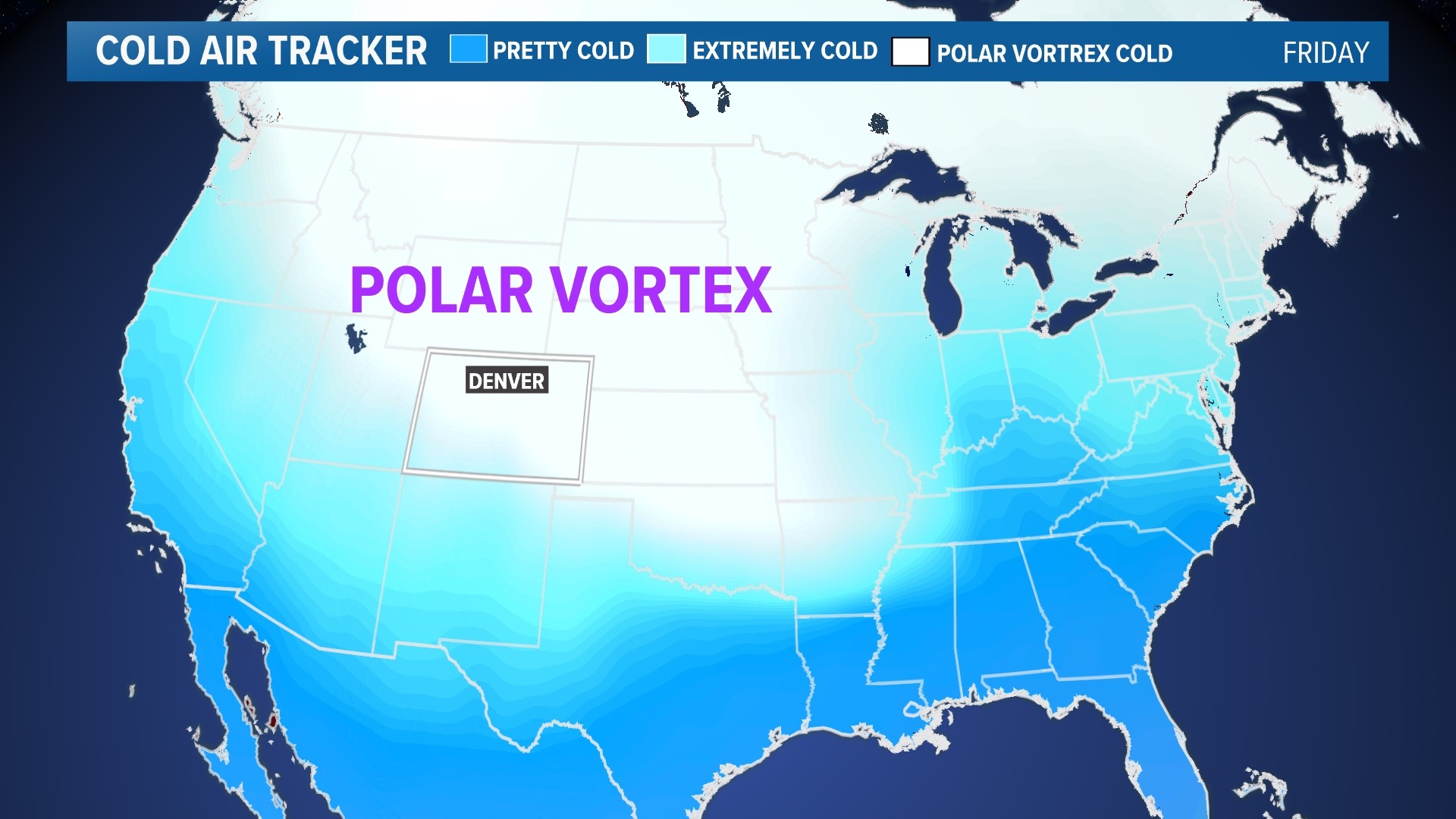
Polar Vortex, Friday through Monday
While the impacts from the bomb cyclone will be minimal in Colorado directly, it will help pull down frigid arctic air from an unstable polar vortex and guide it right over the state Friday through Monday. The result will likely be the coldest three-day stretch in Denver since last January.
The high temperature in Denver is forecast to be below 20 degrees Saturday through Monday, with lows in the negative and wind chills below -20 degrees.
While arctic air is extremely cold, it carries very little of its own moisture in the air mass. That means the snow totals in Denver over that three-day stretch will likely be on the lighter side, with only 1 to 3 inches by Monday. Even if we end up with a favorable jet streak, which is possible with the jet stream directly over top of the state, 6 inches would be about the maximum potential.


The mountains are forecast to do much better. The totals over the last week have generally been in the 1- to 10-inch range with only a few spots reporting more than 12 inches a day, but with the weekend pattern there should be more widespread totals above a foot per day.
That should help get the mountain snowpack headed in the right direction. As of Wednesday, the statewide snowpack percentage was among the lowest in history standing at about 28% below average.
The weather pattern is forecast to slow down for the second half of January for Colorado. With the next three storm systems coming close to the state but not have direct or major impacts.
SUGGESTED VIDEOS: Severe Weather