
DENVER — It's been an exceptionally wet start to 2023 for the Denver area.
You probably didn't know – until you read the headline – that Denver has had more total precipitation than Seattle since the start of 2023.
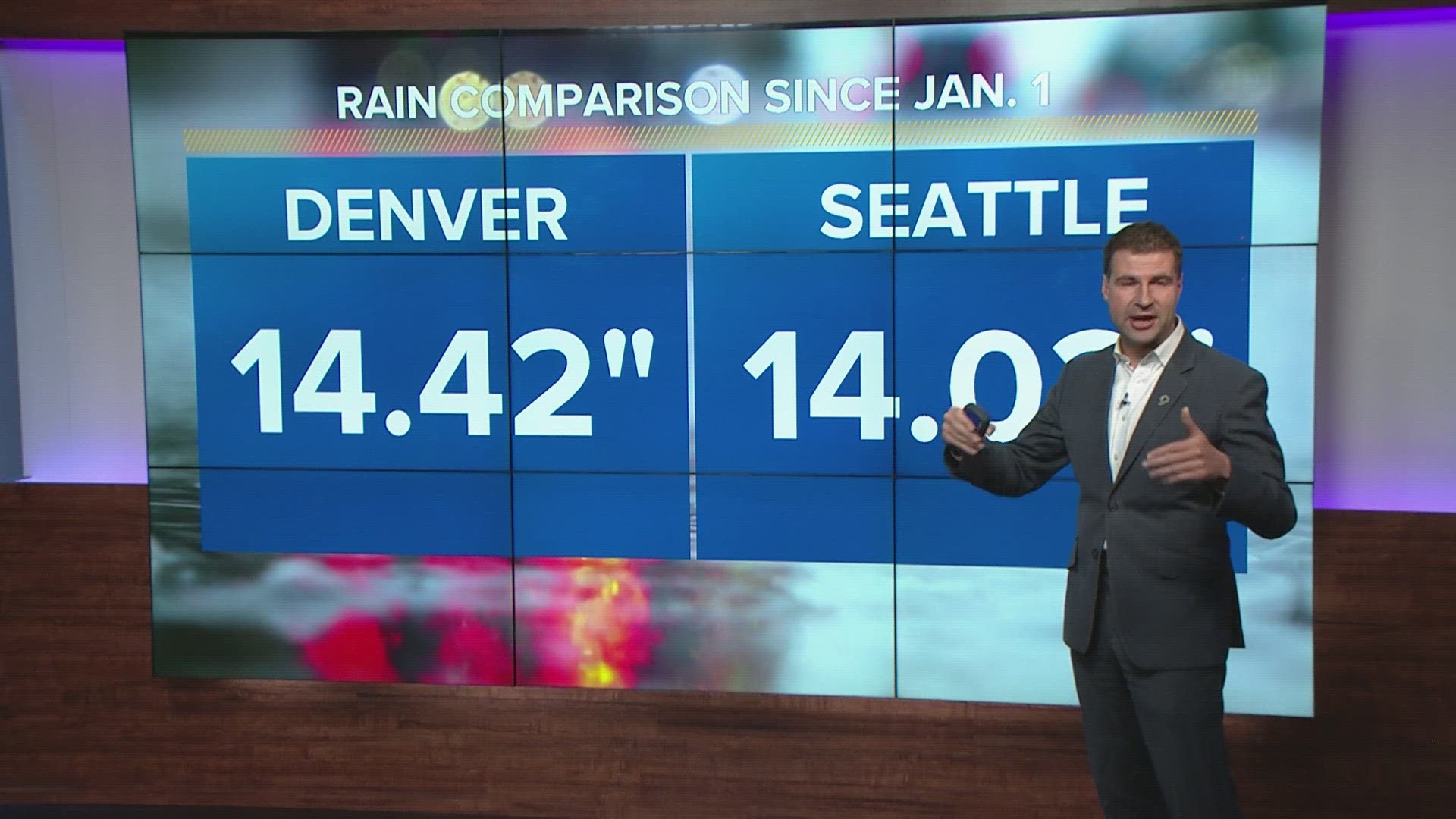
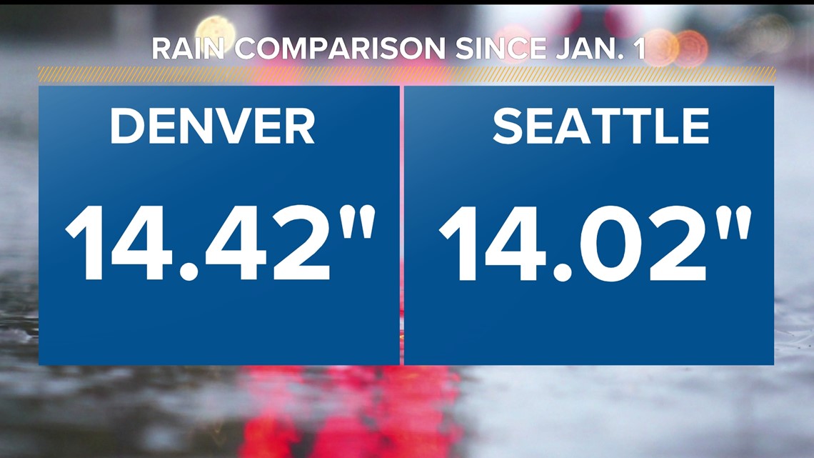
That's right: Since Jan. 1, Denver International Airport – the city's official climate site – has picked up a whopping 14.42 inches of rain and melted snow equivalent. That's a smidge more than Seattle's official precipitation total of 14.02 inches.
This is the first time on record that Denver has recorded more precipitation than Seattle over the first six months of the year. Official records at both locations date back to 1945.
Seattle averages roughly three times the amount of precipitation that Denver does over the first six months of the year.

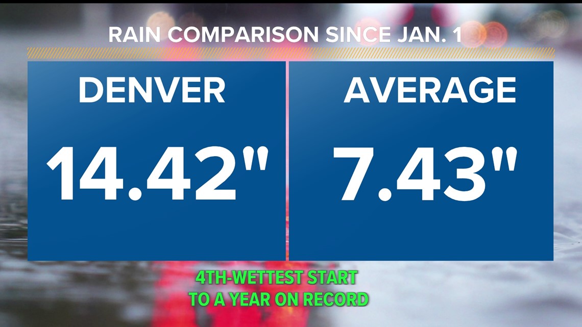
While Denver has had nearly double its typical year-to-date precipitation – this is Denver's fourth-wettest start to a calendar year on record, through Thursday – Seattle is only at about 69% of its typical year-to-date precipitation.
A combination of an exceptionally wet spring and early summer in Denver is combining with a very dry Seattle over the same time period to create this unusual statistic.
Seattle is not the only unusual place that has had less precipitation than Denver so far this year. Denver's also had more precipitation than Washington, D.C., and Dallas, despite both of those cities averaging roughly three times Denver's precipitation over the first six months of a year.

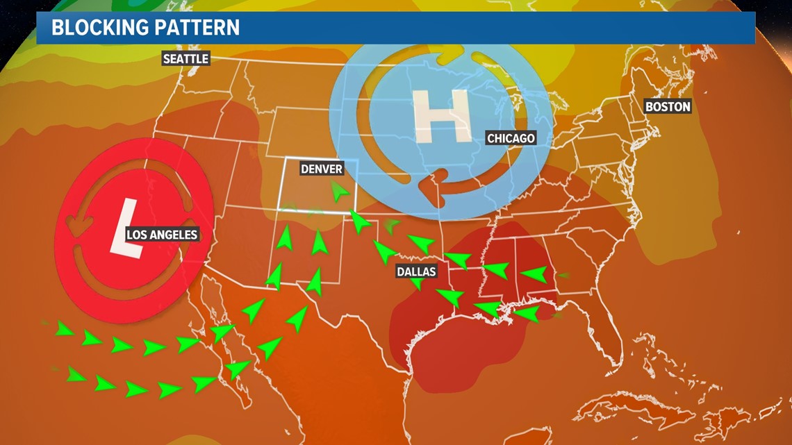
A persistent weather pattern featuring a blocking area of high pressure to our east and a stagnant area of low pressure to our west has kept the faucet turned on virtually all year long.

Weird overnight rain?
On top of all that rain, a lot of unusually active weather has plagued northeastern Colorado this week.
Strong storms blasted northeastern Colorado with up to softball-sized hail on Wednesday night, and showers and storms greeted parts of the Front Range early on Friday morning, as well.
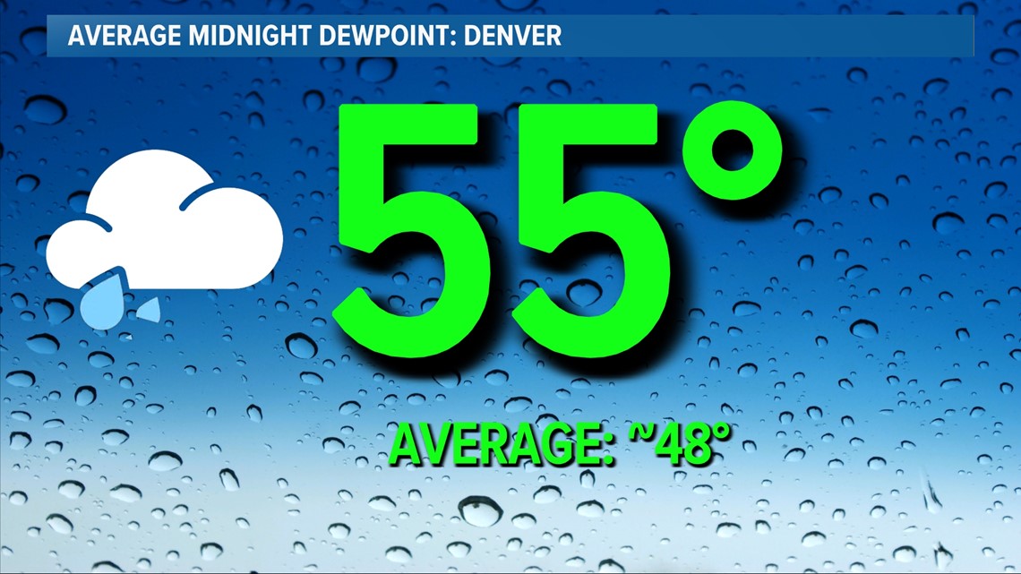
The main reason for all of the active overnight weather? Higher-than-usual moisture levels.
That same persistent pattern means that Front Range dewpoints, a measure of the amount of moisture in the atmosphere, are running considerably higher than usual.
That means the threat for storms is lingering well after dark, and in some cases, well into the overnight hours.

The good news is that shower and storm coverage will drop considerably for the upcoming weekend and into early next week. That said, more storms are possible for the Fourth of July and for Wednesday and Thursday of next week.
SUGGESTED VIDEOS: Colorado Climate