
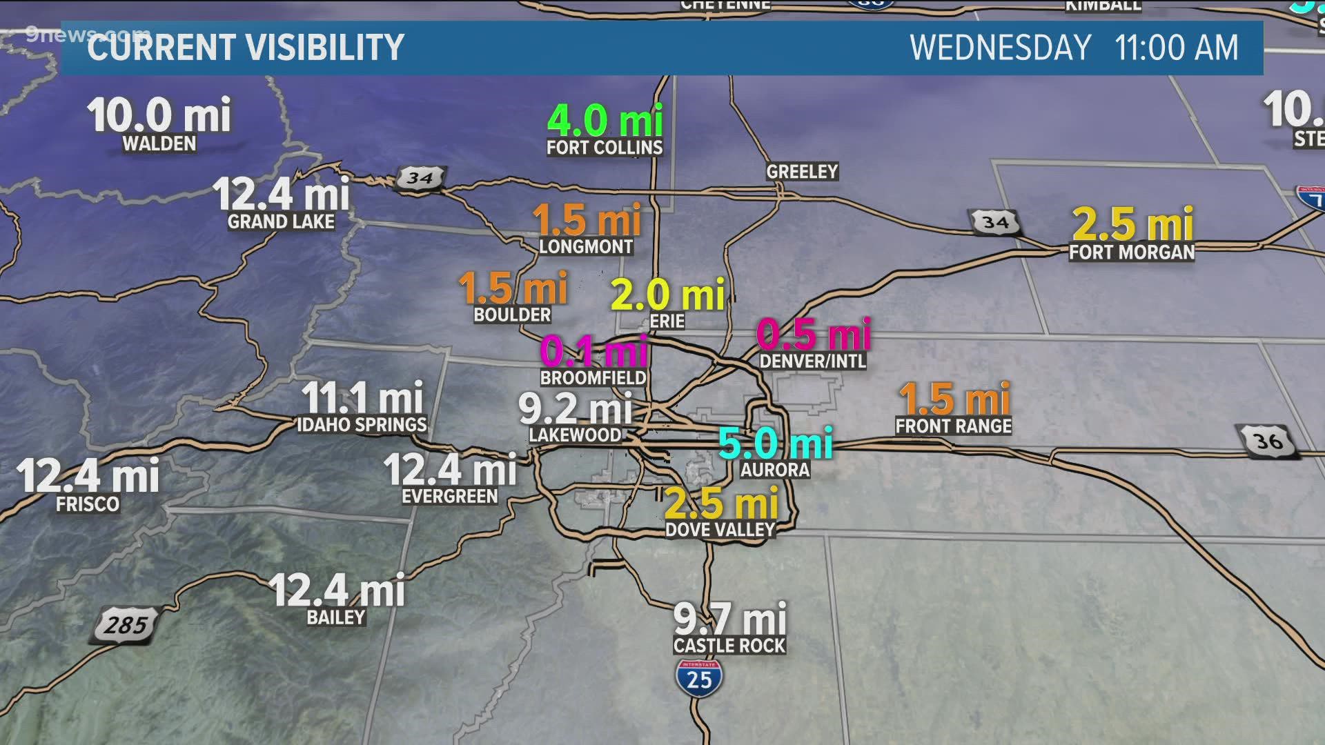
DENVER — Freezing drizzle in Denver and throughout northeastern Colorado continues to make driving conditions slick and dangerous.
The drizzle will likely continue for most of the rest of the afternoon, though it may briefly change over to snow before the precipitation comes to an end later tonight.
The worst of the ice is on the north and west sides of the Denver area, with icy roads and sidewalks reported in Boulder, Loveland, Fort Collins and even in and near Denver as of midday Wednesday.
Ice amounts are relatively low, with totals across northeastern Colorado under a tenth of an inch. While that means there's virtually no threat for downed trees and power lines, all it takes is a glaze of ice to create slippery roadways.
We have a list of closings and traffic issues relating to the ice.
Freezing drizzle and/or rain is relatively rare in Denver. Wednesday's freezing drizzle event marked just the fifth freezing drizzle or rain report in Denver in the last two-plus years (since the start of 2020).
Wednesday's ice is being caused by a shallow layer of moisture right at the surface, and a sharp cold front that moved through on Tuesday night pushed in enough cold air to turn the drizzle into freezing drizzle. Because temperatures are below freezing, the liquid drizzle freezes on contact with most surfaces.
Stay with 9NEWS for the latest on Wednesday's freezing rain and the latest forecast.
SUGGESTED VIDEOS: Science & Weather