
GRAND COUNTY, Colo. — Hydrologists track the amount of snow that accumulates in the mountains over the winter. That helps them get an idea of how much water will runoff into our streams and reservoirs in the summer when the demand for water goes up.
Even though it's a measurement of water, let's call it snowpack.
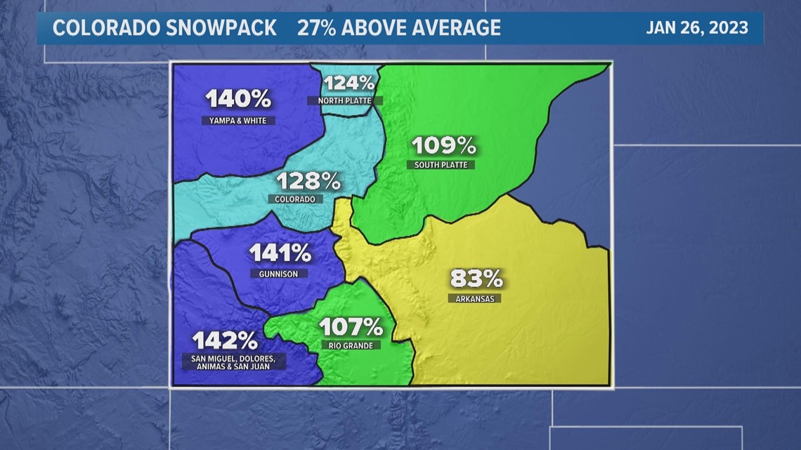
As of Thursday, statewide snowpack was 27% above average. That means there was an average of 11.5 inches of water in all the snow across the Colorado mountains.

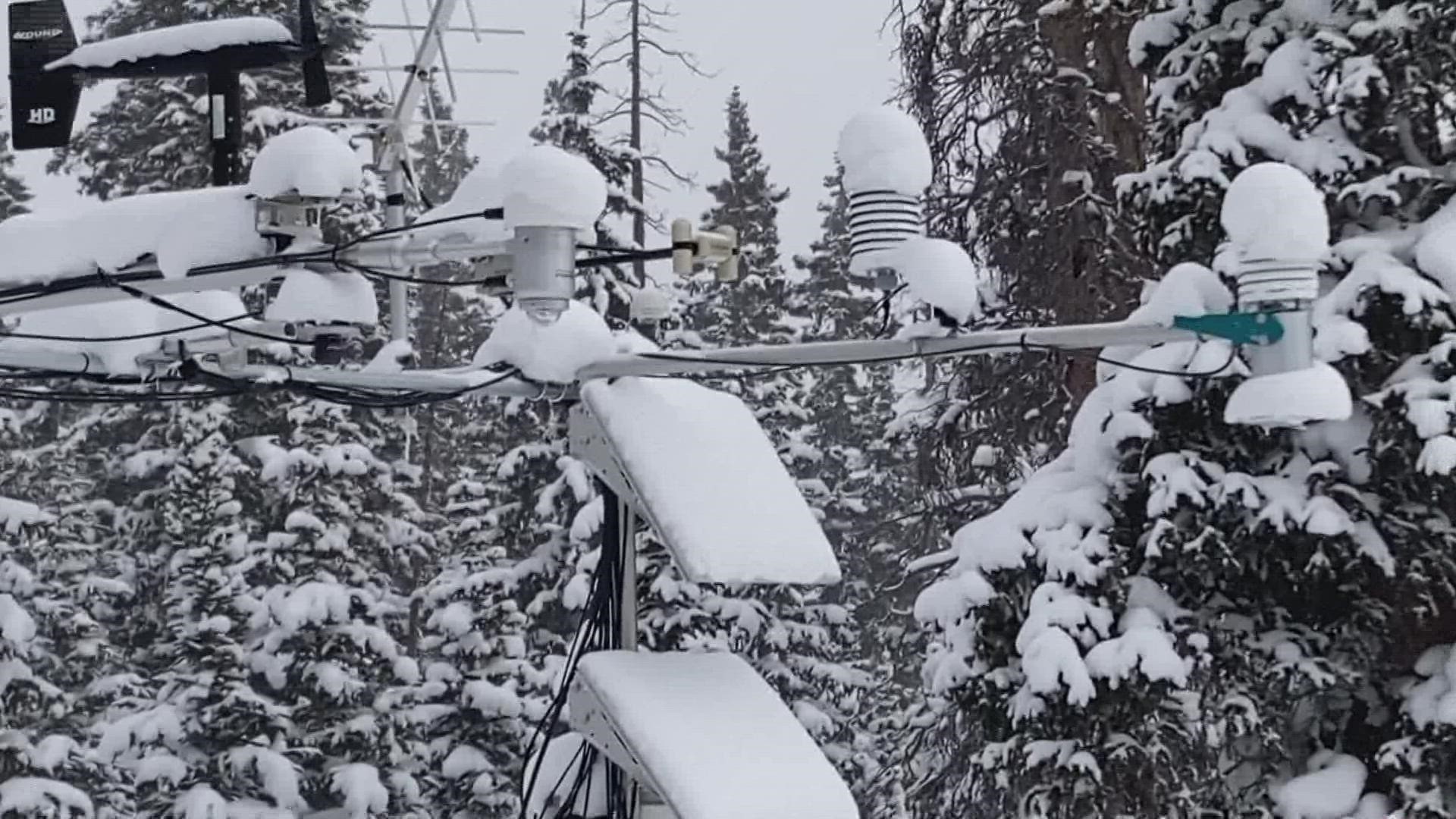
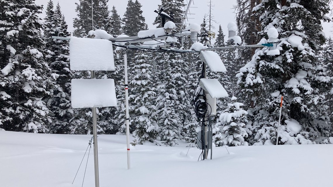
A network of sophisticated weather stations is responsible for determining snowpack numbers across the western United States. They're called Snowpack Telemetry Stations (SNOTELS).
In Colorado, there are 115 of them spread across the mountains near the headwaters of our river systems. That’s just enough coverage to make a good estimate of the snowpack statewide.
Each station has a scale that sits underneath the snow which measures the weight of the snowpack. Another sensor measures the depth of the snow. With that information, you can calculate how much water there will be when the snow melts.

The peak snowpack level is usually reached in the second week of April, and by that time, hydrologists can estimate the amount of water that will be available for us to use in the summer.
So far, the statewide snowpack is higher than it’s been since 2017.
The statewide percentage is what gets most often gets the most attention, and deservingly so because it really gives people a good synopsis of the snow season in general. But that number doesn't always tell the whole story, because the snowpack conditions can vary greatly across the state.
This season would be a good example. The bulk of the snow has fallen in the west of the Continental Divide, while the east and southeastern mountains have had much less. That balances the statewide average to be somewhat pedestrian compared to what you might think the average is.
Each river basin, and even sub-basins within have specific data to give water managers the best snowpack information for smaller and more specific areas.
SUGGESTED VIDEOS: Colorado Climate